Local Communities
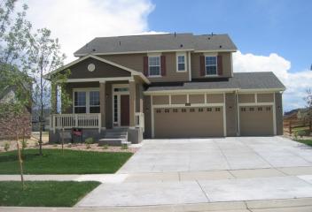
Home seekers will enjoy the many different neighborhoods to choose from here, as well as the variety of houses, condos and townhomes available. Depending on where you settle, you could be right downtown, next to a popular community park or near top-rated schools.
We hope that our website's community information will help you to choose between the many wonderful areas; each has a lot to offer the home buyer.
Contact us anytime for more information about local areas!
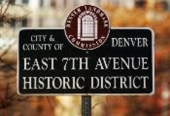
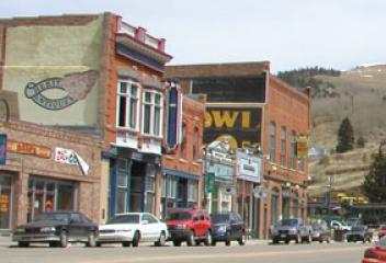
7th Avenue Historic District
The 7th Avenue Historic District runs from Logan Street to Colorado Blvd. and from 6th to 8th Avenues. The East 7th Avenue Historic District preserves one central neighborhood and three pieces of the park system. The District was developed at the height of the City Beautiful Movement. When the development reached Williams Street, the plan was implemented, creating the East 7th Avenue Parkway and the Williams Street Parkway. The city bought the parkway land in 1912 and redesigned the streets.
View Community
Acreage
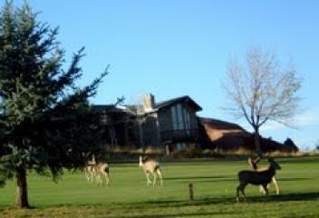
The Acreage neighborhood is located in the western portion of Arvada. This neighborhood has acreage for horses and other animals. These properties may have a minimum of 5 acres and others more. This neighborhood is located at approximately West 82nd Avenue north, Indiana Street east, West 73rd Avenue south and Quaker Street west. Leyden Lake is located in this neighborhood as a featured attraction. This neighborhood is any horse lovers dream, country living yet being close enough to convenience.
View Community
Alamo Placita
The history of the Alamo Placita Historic District tells the story of the 1860's prairie land along Cherry Creek. Moses Hallett had the foresight and bought the land in 1864. Hallett's quarter section of land became Arlington Park and later named Alamo Placita Neighborhood. Robert W. Speer became Denver's first mayor under home rule in 1904 and his exuberance for Denver's City Beautiful Movement and Alamo Placita Neighborhood was Speer's first major real estate investment and developed the land.
View Community
Alamosa
The City of Alamos is located in Alamosa County and was established in May 1878. Alamosa was established by the Denver and Rio Grande Railroad and quickly became an important rail center. The railroad had an extensive construction, repair and shopping facility in Alamosa for many years, Today Alamosa is a tourist town with many nearby attractions, including Great Sand Dunes National Park and Preserve and Colorado Gators Reptile Park. The town hosts "Summer Fest on the Rio" which occurs in June.
View Community
Alkire Acres
Alkire Acres is an established neighborhood in Littleton Colorado. This community is located at about South Alkire Street and West Cross Avenue. Construction began in this community about mid 1980's and continued into 1990's. Mossbrucker Park, a neighborhood park, and Mount Carbon Elementary School are located at this community. This community is located close to hiking and biking trails, great access to the mountains, C-470, US Highway 285, Red Rocks State Park, Chatfield Reservoir and etc.
View Community
Alkire Estates
Alkire Estates is a newer established neighborhood in Arvada. This community is located at about West 82nd Avenue north-northeast, West 80th Avenue south, Alkire Street west. This community offers larger lot sizes, approximately one half an acre (more or less). Ralston High School is located just west of this neighborhood. This community offers a open green space going through the centre of the neighborhood. This community is close proximity to Standley Lake and Stanley Lake State Park.
View Community
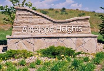
Antelope Heights
Antelope Heights is newer community in Parker. This community is located along South Jordan Road and north of Hess Road. This community began its development at about 2005 and continued construction for the next several years. This community is located south/southeast of Downtown Parker, Salisbury Equestrian Park and Sports Complex. Antelope Heights has convenient access to the Denver Tech Center via South Chambers Road to Ridgegate Parkway or East Lincoln Avenue, both providing access to I-25.
View Community
Antelope Hills
Antelope Hills is a community located in Elizabeth. This community is located south of Highway 86 and south of Elizabeth from County Road 13 and South Elbert Road. Antelope Hills was developed about 2000, newer home development built on approximately 40 acres. This community is zoned AA1, which is zoned agriculture and for livestock. Antelope Hills is ideal for homeowners looking to have livestock and horses and acreage. These ranches have convenient access to Elizabeth, Parker and Castle Rock.
View Community
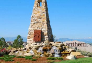
Anthem
Anthem Community is located in Broomfield Colorado. There are several different communities in the Anthem Community. There is an Anthem Community for adults 55 or older and others that are family oriented. The all adult community was a Del Webb designed community and other family oriented communities are still in construction phase. They have Community Centers which provides clubs, actives and events for its residents. There are 48 miles of hiking and biking trails within the community.
View Community
Applewood
The Applewood Subdivisions are located Jefferson County and in three different cities, Golden, Lakewood and Wheat Ridge. Over the past several years, contractors have been completely renovating many of the older homes and updating the the interiors. Applewood Golf Course, in Unincorporated Jefferson County and is bordered by neighborhoods to the south and east, Colorado State Rd 58 to the north and open space and retention ponds to the west. Developers would like to add 454 houses in its place.
View Community
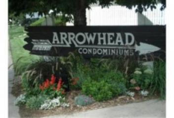
Arrowhead
Arrowhead is an established condominium community in southeast Denver County. This community is located East Mexico Avenue north, South Quebec Way east, East Colorado Avenue south, and South Trenton Street west. Arrowhead condominium community was developed about 1980. This condominium community offers its residence a community pool, maintains all exterior maintenance, grounds, trash, water & snow removal. Arrowhead is conveniently located to DTC, RTD Lightrail and transportation, trails, & etc.
View Community
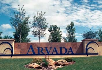
Arvada
Olde Town Arvada was established in 1870. The Town of Arvada was formally incorporated on August 14, 1904. It was a vibrant agricultural community and claimed the title "Celery Capital of the World." During the 20th century as a suburb of nearby Denver it grew rapidly. Today revitalization around Olde Town Arvada has taken place, with the construction of new condos, townhomes, shopping centers and etc. There are numerous restaurants, pastry shops, wineries and bars, shops and boutiques and etc.
View Community
Arvada West
Arvada West is an established community in Arvada. This community is located at approximately West 72nd Avenue north, Simms Street west, wWest 64th Avenue south and Kipling Street/Oberon Road east. Arvada West is an older neighborhood and its development started about early 1950's. This community has a great location and is in close proximity to Historic Olde Town Arvada, Standley Lake and Standley Lake Regional Park, Fitzmorris Park, Independence Park, Davis Lane Park, Oak Park, and Hayes Lake.
View Community
Aspen
The City of Aspen is located in Pitkin County. Founded as a mining camp during the Colorado Silver Boom, it was later named "Aspen" because of the abundance of Aspen trees in the area. The City of Aspen was first settled in 1879 & incorporated in 1881. In the 20th century, the city became a popular retreat for celebrities. Aspen is the most expensive place to purchase real estate in the United States. It is a mixture of high-end luxury estates and condominiums intermixed with single family homes
View Community
Athmar
Athmar Park was annexed incrementally by the City of Denver. In 1902, the eastern edge of Athmar Park was annexed, along with the town of Valverde, from Zuni to the South Platte River border. In 1932 the area west of Zuni was annexed by the City of Denver. The area west of the town of Valverde that had originally been in the hands of three different owners was auctioned and purchased by Thomas and John R. Mccosker in 1946 and developed into the subdivision of Denver named "Athmar Park".
View Community
Auraria
Auraria Neighborhood is dominated by the Auraria Campus, which is home to three institutions, University of Colorado, Metropolitan State University of Denver & Community of Denver. Auraria was founded by William Greeneberry Russell and party of fellow settlers from Auraria Georgia, three weeks before William Larimer platted the future "denver City" across Cherry Creek. Auraria ceased to exist as a separate town on April 6, 1860 when it was incorporated into Denver, & was referred as West Denver.
View Community
Aurora
Aurora originated in the 1880's as the town of Fletcher, taking its name from Denver businessman Donald Fletcher. He and his partners staked out four square miles east of Denver. The town of Fletcher was renamed Aurora in 1907 after Fletcher skipped town. Today Aurora is home to Anschutz Medical Center of University of Colorado Denver, Children's Hospital, and the new VA Medical Center, Buckley Air Force Base, Aurora and Southlands Mall, Aurora & Quincy Reservoirs, restaurants, & golf courses.
View Community
Aurora Highlands
Aurora Highlands Neighborhood is located in South Aurora and is located between South Buckley Rd. and South Tower Rd, and from East Mississippi Avenue and approximately East Mexico Avenue. Highland Hollow Park is located in this neighborhood, which runs from East Louisiana Avenue to East Mexico Avenue along Uravan Street. Aurora Highlands is conveniently located to Buckley Air Force Base and the shopping center at Hampden Avenue and Tower Road. This neighborhood is in Aurora School District.
View Community
Aurora Hills
Aurora Hills Neighborhood is located in South Aurora. Its boundaries are from Alameda Ave. (north), Exposition and Mississippi Ave. (south), Havana Street (west) and Potomac Street (east). The homes constructed in this neighborhood were typically brick ranch style homes and/or bi-level style homes. Peoria Street determines which school district, west of Peoria is Cherry Creek School District and east of Peoria is Aurora School District. Aurora Hills Golf Course is located north of Alameda/Peoria
View Community
Aurora Knolls
Aurora Knolls is a subdivision in South Aurora, located between South Buckley Rd. and South Tower Rd. It sets in the southeastern quadrant of the intersection of South Buckley Road and East Yale Avenue. Aurora Knolls is in a convenient location because of its proximity to Buckley Air Force Base, which is located at South Tower Road and East Mississippi Avenue. It has close proximity to shopping at Hampden Ave. and Tower Rd., I-225, E-470, DTC, Parker Road, Rangeview High School and Olympic Park.
View Community
Avon
The Town of Avon is located in Eagle County. The town first consisted of a rail station opened in 1889. Originally its name was spelled "Avin" & later changed to "Avon". The town was incorporated in August 1978. It is the gateway to the Beaver Creek Resort which is about two miles south of town. Avon was the previous site for Vail Resorts prior to the company moving its headquarters to Broomfield Colorado in 2006. The town is also home to Liberty Skis, an independent ski manufacturing company.
View Community

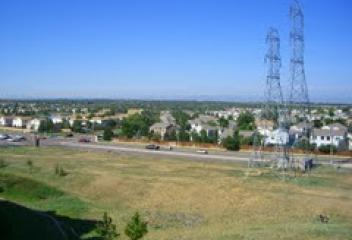
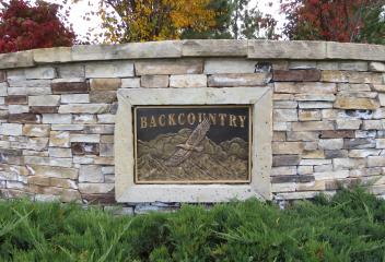
BackCountry
BackCountry is a newer community in Highlands Ranch. This community is a gated community located at the intersection of South Broadway & W Wildcat Reserve Parkway. The construction of this community began about 2007/2008 & continues into 2015 and beyond. BackCountry offers residents awe-inspiring natural backdrops for enjoying the surroundings, including the panoramic mountain views. BackCountry offers the 467-acre South Rim area & 8,200-acre BackCountry Wilderness Area that surround BackCountry
View Community
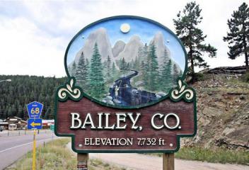
Bailey
William Bailey settled a ranch and built a stage station known as Bailey's Ranch in 1864. Bailey also built a hotel at the station, and the town eventually became known as Bailey. The Denver and South Park Railroad reached Bailey in 1878 and the Bailey Post Office opened on November 20, 1878. Also on March 18, 2006 Bailey became home to the landmark building shaped like a giant hotdog, which was relocated from Aspen Park. Glen-Isle Resort and Estabrook Historic District are both in Bailey.
View Community
Baker
Baker's historic district is approximately 30 blocks and is one of Denver's oldest neighborhoods. The neighborhood includes hundreds of 19th century brick homes and 39 buildings by locally famous architect William Lang. More than 80% of the neighborhood was developed by 1900. Baker Neighborhood has several blocks of Painted Ladys' Victorian Homes in the city. The Historic Mayan Theater is in the Baker Neighborhood as are a collection of restaurants, coffee shops, shops, bars along Broadway
View Community
Barnum
Barnum is a neighborhood west of Denver. Barnum and several of the surrounding neighborhoods were annexed to Denver in 1896. The area is named after P.T. Barnum of the Barnum and Bailey Circus, according to the City of Denver. He purchased 760 acres in 1882 as an off-season winter respite for his show, and originally named many of the streets in the area after famous people. Barnum is home to the Trestle Bike Park, BMX Dirt Jumping, ballfields complex, Platte River Bike Trails & close to Denver.
View Community
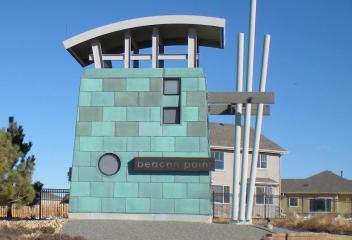
Beacon Point
Beacon Point is a neighborhood in Southeastern Aurora by the Southshore of the Aurora Reservoir. Beacon Pointe has a Community Center for its residents with a swimming pool, tennis courts, meeting and party rooms & etc. Aurora Reservoir is a major attraction for this community that is located on the south shores of the reservoir. Southland Mall is in close proximity that residents can enjoy shopping, restaurants, coffee shops, specialty shopping, and is in the Cherry Creek School District.
View Community
Bear Valley
Bear Valley is a Denver Neighborhood located from South Sheridan Blvd. to Yale to the north, South Wadsworth Blvd. to the west and some areas to the south of West Hampden Avenue. Bear Valley is located north of the Pinehurst Country Club and also has a neighborhood park, Bear Valley which has Bear Creek flowing through the park, and trails that are located close to the center of the neighborhood. The Bear Valley Shopping center is located at the intersection of Sheridan Blvd and Hampden Avenue.
View Community
Beaver Creek
Beaver Creek Resort is a major ski resort in the western Colorado, near Avon, CO. Beaver Creek Resort was envisioned in the 1950's by Earl Eaton, but it wasn't until the early 1970's that Pete Seibert tried to convince the Denver Organizing Committee to hold the 1976 Winter Olympics, his plans collapsed. When Vail Associates was purchased by Harry Bass, he continued Seibert's dream of building Beaver Creek. During the 1980-1981 ski season, Beaver Creek opened along with the first hotel property.
View Community
Bel-aire Estates
Bel-aire Estates is an established neighborhood in South Aurora. Its location is at about East Quincy Avenue and South Eagle Court. This neighborhood'c construction began at about late 1990's, even though there are a few that may have been built prior. This community is conveniently located close to Cherry Creek Reservoir and Cherry Creek State Park, which offers trails for hiking, walking and biking, water skiing on the reservoir, and offers easy access to DTC, I-225 & Buckley Air Force Base.
View Community
Belcaro
Belcaro is a neighborhood in Denver, with Cherry Creek to its north, Colorado Blvd. to its east, Mississippi Avenue to its south & South University to its west. The neighborhood gets its name from the mansion of Lawrence C. Phipps, a United States Senator who represented Colorado from 1919-1931. Phipps chose "Belcaro" as the name of the mansion, today it is more commonly known as the Phipps Mansion. Phipps developed much of the neighborhood. Large ranch style homes dominate the neighborhood.
View Community
Bell Mountain Ranch
Bell Mountain Ranch is a newer established community in Castle Rock. This community is nestled against the bluffs just south of Downtown Castle Rock. Bell Mountain Ranch began its development in the latter 1990's & continued into 2000. Bell Mountain Ranch has sprawling acreage and gently rolling terrain laced with winding trails & is part of an exclusive master planned covenant controlled community. Home sites average 5 to 12 acres with many zoned as horse property, nearly 1,000 acres open space
View Community
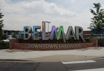
Belmar
Belmar is a neighborhood in Lakewood by the Belmar Mall. Belmar Mall, the old Villa Italia Mall, was completely renovated and revitalized. It reenergized the community and brought much needed vitality back into the community. The neighborhoods around the Belmar Mall are changing, homes renovated and new construction has modified the community, bringing more residents into this community. It was built as a community with shopping, restaurants, specialty shops, open space & parks in the community
View Community
Bennett
Bennett is a town located 25 miles east of Denver at the intersection of State Highways 36 & 79 just north of I-70. This growing, high plains community lies in Eastern Adams and Arapahoe Counties. Bennett residents enjoy the quiet small town atmosphere on the eastern plains. Bennett was incorporated on January 22, 1930 & was named for Hiram Pitt Bennet, a congressional delegate from the Territory of Colorado & Colorado Secretary of State. Until 1878, the town was known as Kiowa Crossing.
View Community
Berkeley
Berkeley is a city-center neighborhood located in Northwest Denver. The neighborhood is bounded by Federal Blvd. to the east, I-70 to the north, 38th Avenue to the south, and Sheridan Blvd. to the west. The neighborhood has two lakes surrounded by parks, Berkeley Lake and Rocky Mountain Lake. The William Scheitler Recreation Center is located in Berkeley Park, with indoor and outdoor pools. Tennyson Street has become a commercial culture center for Northwest Denver, rivaling Highland Square.
View Community
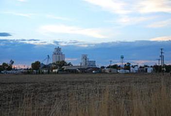
Berthoud
The Town of Berthoud is located in Larimer and Weld County Colorado. It was incorporated on August 28, 1888. White settlers first came to the present day Berthoud area in the early 1860's. Many settlers filed homestead claims, but most bellied up and left the valley to hardier souls who ranched and farmed the prairie that straddled the river bottom. The tiny settlement known as Little Thompson was renamed Berthoud in honor of Edward L. Berthoud, who surveyed the rail route through the valley.
View Community
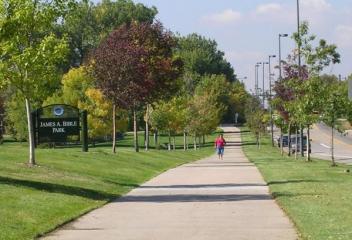
Bible Park
Bible Park Neighborhood is located in Southeast Denver. It is adjacent to Bible Park. Bible Park, named after James A. Bible, is managed by Denver Parks and Recreation. It has Goldsmith Gulch running through the park, biking and walking trails, ballfields, tennis courts, exercise stations and etc. Bible Park Neighborhood is located just north of revitalized and renovated Tamarac Square and Tiffany Plaza, with Whole Foods and Super Target as its main anchors. Hutchinson Homes was the main builder
View Community
Black Forest
The Black Forest history is closely paralleled of the larger area traditionally known as the "Pineries". Arrowheads and charcoal pits provide evidence that the planning area was occupied by Native Americans at least 800 years ago. When settlers began settling in the area in the late 1850's the Black Forest became an important center of activity, primarily as a source of scare timber. General Palmer was the first major landowner of Black Forest & established the Colorado Pinery Trust in 1870.
View Community
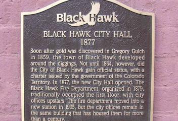
Black Hawk
The historic City of Black Hawk is located in Gilpin County. The tiny town is a historic mining settlement founded in 1859 during the Pike's Peak Gold Rush. Black Hawk is located adjacent to Central City, another historic mining settlement in Gregory Gulch. The two cities form the federally designated Central City/Black Hawk National Historic District. The area flourished during the mining boom of the late 19th century, today it is in heated competition for gambling revenue with Central City.
View Community
Blackstone Country Club
Blackstone Country Club is a Golf Club Community located in Southeast Aurora. It opened in 2007 and is an18-hole course, measures 7262 yards from the longest tees, slope rating of 147 and a 75.0 USGA rating. It offers elegant community country club facilities, such as: pro and exercising facilities, dining and etc. Blackstone Country Club and the Black Bear Golf Club Memberships includes access to both clubs. Local new home builders are still building new construction homes within the community
View Community
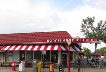
Bonnie Brae
The Bonnie Brae Neighborhood is located in Southeast Denver, west of West Washington Park Neighborhood. It was developed in the 1940's and 1950's. Bonnie Brae has nice collection of Tudor style homes, Colonial and smaller bungalows. It is a mature neighborhood and Bonnie Brae Park is located within the neighborhood. Of course one can not ignore Bonnie Brae Ice Cream and Bonnie Brae Pizzeria is in the neighborhood, in addition to the restaurants, shops & boutiques on Gaylord Street a block away.
View Community
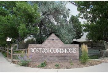
Boston Commons
Boston Commons is an established community in Greenwood Village. This community is located south of East Caley Avenue along South Boston Street. This community began and was developed about late 1980's. Boston Commons is a condominium community in a covenant community. This community offers a Community Clubhouse and pool, whom care for all the grounds maintenance, snow removal and exterior building & roof maintenance. This community is close to Arapahoe Light Rail Station, DTC, restaurants & etc
View Community
Boston Heights
Boston Heights is a neighborhood located in north Aurora. This community is located east of Fitzsimons Medical Campus, home of University of Colorado Hospital, Children's Hospital, new VA Hospital & Fitzsimon's Golf Course. The boundaries for Boston Heights are approximately from East 25th Avenue north, Peoria Street east, East Colfax Avenue south & Havana Street west. This is a neighborhood in transformation because of the relocation of medical facilities, RTD Lightrail, DIA, I-225, I-70 & etc.
View Community
Boulder
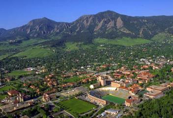
Boulder, college town located at the base of the foothills of the Rocky Mountains at an elevation of 5,430 feet. Boulder is also home of the main campus of the University of Colorado, the state's largest university. It is famous for its colorful Western history. Pearl Street Mall is known for its entertainment, nightlife, restaurants, trendy shopping and boutiques and etc. Boulder was settled in 1858 as Boulder City. Boulder adopted an anti-saloon ordinance in 1907 and ended and repealed in 1933
View Community
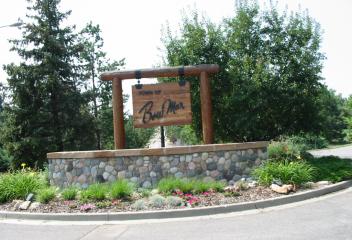
Bow Mar
Bow Mar area was developed as an agriculture area in the late 19th century. The name Bow Mar is derived from combining the names of two nearby lakes, Bowles Lake and Marston Lake. Homes were first constructed into the Bow Mar area in the late 1940's and early 1950's. Homes were constructed upon acre lots and were placed on wide streets, and were limited to being no more than one story tall. Today, many of the homes in the Bow Mar area are being updated or replaced with new construction.
View Community
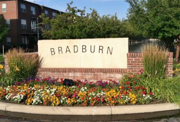
Bradburn
Bradbury is a newer established unique community in Westminster. This community is located along West 120th Avenue between Lowell Blvd. and Sheridan Blvd. This community began its development about 2003 and has continued for a number years. Bradburn is a community that offers a combination of single detached family homes and townhomes. What makes this community unique is its Town Center where Whole Foods, restaurants, 24 Hour Fitness, shopping and community parks are within walking distance.
View Community
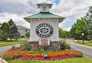
Bradbury Ranch
Bradbury Ranch is a newer established community in Parker. This community is located south of East Mainstreet and west of South Jordan Road. This community began its development about mid 1990's and continued after 2000 with several different builders. Bradbury Ranch is in the Douglas County School District and Prairie Crossing Elementary School is located within the community. Bradbury Ranch is conveniently located to Downtown Parker, DTC, interstate access to I-25, E-470, C-470 and Parker Road
View Community
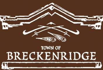
Breckenridge
The historic Town of Breckenridge is located in Summit County. The town was formally created in November 1859 by General George E. Spencer. Spencer chose the name "Breckenridge" after John C. Breckenridge of Kentucky, 14th Vice President of the United States. Prospectors entered what is now Summit County during the 1859 Pikes Peak Gold Rush of 1859. Breckenridge was founded to serve the miners working rich placer gold deposits discovered along the Blue River. Today it is a major ski resort.
View Community
Brighton
Brighton was founded in the 1870's as a stage/railroad depot and farming community. The town was originally named Hughes Station & incorporated in 1887. Brighton was named for Brighton Beach, New York. Brighton is located 20 miles north of Downtown Denver and 20 minutes from Denver International Airport. It has great vistas of the Rocky Mountain Range. Brighton's housing costs remain among the lowest in the metro area. Brighton's housing market continues to expand with new construction & growth
View Community

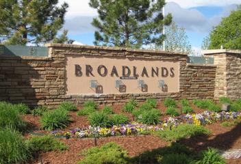
Broadlands
Broadland Neighborhood is located in Broomfield Colorado. Its location is West 144th Avenue and south on Lowell Blvd. The homes built around The Broadlands Golf Course were built in the late 1990's to early 2000's. There are combination of single family detached homes, attached townhomes & condominiums. There is community clubhouse & community pool. Broadlands Golf Course is a championship course, which opened in 1999. It has majestic views of the Rocky Mountain Range, wide fairways to enjoy.
View Community
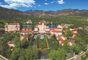
Broadmoor Resort Community
The Broadmoor is a hotel and resort in the Old Broadmoor Neighborhood of Colorado Springs, Colorado. It is a member of Historic Hotels of America of the National Trust for Historic Preservation. The main resort complex is situated at the base of Cheyenne Mountain, southwest of Downtown Colorado Springs. Golf Championships have been held at the Broadmoor Golf Club since 1921, which has 3 golf courses, 18 restaurants, pool cafes. World skating and hockey championships have also been held here.
View Community
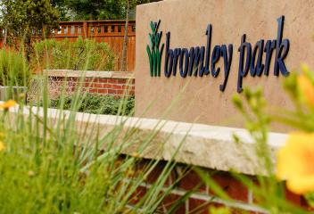
Bromley Park
Bromley Park is an established community in Brighton. Its location is East 152nd Avenue, West Frontage Road South 50th Avenue. Bromley Park was developed and began construction about 2000 & later. Bromley Park is located close to Bromley Business Park, Justice Center, I-76, Bromley East Charter School & Dewey Strong Park. Bromley East Charter School empowers students to achieve academic excellence and leadership through critical thinking. Bromley Business Park is located east of the community.
View Community
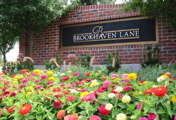
Brookhaven
Brookhaven is a subdivision in Littleton, CO. It has an enclave of homes in the Columbine Valley next to Columbine Country Club. Brookhaven is located off of West Bowles Avenue between Santa Fe Drive & South Platte Canyon Road. Brookhaven is located east of Columbine Country Club & is a golf cart ride away. The proximity to Historic Downtown Littleton makes it a convenient location for restaurants, shopping, boutiques & etc. It is any golfer's dream being in a golf community only blocks away.
View Community
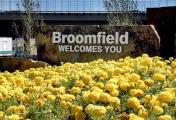
Broomfield
Broomfield was in incorporated as a municipality in 1961in the southeast corner of Boulder County. It received its name from "broomcorn" grown in the area. Over the next three decades, the city grew through annexations, which crossed adjacent county lines of Adams, Jefferson and Weld. In 1998 an amendment was passed allowing Broomfield to operate more efficiently verses dealing with four separate county sales tax bases. On November 2001 Broomfield became the City & County of Broomfield.
View Community
Buffalo Mesa
Buffalo Mesa is a newer neighborhood in Commerce City. It is located at East 104th Avenue and Chambers Road. The development of this community began about 2005 and continued for the next few years. This is a detached single family development. Buffalo Run Golf Course is located behind this community, Buffalo Mesa, off of East 112th Avenue. It was a golf course designed by renowned golf course architect Keith Foster. This course offers a restaurant & has magnificent views of the Rocky Mountains.
View Community

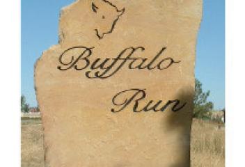
Buffalo Run
Buffalo Run is a community located in Commerce City Colorado. Its location is at I-76 north/East 120th Avenue at Chambers Rd. south of 120th. This community began its development post 2000 and continues construction at The Villages of Buffalo Run. This is a single family home development. Buffalo Run Golf Course is located nearby at 15700 East 112th Avenue, Commerce City, Colorado. It was designed by renowned golf course architect Keith Foster and has picturesque views of the Rocky Mountains.
View Community
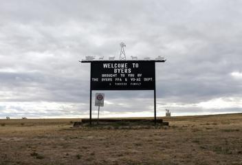
Byers
Byers neighborhood is named after William Newton Byers. Upon moving to Denver, he built and lived in several mansions, including the one known as the Byers-Evans House. The Byers-Evans House is now a museum and is located next to the Denver Art Museum in Downtown Denver. Byers also lived in a mansion on a large tract of land between Washington and Pearl Streets, some historians believe 171 Washington Street was the address. William N. Byers Junior High School was named in his honor.
View Community
Byers Colorado
Byers Colorado is located in Arapahoe County on the eastern plains of Colorado, approximately 50 miles east of Denver. It is an unincorporated community. Byers is located along Interstate 70 at the intersection of US Highway 36 and East Highway 40. The majority of the homes and land around Byers is ranch or vacant land, most are ranchers, while others commute to Denver or other places for employment. Byers has seen an increase in population growth with the construction expansion around Denver
View Community
Cameo Estates
Cameo Estates is an established community in Arvada. Its location is approximately at West 80th Avenue and South Simms Street. Some of the older homes in this community have been replaced with newer construction. This community is located near Pioneer Park, which has approximately 6 ball fields. Alice Sweet Thomas Park is also nearby to this established community. This community is located close to Standley Lake and Stanley Lake State Park. It can be utilized for boating, biking, hiking and etc.
View Community
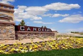
Candelas
Candelas is the largest master-planned community in Arvada Colorado. The Candelas master planned community is located in the southwest quadrant of land formerly known as "Rocky Flats", offsite area at the intersection of Candelas and Coal Creek Canyon Road. Candelas is the only planned community to border property lines with the Rocky Flats National Wildlife Refuge. Candelas is divided in to six subsections east to west: Parkview, Mountainview, Canyonview, Valleyview, Townview, and Skyview.
View Community
Candlelight Crest
The Candlelight Community is an established neighborhood located in Arvada. This community first began development in about the latter 1980's. Candlelight is located at approximately West 58th Avenue and Indiana Street. Candlelight Crest is a new Sheffield Development at the Van Bibber Open Space neighborhood at Indiana Street and 58th Avenue. This new community has gorgeous mountain views and South Table Mountain views. The new development is offering modest 1/3 acre lots, & great floor plans.
View Community
Canon City
Canon City was laid out on January 17, 1858 during the Pikes Peak Gold Rush, but ten the land was left idle. A new company "jumped the claim" to be town's site in late 1859, & put up the first building in February 1860. Originally the town was intended as a commercial center for the mining in South Park & the upper Arkansas River. The Canon City Downtown Historic District is a historic district that was listed on the National Register of Historic Places in 1983. It sits in the "high desert" land
View Community
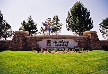
Canterberry Crossing
Canterberry Crossing is a Parker golf community neighborhood. The community is located off of Main Street East from Downtown Parker. Black Bear Golf Course, which used to be Canterbury Golf Course, renamed to Black Bear Golf Course, is located in Canterberry Crossing. Canterbury Crossing has a Recreation Center, with pool, walking & biking trails, Black Bear Clubhouse. There are a number of different communities throughout Canterberry Crossing & the golf course wraps around the communities.
View Community
Capitol Hill
Capitol Hill is located in Central Denver, with boundaries from Broadway to the west, Colfax to the north, Downing to the east and 7th Ave to the south. Capitol Hill is close to 2 major Denver Parks, Cheesman and Civic Center Park. Both parks are meeting centers for the community, host many festivities and etc. Capitol Hill is Denver's most densely populated neighborhoods. Shops, restaurants, nightlife, coffee shops, theaters are within walking distance in and around this lovely neighborhood.
View Community
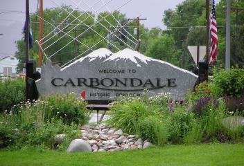
Carbondale
The Town of Carbondale is located in Garfield County Colorado. Carbondale takes its name from Carbondale Pennsylvania, hometown of early settlers. The town is located in the valley of the Roaring Fork River, downstream from Aspen and upstream from the mouth of the Roaring Fork at Glenwood Springs. The town proper sits on the south bank of the river, at the confluence of the Crystal River. Carbondale's horizon is dominated by the 12,953 foot tall Mount Sopris several miles to the south of town.
View Community
Castle Pines
Castle Pines is located 20 miles south of Downtown Denver and 43 miles north of Colorado Springs. Happy Canyon Creek runs north-northeast through the western part of the city and Newline Gulch and its tributary, South Newline Gulch, run north-northeast and north, respectively, through the eastern part of the city. Castle Pines was incorporated November 6, 2007 & was Douglas County's first new city since 1995, Colorado's newest city since 2004. It is located north of the Castle Pines Golf Club.
View Community
Castle Rock
Castle Rock was founded in 1874. Picturesque Castle Rock is situated 30 miles south of Denver and 40 miles north of Colorado Springs. Nestled in the heart of East Plum Creek Valley, surrounded by rocky buttes & featuring views of the Rocky Mountain Range. It is named for prominent rock formations overlooking the town and the discovery of rhyolite stone in the butte near Plum Creek is what put Castle Rock on the map. Castle Rock is home of the Outlets at Castle Rock and an expanding communities.
View Community
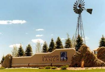
Castlewood Ranch
Castlewood Ranch is a newer community in Castle Rock. This community is located east/southeast of Downtown Castle Rock, & Founders Village neighborhood. Castlewood Ranch began its development at about 2002 and construction of new developments continues in 2015 & beyond. This community is a combination of detached single family homes and attached townhomes. Castlewood Ranch is conveniently located near Downtown Castle Rock, the Outlet Shops, several golf courses, Mitchell Gulch Park & open space.
View Community
Cattails in The Meadows
Cattails in The Meadows is a newer community in Littleton Colorado. It is located at at South Kipling Street and West Geddes Avenue at the entrance of the Stony Creek Neighborhood. Construction on this development began about 2005 and it is in its final phase in 2015 closeout. This development is located just across the street The Meadows Golf Course. Its location provides easy access to Southwest Plaza, C-470, US Highway 285, shopping, restaurants, Clements Park, mountain access and schools
View Community
Centennial
The City of Centennial was formed in February 2001 from portions of unincorporated Arapahoe County, including the former Castlewood and Southglenn census designated areas. The citizens voted to incorporate in September 2000, choosing Centennial as the official name during the vote. Centennial was incorporated in large part to prevent further annexations of unincorporated areas by the City of Greenwood Village. Centennial was incorporated on a promise to keep city taxes at 1%.
View Community
Centennial Acres
Centennial Acres is an established community in Southwest Denver/Arapahoe County. This community was developed about 1960's and mostly brick ranch style homes with basements, most have great lot sizes. Its boundaries are approximately West Union Avenue north, Federal Blvd. east, West Belleview Avenue south and abuts to Bow Mar to its western boundary. It is close to shopping at Federal Blvd and Belleview Avenue, is close to Littleton's Riverwalk/Golf, Platte River, Historic Downtown Littleton.
View Community
Central City
The City of Central, commonly known as Central City is located in Gilpin and Clear Creek Counties. The city is a historic mining settlement founded in 1859 during the Pikes Peak Gold Rush and came to be known as the "Richest Square Mile on Earth". Central City and the adjacent city of Black Hawk form the federally designated Central City/Black hawk Historic District. Today Central City and Black Hawk are gambling casino towns and are in direct competition, competing for gambling revenues.
View Community
Century Highland Park
Century at Highland Park community is a Century Communities Development located in Centennial. The first phase of this development was the townhouse community at Villas at Highland Park which development began about 2007 & continued through the phase out of about 2010. The newer phase of development is at Waterside at Highland Park & construction began at about 2014 & continues. This townhouse community is located at South Yosemite and Nichols Place & the newer phase at Yosemite & Phillips Lane.
View Community
Chaffee Park
Chaffee Park is a neighborhood of Denver. It is an area known by many as North Denver. It was platted in 1946 & most completed by 1949. The neighborhood was named after Jerome B. Chaffee, one of the founders of the City of Denver & US Senator from November 1876 to March 1879. Chaffee Park, along with Regis Neighborhood, are the north Denver Neighborhoods that border the adjacent areas of Southeast Arvada and Twin lakes. Zuni Park is in the northern edge of the neighborhood bordering Adams County
View Community
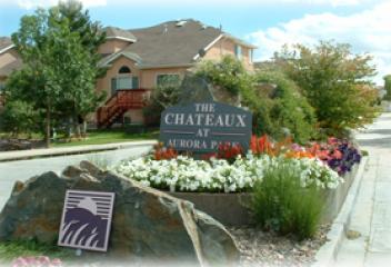
Chateaux
Chateaux is an established community in south Aurora. This community is located on East Iliff Avenue & South Revere Street. This community was developed in the latter 1990's and is a collection of attached townhomes and detached single patio homes. This is a covenant protected community and the HOA manages the ground maintenance and snow removal. Chateaux is located in the Cherry Creek School District. This community is in close proximity to the Golf Club at Heather Ridge, I-225, shopping & etc.
View Community
Chatfield Bluffs
Chatfield Bluffs is a neighborhood in Littleton Colorado. Its location is C-470 and South Kipling Parkway to Ute Avenue. This community was beginning developed about mid 1990's & continued after 2000's. The development has a combination of detached single family homes, attached townhomes & condominiums. It is a covenant controlled community. Chatfield Bluffs is near Chatfield Reservoir and State Park. This community is convenient for Lockheed Martin employees, C-470 getting to your destination.
View Community
.jpg)
Chatfield Commons
Chatfield Commons is a newer community in Littleton Colorado. Chatfield Commons is located on West Chatfield Avenue between South Wadsworth Blvd. and South Kipling Parkway. This is a attached housing community and is ideal for homeowners who like maintenance free living. The community offers its residents a community clubhouse and pool, grounds maintenance and insurance and exterior maintenance of all buildings. Willow Creek Park, C-470 and Chatfield Reservoir are nearby to Chatfield Commons
View Community
Chatfield East
Chatfield East is a community in Littleton Colorado. The community is located approximately 30 minutes from Denver, On South Santa Fe Drive south of C-470, past Highlands Ranch Parkway at approximately South Santa Fe Drive and Titan Road. This is a community for residents that are seeking a few acres for horses property, living in the relaxing country-like lifestyle with breath taking mountain views of the front range and Pikes Peak, this may be a community to research closer.
View Community
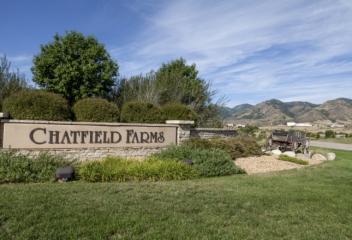
Chatfield Farms
Chatfield Farms is newer community in Littleton Colorado. Its location is South Wadsworth Blvd. south to Waterton Canyon Road. This community's development started at about 2003 and continued into 2014. Chatfield Farms is close to the Denver Botanical Gardens at Chatfield that is a working farm. They hold a number of activities throughout the year, including a red barn to hold events, weddings and etc., summer concerts and etc. Arrowhead Golf Course, Chatfield Reservoir and State Park is nearby
View Community
Cheesman Park
Cheesman Park was Prospect Hill Cemetery in the late 19th century, which also included the land now known as the Denver Botanical Gardens & Congress Park further east. The long disused cemetery was converted to a park in 1907. Cheesman Park Neighborhood is one of the oldest in Denver. With the completion of the park, the neighborhood was mostly developed with large mansions for some of the city's wealthiest people. The neighborhood has become much denser with a plethora of apartment buildings.
View Community
Chelsea Hills
Chelsea Hills is an established community in south Aurora. This community is located in the southeastern quadrant of the intersection of East Iliff Avenue and South Lima Street. Chelsea Hills was developed about early 1990's. This is a covenant controlled community that offers a community pool. Chelsea Hills is in the Cherry Creek School District. It is conveniently located close to Buckley Air Force Base, Denver Tech Center, RTD Lightrail, shopping, restaurants, coffee shops, neighborhood parks
View Community
Cherry Creek
Cherry Creek Neighborhood is known for its trendy shops and boutiques, Cherry Creek Mall, Cherry Creek North shopping district, which is along East First, Second and Third Avenues, restaurants, coffee shops, and etc. Cherry Creek North shopping and dining district is a 16 city-block area with more than 320 upscale galleries, boutiques, restaurants, salons/spas and a pedestrian plaza, Fillmore Plaza. Fillmore Plaza is home to the Cherry Creek Arts Festival, North Ice Rink in the winter.
View Community
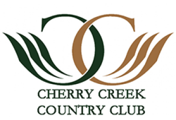
Cherry Creek Country Club
Cherry Creek Country Club and neighborhood, located in southeast Denver at Yosemite and Iliff, is a Jack Nicklaus Signature Course Design in your backyard. The luxurious estates behind its gates that surround this golf course offer the best of the best in a Country Club. Cherry Creek Country Club its magnificent views, beautifully designed golf course, incredible waterways, and Clubhouse that was built in 2002. The clubhouse offers dining, pool, spa, fitness center and private rooms.
View Community
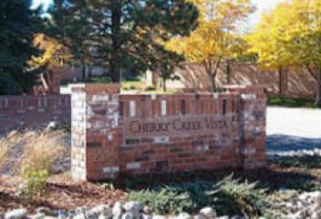
Cherry Creek Vista
Cherry Creek Vista is a neighborhood located in Englewood and Greenwood Village Colorado. Its approximate boundaries are East Belleview Avenue to its north, South Peoria Street to its east, East Arapahoe Road to its south and South Havana Street to its west. Cherry Creek Vista borders the Cherry Creek State Park and Cherry Creek Reservoir. Its location and scenic views are magnificence. It is located near the Arapahoe Marketplace Shopping Center, Denver Tech Center, and Cherry Creek State Park
View Community
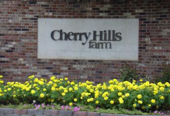
Cherry Hills Farm
Cherry Hills Farm is a neighborhood within Cherry Hills Village and is located to the northeast at South University Blvd. and East Belleville Avenue. Many homes were built in the 1980's and 1990's. The history of Cherry Hills Village in 1938 had a number of homes built known as the "Country Homes" or sometimes called "The Circle", which is the area south of Hampden and west of University Blvd. Denver threatened to annex this area and to prevent encroachment, Cherry Hills annexed several areas.
View Community
Cherry Hills Park
Cherry Hills Park is located in Cherry Hills Village Colorado. It is located between East Hamden Avenue north & East Quincy Avenue south. Cherry Hills Park is a neighborhood that loops around Cherry Hills Park Drive. The Cherry Hills Country Club is across South University Blvd. Cherry Hills Country Club was born in 1922 from a wealthy businessman in the city and carved from the earth by well-known designer William Flynn, proficient in making a golf course blend into its natural setting.
View Community
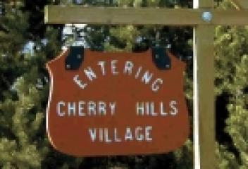
Cherry Hills Village
Cherry Hills Village was incorporated on July 19, 1945. The city hosted two PGA Championships (1941 and 1985) and the U.S. Women's Open in 2005 at the Cherry Hills Country Club. Cherry Hills Village has a population of around 6,000 residence. It is home to a number of Denver Celebrities. The city borders Hamden to the north, Clarkson to the west, Belleview Ave. to the south and Monaco to the east, which follows Happy Canyon Rd to Mansfield Ave. to Dalhia. It is part of the Cherry Creek Schools.
View Community
Cherry Knolls
Cherry Knolls is an established neighborhood in Centennial Colorado. Its boundaries are East Arapahoe Road to the north, South Colorado Blvd. to the east, Dry Creek Road to the south & South University to the west. Most of these homes were built in the 1960's & 1970's with styles of 2-story, ranches, multi-levels, bi-levels and etc. Cherry Knolls Park is a neighborhood community park located towards University Blvd. The newly renovated Southglenn Mall is blocks away, shopping, restaurants & etc.
View Community
Churchill
Churchill neighborhood is an established community in south Aurora. This community is located east of South Parker Road on East Hampden Avenue at South Hamilton Drive. This community was developed about 1980's and abuts to open space and trails that leads to adjoining trails. Churchill community is conveniently located in its proximity to Cherry Creek Reservoir and Cherry Creek State Park, Meadow Hills Golf Course, shopping centers, and offers convenience access to Parker Road, I-225, and DTC
View Community
City Park
City Park is one of the oldest public spaces in Denver. The initial park design was created by Henry Meryweather in 1882 in the tradition of both English pastoral gardens and Central Park in New York City with a flowing, casual design. His concept followed the precepts of Frederick Law Olmsted. Richard Sopris who managed the park from 1881 to 1891, is considered the father of the park. Today City Park contains the Denver Zoo, Denver Museum of Nature & Science, Ferril and Duck Lakes & a boathouse
View Community
City Park North
City Park North may also be referred to as Skyland. Its boundaries are Martin Luther King Blvd. to the north, Colorado Blvd. to the east., East 23rd Avenue to the south and York Street to the west. City Park North neighborhood is going through changes, just like many parts of the Downtown Denver areas. With home values increasing from Downtown and Park Hill, homeowners may be looking at this area. City Park Golf Course is in this neighborhood for golfers. This area is close to Downtown and LoDo.
View Community
City Park South
City Park South is a charming neighborhood south of City Park. It borders 17th Avenue to the north, Colorado Blvd. to the east, Colfax Avenue to the south and York Street to the west. This area is 2 miles east of Downtown Denver, has City Park in its backyard, easy access to the Denver Nightlife, restaurants, bars, trails, Denver Zoo, Jazz in City Park in the summer, Denver's Science Museum, Greek Town on Colfax, East High School, Tattered Book Cover, Sprouts Market, theaters and much much more
View Community
City Park West
City Park West Neighborhood is a neighborhood that borders 17th and 18th Avenue cross the neighborhood from east to west and are busy, one way streets that are growing commercial areas with many poplar neighborhood bars & restaurants. City Park is its eastern border. The neighborhood is dominated with single-family homes, apartment blocks, & medical offices. East Colfax along the City Park's southern border is showing evidence of new vitality, investment with the potential for infill additions.
View Community
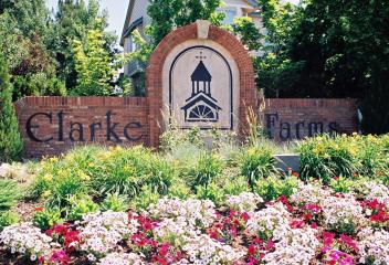
Clarke Farms
Clarke Farms is a neighborhood in Parker Colorado. It is located at East Mainstream and Jordan Road. Development of this community began approximately late 1980's, however the majority of the construction was in the 1990's. There was some additional construction that occurred around 2000 to approximately 2006. Clarke Farms does have a community pool, parks, trails and etc. Its proximity to Downtown Parker and the convenience to travel to Denver, DTC, DIA, E-470, I-25 commutes are convenient.
View Community
Clayton
Clayton is a Denver Neighborhood in east Denver. It is often confused with Park Hill, Cole, or even the City Park neighborhoods. Clayton is bordered by York Street west, Colorado Blvd. east, 40th Street north & MLK south. Clayton is a distinct neighborhood. The neighborhood is named for the historical former George W. Clayton Trust and College located on the northwest corner of Martin Luther King Blvd. and Colorado Blvd. The College has been listed on the National Register of Historic Places.
View Community
Cloverdale
Cloverdale and Cloverdale West are Neighborhoods in Lakewood, Colorado. These are established neighborhoods. Its boundaries are West Mississippi Avenue to the north, South Sheridan Blvd. to the east, West jewell Avenue to the south and South Garrison Street to the west. Cloverdale is south of the renovated and revitalized Belmar Shopping Center. Most of the homes in these areas were built in the mid 1950's and 1960's and are the typical brick ranch homes with basements, with neighborhood parks.
View Community
Club Crest
Club Crest is an established neighborhood in Arvada Colorado. Its boundaries are West 80th Avenue north, Wadsworth Blvd. east, West 74th Avenue south and Kipling Street west. Indian Tree Golf Course is located in the southeastern quadrant of this neighborhood. This neighborhood was developed about 1970's, with the single family homes styles ranging from ranch, bi-level, multi-level. There were condominiums constructed in the area as well about 1980's. Club Crest is close proximity to Old Arvada.
View Community
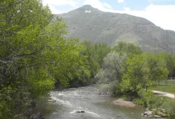
Coal Creek
Coal Creek is a neighborhood outside of Golden, CO. Coal Creek is accessed at Foothills Road & Highway 72. Highway 72 follows Coal Creek to the residential area. It is a windy road to the neighborhood, yet very scenic. The community is mountain living, with only a few convenience shops in the community. If mountain living is ideal, this is an area for one to consider. Coal Creek & a few open spaces are along the drive, homes are usually built on hills to take advantage of the magnificent views.
View Community
Cole
Cole is a neighborhood of Denver named after Carlos M. Cole. The neighborhood became part of Denver in 1874. It is commonly known as East Denver, or the "East Side". The shape of the neighborhood is like a square, it is bordered on the west by Downing Street, northwest Walnut Street, north 40th Avenue, east by York Street & Martin Luther King Blvd. to the south. It borders Five Points/Curtis Park to the west. The neighborhood consist of single family homes. Russell Square Park the community park
View Community
College View
College View is a Neighborhood in City and County Denver. It is located in southwest Denver. Its boundaries are West Evans Avenue to the north, South Zuni to the east (Town of Sheridan city limits) West Dartmouth Avenue and West Floyd Avenue to the south and South Lowell Blvd to the west. Loretta Heights University is in this neighborhood, which has magnificent views of the Rocky Mountain Front Range and of the plains. This is a neighborhood of Denver that is not very prominent at the moment.
View Community
Colorado City
Colorado City is part of the Pueblo Metropolitan Area. Located at the base of the of the Greenhorn Valley, Colorado City blends alpine views with the climate closer to that of Colorado's Banana belt. Colorado City residents enjoy public parks and lands, since much of Colorado City is open space, Lake beck with, and easy access to state highway 165 and I-25. Colorado City enjoys more precipitation and greener summers than most of Colorado, thus it is possible to golf there year around.
View Community
Colorado Springs
In 1871 the Colorado Springs Company laid out the towns of La Font (later called Manitou Springs) and Fountain Colony, upstream and downstream respectively, of Colorado City. Within a year, Fountain Colony was renamed Colorado Springs, and was officially incorporated. On December 1, 1880, Colorado Springs expanded northward with 2 annexations. Colorado Springs is also home to the Broadmoor, Colorado Springs Airport, US Olympic Training Center, Peterson Air Force Base, number of colleges and etc.
View Community
Columbine
Columbine is a neighborhood in Littleton Colorado. Its approximate boundaries are West Bowles Avenue north, South Santa Fe Drive east, West Ken Caryl Avenue south and South Wadsworth Blvd. Columbine was first developed about 1970's and has been changing the past few years. The area in the Columbine Valley has seen some fairly dramatic changes in their landscape. It is home of the Columbine Country Club and the Columbine Polo Club. The proximity to Historic Downtown Littleton is an attraction.
View Community
Columbine Acres
Columbine Acres is an established neighborhood in Arvada Colorado. Its approximate boundaries are West 56th Avenue north, Wadsworth Blvd. west, West 52nd Avenue south and Marshall Street east. This community was developed at about 1950's and offers the typical ranch style brick homes and tri-levels style homes from that era. Columbine Park is a neighborhood park in this community. Historic Olde Town Arvada, coming RTD Lightrail, shopping at Wadsworth, restaurants, I-70, I-76 are all nearby.
View Community
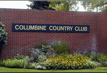
Columbine Country Club
Columbine Country Club is a country club located in the Columbine Valley. The club was established in 1955, has an 18 hole golf course that was designed by Henry Hughes and a 9 hole golf course. The Championship course hosted the PGA Championship in 1967. The neighborhoods single family homes are built around the golf course. The neighborhood is located east of Platte Canyon Road to the west and West Bowles Avenue to the north. Old Historic Littleton and South Platte River are in its vicinity.
View Community
Columbine Hills
Columbine Hills is a neighborhood in Littleton, CO. Columbine Hills boundaries are South Garrison Street to the west, West Ken Caryl Avenue to the north, South Pierce Street to the east and West Chatfield Avenue to the south. Columbine Hills was established in 1959. Jefferson County School District serves this neighborhood, Columbine Hills Elementary, Ken Caryl Middle School and Columbine High School. Columbine Hills is an established community and close proximity to shopping strips and malls.
View Community
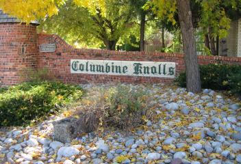
Columbine Knolls
Columbine Knolls is a Neighborhood in Littleton, CO. Columbine Knolls boundaries are West Ken Caryl Avenue to the south, South Platte Canyon Rd. to the east, West Rowland Place to the north to South Kendall Blvd. north to West Coal Mine Road and West Coal Mine Road to north. The recreation facility located on South Kendall Blvd. Normandy Elementary School, Ken Caryl Middle School and Columbine High School serves the Columbine Knolls community. Several park and open space service this community.
View Community
Commerce City
Commerce City was incorporated in 1962. As Denver was considering annexing the area, a plan to incorporate all of southern Adams County was developed. Area residents overwhelmingly voted to incorporate Commerce Town, comprising neighborhoods, such as Rose Hill and southern Adams City. Commerce Town annexed part of Derby in 1962 increasing its population enough to gain status as a city. The city name was changed to Commerce City. Today Commerce City is home to Dick's Sporting Goods Park.
View Community
Como
Como is an unincorporated community in Park County, northern end of South Park. It is believed the town was named by miners from Como, Italy, who worked the coal fields of the area. In 1879, the town became the location of a depot of the Denver, South Park & Pacific Railroad, which extended over Kenosha Pass to reach the silver mining areas during the Colorado Silver Boom. The town has many historic weathered structures, including the roundhouse, hotel, and depot and has an air of a ghost town.
View Community
Congress Park
Congress Park, just east of Cheesman Park and Denver's Botanic Gardens, was born after a bill was introduced in the 1890's to have the grave sites removed from the Cheesman Park and Botanic Gardens areas known at that time as Cemetery Hill. Today Congress Park has over 10,000 residents and approximately 6,000 households. Congress Park has public ballfields, swimming pool, tennis courts and etc. It has a variety of neighborhood shops, restaurants, theaters, coffee shops serving this community.
View Community
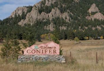
Conifer
Conifer was known in the 1860's as Bradford Junction, a stop on the stagecoach road to South Park. A few building were erected, tavern, rest house, and general store. Bradford Junction deteriorated by the 1890's when the stagecoach road was replaced by the Denver and South Park railroad. By the 1920's the area was simply known as Conifer, a destination known for its beautiful mountainous scenery and abundance of wildlife. It was primarily a ranching area and continues with some ranching in areas
View Community
Copper Mountain
Copper Mountain is located in Summit County with an elevation of 9,695 feet. It is located approximately, 75 miles west of Denver on I-70 and 20 miles north-northeast of Leadville. It was originally named "Wheeler" for a local judge and developer, and it has also been known as "Wheeler Station" in the past. The naming question was settled by a decision from the Board on Geographic Names, which ruled in favor of "Copper Mountain" in 1977. This ski resort officially opened in November 1972.
View Community
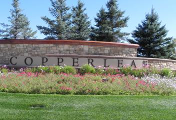
Coppereleaf
Copperleaf is a neighborhood in southeast Aurora, located at Copperleaf Blvd. and South Picadilly Road. Copper leaf is a newer community and additional communities are being built by different builders today. This community has a Community Clubhouse, pool, basketball courts, community parks, trails for biking, walking or jogging and etc. Plans call for additional shopping to be constructed along Quincy Avenue and Picadilly Road. Copperleaf is conveniently located to Southlands Mall, DIA & DTC.
View Community
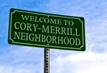
Cory Merrill
Cory-Merrill named after the schools in the area was at one point part of the Town of South Denver. In the 1920's, the future Cory-Merrill neighborhood had been annexed by Denver. In the late 1940's, Armstrong donated his farm land to Denver Public Schools to replace the aging Coronado School. The school district built Cory Elementary, Merrill Junior High. Les Tremblay purchased plots around the schools along Monroe Street called "Les Tremblay Small Houses". This became Cory-Merrill Neighborhood
View Community
Cottonwood
Cottonwood is an established neighborhood located in Parker Colorado. It is located approximately along Parker Road or Jordan Road and Cottonwood Drive. Cottonwood neighborhood was first developed about late 1970's and 1980's. There have been some newer subdivisions developed later along Jordan Road. Cottonwood West Park is located in Cottonwood, which is a large open space with trails, ballfields, playgrounds and etc. Cottonwood is conveniently located to Mainstreet Parker, E-470, and DTC.
View Community
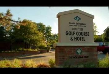
Country Club Estates
The Country Club Estates are located in Lone Tree Colorado. The neighborhood was developed approximately mid 1990's, is located at Lone Tree Parkway and Ptarmigan Trail/Sunningdale Blvd. This community is located at the Lone Tree Golf Club and Hotel. The Lone Tree Golf Club originally opened in 1986 as a private club, Lone Tree Golf Club and Hotel was purchased by South Suburban Parks and Recreation in 1991. Since then, this unique Arnold Palmer designed course has been available to the public.
View Community
Country Meadows
Country Meadows is an established community in Parker. It is located along South Parker Road & north of Hess Road. This community was developed about mid 1990's. Country Meadows is located just east of the Salisbury Equestrian Park & Sports Complex, which is 160 acre park with 30 acres of undeveloped open space. Salisbury Equestrian Park serves Parker's Equestrian community, which features include an lighted arena, arena grandstand, renovated dressage arena, in addition to youth baseball fields.
View Community
Countryside
The Countryside Neighborhood community is located in Westminster Colorado. Its boundaries are West 100th Ave. to the south, Simms Street to the west, West 108th Avenue to the north and blending into the Walnut Creek Neighborhood to the east. Countryside is located north of Stanley Lake and has North Stanley Lake Open Space Park across the West 100th Avenue to the south. This is an ideal community for water enthusiasts to Stanley Lake, proximity to Boulder and Denver & Stanley Lake High School.
View Community
Coventry
The Coventry neighborhood complex is located in Littleton Colorado in Arapahoe County at 5011 West Bowles Avenue. The Coventry is situated on approximately 101 acres, containing 202 homes with 11.5 acres of green belt, a one acre pond that is used for irrigation and fishing. There are 4 miles of private paved roads maintained by the Homeowners Association. The Coventry has two lighted tennis courts, swimming pool that is staffed by life guards in the summer months and a children's playground.
View Community
Crested Butte
The Town of Crested Butte, which was a former coal mining town, today a destination for skiing and biking. The East River Valley where Crested Butte is located was once used as a summer residence of the Ute People. In the 1860's and 1870's coal and silver mines opened in the surrounding area, many mining towns formed. When the silver mining declined, many of the other towns failed, Crested Butte was in a better position to survive because it served a s a supply town to the surrounding area.
View Community
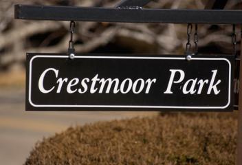
Crestmoor
Crestmoor Neighborhood is located in southeast Denver with its boundaries of 6th Avenue to the north, to Holly Street to the west, East Alameda Avenue to the south & meanders north on Onieda Street to to Monaco & parts of Quebec Street. This neighborhood consists of sizable ranch style homes, however it has been experiencing popping tops to many of the contemporary homes, dotting the southern edge. The northern edge has many victorians and tudors homes. Crestmoor Park is the neighborhood Park.
View Community
Cripple Creek
The City of Cripple Creek is located in Teller County. The Cripple Creek Historic District, which received National Historic Landmark status in 1961, includes part or all of city and surrounding area. The City of Cripple Creek was incorporated on June 9, 1892. For many years Cripple Creek's high valley, an elevation of 9,494 feet, was considered no more important than a cattle pasture. On October 20, 1890, Robert Miller Womack discovered a rich ore and the last great Colorado gold rush began.
View Community
Cross Creek
Croos Creek is a newer community in Aurora Colorado. It is located in the northern corridor of Aurora, just south of I-70 & Gun Club Rd. behind Buckley Air Force Base. Its approximate boundaries are 6th Avenue north, Powhatan Rd. east, East Alameda Avenue south, and Gun Club Rd. east. The development of this community began about 2005 and continues in 2015. This community does have a community clubhouse and pool as amenities. It is conveniently located to Buckley Air Force Base, DIA, E-470, I-70
View Community
Curtis Park
Curtis Park is located just north of Downtown Denver. It is a historic area that was developed in the 1860's and 1870's as a residential area. Curtis Park itself is the city's Oldest official park. After World War II Curtis Park experienced significant decline with many of the historic properties falling into disrepair & commercial developments encroaching from Downtown. Today as many of Denver's Center City districts, Curtis Park-Five Points area is now witnessing a remarkable revitalization.
View Community
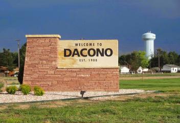
Dacono
The City of Dacono is located in Weld County. The city name was created from the first two letters of the names of three local residents. Dacono was first settled in 1901, & early settlers moved there to work in the coal mines. Dacono was incorporated in 1908. Dacono is located approximately 28 miles north of Denver, east of I-25 on Highway 52 & south of the Towns of Frederick and Firestone Colorado. Expansion continues from City and County of Broomfield, Brighton, & Thornton towards Dacono.
View Community
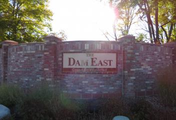
Dam East
Dam East is an established community in south Aurora. This community is located east of South Peoria Street on East Yale Avenue and South Racine Street. Dam East began construction about early 1970's and continued throughout the 1970's. This community is conveniently located to I-225, RTD Light Rail Station and Park and Ride at South Parker Road and I-225, Heather Ridge Golf Course, Denver Tech Center, Cherry Creek Reservoir and Cherry Creek State Park, trails for biking, walking, shopping & etc
View Community
Dancing Willows
Dancing Willows is a newer community located in Littleton Colorado. It is located on West Bowles Avenue past South Simms Street. Dancing Willows development was started at about 2005 and just recently completed. It is a collection of single family detached patio homes and attached townhomes. There is a community clubhouse, community pool and spa for its residents. The HOA maintains all the exterior building maintenance and roof and all ground maintenance. Maintenance free living at its finest.
View Community
Deer Creek Canyon
Deer Creek Canyon is located in Littleton Colorado. Today Lockheed Martin Aerospace Campus is located in entrance of Deer Creek Canyon. In the 1800's, Deer Creek Canyon's rolling hills and fertile fields lured many homesteaders, and its veins of silver and gold brought miners rushing to the area. Today Deer Creek Canyon Park is defined by its sterling recreation opportunities and golden habitat for wildlife, trails for biking and hiking, open space and residents enjoying its scenic beauty.
View Community
Deer Trail
The Town of Deer Trail is a town on the eastern plains of Arapahoe County. Deer Trail is situated along I-70, approximately 55 miles east of Denver. Deer Trail was founded when the Kansas Pacific Railway built at a station that is now Deer Trail in 1870. The town was platted by the railway in 1875 and soon became a shipping point of grain, livestock, and eggs. By the late 1920's deer Trail grew into a town larger than it is today, with two banks, five grocery stores and three hotels.
View Community
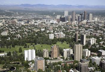
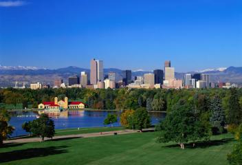
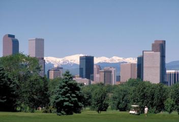
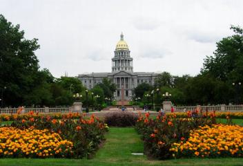
Denver
Denver was founded in November 1858 as a mining town during the Pike's Peak Gold Rush in western Kansas Territory. It has an arid low humidity climate, averaging 14 inches of rainfall/year and 300 days of sunshine. Today it is home to Denver International Airport, 7 professional sport teams, Golf Courses, Denver Botanical Gardens, shopping centers. Denver is home to one of the most comprehensive park systems, connecting lakes to accommodate its water supply in addition to a vast trail system.
View Community
Denver Country Club
The Denver Country Club is a private club located on the southern boundary of the neighborhood along Cherry Creek. The two main features of the neighborhood are the Denver Country Club and Country Club Place Subdivision, designed by William and Arthur Fisher, working with Frederick Law Olmsted, Jr. in 1909. Part of the neighborhood forms the Country Club Historic District, but the boundaries of the historic district and the neighborhood proper are not the same, the historic district is smaller.
View Community
Denver University
The Denver University Neighborhood is home to Denver University and the Denver Pioneers. The neighborhood and housing around the university are smaller bungalows and many have been converted to rentals for college students. The intersection of University Blvd. and Evans Avenue is lined with restaurants and shops to accommodate the students. The DU Neighborhood is one of the many poplar Denver Neighborhoods because of its proximity to Cherry Creek, Wash Park, Platt Park, easy interstate access
View Community
Dillon
The Town of Dillon is located in Summit County Colorado. The original town of Dillon was built as a stage stop & trading post on the northeast side of the Snake River. The town was named for Tom Dillon, a prospector, incorporated in January 26, 1883. During the Great Depression, Denver Water began acquiring land around Dillon. Denver Water began construction on the dam just downstream from the town & the resulting reservoir was going to flood Dillon & the surrounding valley, now Dillon Reservoir
View Community
Double E Ranch
Double E Ranch is a newer community in Arvada. This community is located east of Alkire Street on Ward Road/West 78th Avenue N. This community began construction at about 2003. Double E Ranch is located nearby the Youth Memorial Sports Complex, Van Arsdale Elementary and Ralston Valley Senior High. Standley Lake and Standley Lake Regional Park is in close proximity. Apex Park and Recreation Center is located at Alkire Street and West 72nd Avenue, which offers swimming, health and fitness classes
View Community
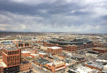
Downtown LoDo
LoDo, Denver is the oldest and original settlement of the City of Denver. It is a mixed use historic district, known for its nightlife and restaurants. The LoDo neighborhood began its revitalization approximately 1988 and by the time Coors Field opened in 1995, it had revitalized itself. Today it is a new hip neighborhood filled with clubs, restaurants, art galleries, boutiques, bars and other businesses. New residential development came to LoDo, transforming old warehouses into pricey new lofts
View Community
Durango
The City of Durango is located in La Plata County Colorado, and incorporated on April 27, 1881. The town was organized in September 1881 by the Denver and Rio Grande Railroad to serve the San Juan mining district. The city is named after Durango, Mexico, which was named after Durango, Spain. The word Durango originates from the Basque word "urango" meaning "water town". The Denver and Rio Grande Railroad chose a site south of Animas City for its depot after Animas City refused to pay a dowry.
View Community
 WBlog.jpg)
Eagle
Eagle is located in Eagle County Colorado. In the early 1800's the town site of the present town of Eagle was covered with sagebrush, grass and small bushes. The upper part of Eagle County was being settled, however gradually the people began moving down the Eagle River Valley. The first person to live on what is now the town of Eagle was William Edwards. He laid claim to 156 acres of land and called the town Castle. When the railroad built its station in Eagle, it was named "Rio Aquilla."
View Community
East Colfax
East Colfax Neighborhood is east of Denver along the Colfax corridor. Its boundaries are Quebec Street to the west, 11th Avenue to the south, Yosemite Street to the east, and Montview Blvd. and 23 rd to the north. East Colfax Neighborhood is below Stapleton to the north and Park Hill Neighborhoods to the west. The eastern boundary is adjacent to the City of Aurora. With the Lowry & Stapleton development, revitalization & expansion, East Colfax Neighborhood is tucked in between both communities.
View Community
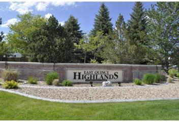
East Quincy Highlands
East Quincy Highlands is a neighborhood in South Aurora. Its boundaries are East Quincy Avenue south, South Picadilly Road west, East Hampden Avenue north and the eastern side borders a greenbelt buffer to E-470. The neighborhood's homes were built about 2000's. East Quincy Highlands is located north of the newer neighborhood development of Copperleaf. East Quincy Highlands is located near Southlands Mall, E-470, Aurora Reservoir, golf courses, restaurants, coffee shops, shopping and etc.
View Community
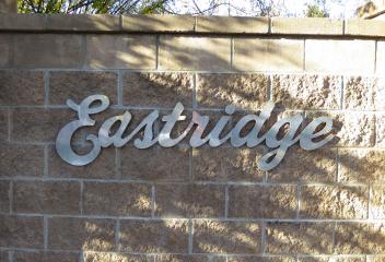
Eastridge
Eastridge is a neighborhood in South Aurora, built in late 1960's and 1970's. Its boundaries are East Iliff Avenue to the north, South Peoria Street to the east, East Yale Avenue to the south & South Jamaica Street to the west. This community is mostly a detached single family residential homes, 2-story, ranches, multi-level style. This community has easy access to the Denver Tech Center, Downtown Denver, shopping, restaurants, coffee shops, RTD Lightrail, Cherry Creek State Park and Reservoir.
View Community
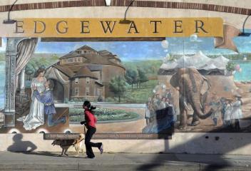
Edgewater
Edgewater was incorporated on August 17, 1901. It is a quiet neighborhood with plenty of open space for its residences to enjoy. Sloans Lake, a Denver Neighborhood Park, is a large body of water to the east of its city limits. Edgewater is located just west of City and County of Denver along Sheridan Blvd. and Sloans Lake Neighborhood Park. Edgewater is also bordered by Lakewood to the south and west and Wheat Ridge to the north. The city has a total area of 0.7 square miles, all of it land.
View Community
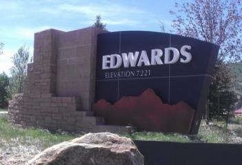
Edwards
Edwards is located in Eagle County Colorado. The Town of Edwards was named for Melvin Edwards, postmaster and later Colorado Secretary of State. Edwards Colorado is in a favorable location for skiers and riders. Beaver Creek Resort is about 4 miles away while Vail is about 14.5 miles away. Edwards offers an alternative and overflow housing during ski season. Edwards is the largest community within in Eagle County, therefore it offers quite a few hotel options, restaurants, coffee shops and etc.
View Community
Elbert
Elbert is located in Elbert County. The community is named for past Colorado territorial governor & state Supreme Court Justice Samuel Hitt Elbert. Elbert lies along Elbert Road, which connects the town of Kiowa to US Highway 24. The largest nearby city is Castle Rock, which is located about 45 minutes away via SH 86, which Elbert Road crosses at Kiowa. Colorado Springs is approximately an hours drive away via US 24. Summers are busier due to a nearby Boy Scout Camp, Peaceful Valley Scout Ranch.
View Community
Eldorado Estates
Eldorado Estates is an established neighborhood in Arvada. This neighborhood is located at approximately at West 80th Avenue and Quaker Street. This community began development at about the early 1970's into the early 1980's. Eldorado Estates is located near Standley Lake and Standley Lake Regional Park. The homes in this neighborhood were the common 1970's architecture, ranch style, bi-levels, try-levels and 4-level homes. This community does not have HOA covenants and are on larger lots.
View Community
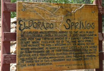
Eldorado Springs
Eldorado Springs, located in Boulder County Colorado. In 1910, Eldorado Springs was a resort community, known for its Big Radium Pool, then the largest swimming pool in the United States. The pool, along with several smaller ones, was known as "Coney Island of the West." Nearby Eldorado Canyon State Park famous for its classic North American climbing routes. Eldorado Canyon State Park offers over five hundred technical rock climbing routes luring & challenging climbers from all over the world.
View Community
Elizabeth
Records indicate the first settler to Elizabeth was Peter I. Van Wormer in 1859 on Running Creek, which today runs through Town of Elizabeth. Elizabeth is still a small, even though it is close to an ever expanding growth from Parker. It is a poplar area for ranchers or residents that prefer the quietness away from the hustle and bustle of the larger towns and cities or prefer to live on acreage. Even though it is a smaller country town, Elizabeth is in close proximity to Castle Rock and Parker.
View Community
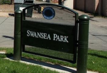
Elyria-Swansea
Both Elyria and Swansea each began as separate, incorporated towns. Swansea was annexed into Denver in two phases, one in 1883 and one in 1902. Elia was annexed to Denver in 1902. The northern boundary of the neighborhood is Adams County, the eastern border is Colorado Blvd., the southern border is 38th Street and 40th Avenue and the western border is the South Platte River. There are current planning stages to connect North Denver's Neighborhoods with a cross over park over Interstate I-70.
View Community
Englewood
The history of Englewood begins when gold was discovered on what came to be called Little Dry Creek in 1858. Two years later, Thomas Skerritt, considered to be the founder of the city, established a home in the area, which was called Orchard Place. Four years later the first road connecting Denver and Orchard Place was created. The Cherrelyn horsecar was laid in 1883, which is a very important year. The Cherrelyn trolley was and is an important city icon, being carried up Broadway by horse.
View Community
Erie
The Town of Erie was officially established on November 16, 1874. It is named after Rev. Richard Jeptha Van Valkenburg who made his way to Colorado from Erie, Pennsylvania. He was the founder of the Erie Methodist Church and a force that helped organize the establishment of the the Town, which was named after his birth place Erie, PA. Today Erie continues to grow and it has built a Erie Community Center, Black Rock Elementary School, Erie Library, and Wise Homestead Museum (dates back to 1869).
View Community
Estes Park
The Town of Estes Park is located in Larimer County and lies along the Big Thompson River. It is a summer resort and the location of the headquarters for the Rocky Mountain National Park. Before Europeans came to the Estes Park Valley, the Arapahoe Indians lived there in the summertime and called the valley "The Circle". The Town of Estes Park is named after Missouri native Joel Estes, who founded the community in 1859. Today Estes Park is a tourist town in the fall to experience the Elk bugling
View Community
Evergreen
Thomas Bergen arrived in 1859, establishing a ranch and stage coach stop north of the present-day downtown Evergreen. Settlers homesteaded south of Bergen along Bear Creek Canyon and the downtown area grew around the confluence of Cub Creek and Bear Creek. Dwight P. Wilmot is credited with naming the area "Evergreen", his home has been preserved and still functions as a private residence across the street from Wilmot Elementary School. The town grew on the lumber demand for buildings in Denver.
View Community
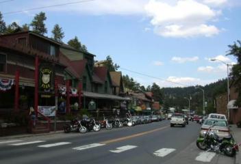
Fairplay
Fairplay is historic gold mining settlement. The town was founded in 1959 during the early days of the Pike's Peak Gold Rush. The town of Fairplay was incorporated in 1872. It is the largest community in the grassland basin of Colorado known as South Park, which sits at the basin of US Highway 285 and State Highway 9. It sits on the hillside just east of the Middle Fork South Platte River. FairPlay is a quiet town and the town consists of modern day retail businesses along the highway.
View Community
Falcon Hills
Falcon Hills is an established gated community in Highlands Ranch. This community is located south of C-470 on South University Blvd, with the entrance at South University Blvd. and Falcon Hills Drive. Development of this community began at about 1985 and continued into the early 1990's. Falcon Hills is a gated covenant community and does have a community pool and fitness center. Falcon Hills has magnificent mountain views, offers convenience for shopping, restaurants, interstate access and etc.
View Community
Federal Heights
The City of Federal Heights is located in Adams County. The community was named for its location on Federal Boulevard & officially incorporated in 1940. Federal Heights is home of a major water park, Water World, one of the largest water parks in the country, & is part of the Hyland Hills Recreation District. Federal Heights boundaries are from West 84th Ave (south), Federal Blvd (west), West 104th Ave (north) and I-25 (east). Federal Heights is part of the Adams 12 Five Star schools District.
View Community
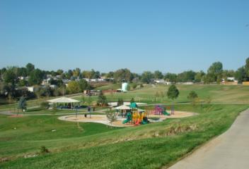
Firelight
Firelight and/or Highlands Ranch Firelight is an established community in Highlands Ranch. This community is located at East Wildcat Reserve Parkway and Poston Parkway. This community began development in the about early 2000's and continued. Firelight is a community in Highlands Ranch with magnificent panoramic view of the Rocky Mountain foothills and range. Red Tail Park is a neighborhood park and offers its residents amenities: shelter, playground, sport fields, basketball courts, and etc.
View Community
Firestone
Firestone was named for Jacob Firestone, a landowner and the town was incorporated in 1908. Firestone is located at or about 30 miles north of Denver. Firestone has experienced considerable growth the past several years as more and more homeowners are seeking a smaller town atmosphere. Firestone has over thirty-five parks & twelve miles of scenic trails, and the Firestone/Legacy Trail is over twelve miles long located where the old railroad tracks were, that used to serviced the coal industry./
View Community
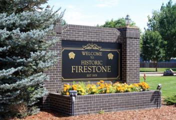
Five Points
Five Points is one of the oldest Denver historic neighborhoods. It is located northeast of the Downtown Central Business District. Five Points District name are the vertexes formed where four streets meet: 26th Avenue, 27th Street, Washington Street and Welton Street. Five Points was the shortened name for the street car stop located at this intersection. Five Points went through economic hardships during 1950's to the late 1990's. Today it is being revitalized and older homes are being restored
View Community
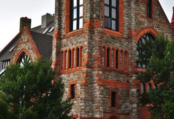
Forest Springs
Forest Springs is an established community in Arvada. Forest Springs is a low maintenance detached patio home community that was constructed about mid 1990's. This patio home community is located at East 64th Avenue & Kendrick Drive and McIntyre Street. The HOA maintains the ground maintenance, exterior maintenance, snow removal in its monthly fees. Forest Springs is near the West Woods Ranch Golf Course, which abuts west of the neighborhood. An ideal community for those who love low maintenance
View Community

Fort Collins
Ft Collins was founded as a military outpost of the United States Army in 1864. The original location of the fort was relocated several miles down the river because a flood destroyed the camp in June 1864. The original fort site is now adjacent to the present historic "Old Town" portion of the city. Settlers began arriving in the vicinity of the fort nearly immediately. Ft. Collins, very conservative town in the 20th century prohibiting alcoholic beverages, student activism ended the ban in 1969
View Community
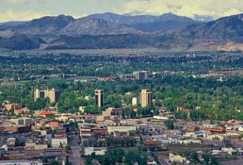
Fort Lupton
The City of Fort Lupton is located in Weld County. The city was named after Lieutenant Lancaster Lupton, who built a trading post here on the Adobe Creek in 1840. Fort Lupton is proud of its history and is fortunate to have many of its historic commercial and residential buildings still in existence today. Denver Avenue, serves as the City's historic main street. The City of Fort Lupton has several community parks for its residence, in addition to the Fort Lupton Recreation Center.
View Community
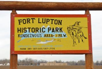
Founders Village
Founders Village Neighborhood is in Douglas County, located in Castle Rock east of Downtown Castle Rock. It is located on Highway 86 heading towards Franktown. Founders Village is a single family home development and has had numerous sub areas built within the confounds of Founders Village. Most of the home styles within Founders Village are 2-story, trip-levels, 4-levels and ranch style. Founders Village is in the Douglas County School District, outlet shops, restaurants, boutiques are nearby.
View Community
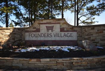
Fountain
The City of Fountain is located in El Paso County Colorado, 10 miles south of downtown Colorado Springs and just east of Fort Carson. Fountain and the Colorado Springs suburbs of Security and Wakefield make up the "Fountain Valley" community. Fountain was built in 1858 as a railroad shipping center for local ranches and farms. The town was named for Fountain Creek and was incorporated in 1900. It was chosen in 1999 as "America's Millennium City", and "All-America City" in 2002 .
View Community
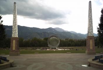
Fox Haven
Fox Haven is a community located in Arapahoe County in Littleton Colorado. This is a custom home development and began construction in the latter portion of about 1990's. This community is located at West Coal Mine Road and South Yates Court. This is a smaller community close to the Columbine Country Club and Golf Course, Columbine Polo Club, Historic Downtown Littleton, Littleton Golf and Tennis Club, Southwest Plaza, Clement Park, Platte River and Riverwalk, restaurants, shopping and etc.
View Community
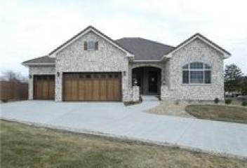
Fox Haven at Mesa Meadows
Fox Haven at Mesa Meadows is an established community located just outside Golden Colorado. This community is located north of Highway 58 & east of Highway 93. Fox Haven at Mesa Meadows is located and close proximity to Historic Downtown Golden, Golden Gate Canyon Road, Coors Brewery, Clear Creek, & etc. Norman D. Memorial Park is a neighborhood park at Fox Haven at the Mesa Meadows. South Table Mountain, east of this community offers magnificent views of its beauty within the community.
View Community
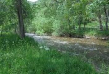
Fox Hill
Fox Hill is an established neighborhood in Centennial Colorado. Its location is at East Qunicy Avenue & South Reservoir Road. This community began construction about mid 1990's & continued for the next several years. This community is east of Quincy Reservoir, which offers trails for walking, running, biking and hiking, fishing, open space and etc. This community is in the Cherry Creek School District and is conveniently located to Buckley Air Force Base, Southlands Mall, shopping centers & etc.
View Community
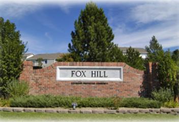
Foxfield
The Town of Foxfield is located in Arapahoe County, at the intersection of Parker and Arapahoe Roads. The town is bordered by the cities Aurora and Centennial, and Unincorporated Arapahoe County. Downtown Denver is 20 miles northwest and the Town of Parker 5 miles south. The town has a total area of 1.3 square miles, all of it land. The Town of Foxfield was incorporated on December 15, 1994. Foxfield's close proximity to Denver and DTC, large rural residential horse property lots are desirable
View Community
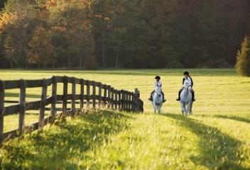
Foxridge
Foxridge Neighborhood is located in Centennial Colorado. Its location and boundaries are approximately East Dry Creek Rd. to the north, South Quebec Street to the east, County Line Rd. to the south and South Holly Street to the west. Foxridge is an established neighborhood and was built in the 1970's and 1980's. The single family dwellings are 2-story, ranch style, trip-levels and 4-levels. There were attached townhomes built in this neighborhood in the mid 1990's. Close to Park Meadows Mall.
View Community
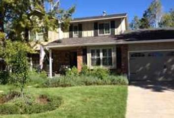
Franktown
Franktown is named for Hon. J. Frank Gardner, an early resident. Franktown was the first county seat in Douglas County, serving in this role from 1861 until 1863. Located at the intersection of Highway 86 (Franktown Road) and Highway 83 (Parker Road), the area does have a rich history, one that is well preserved at the historical museum just outside of town. The museum is located in an old one-room schoolhouse. Castlewood Canyon State Park displaying the remains of the century-old dam.
View Community
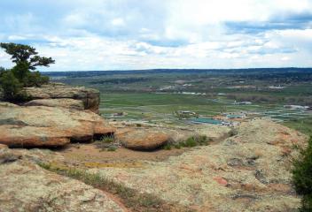
Frederick
Frederick was initially named McKissick. Frederick was renamed when the daughters of Frederick A. Clark, a land owner, laid out the town site in 1907 & named it for their father. It was incorporated in 1907, the town of Frederick began as a coal mining town, attracting immigrants from Italy, France, Greece, Turkey, several slavic countries & Latin America. In 2014 the town "rebranded" by designing a logo that is a stylized gas lamp with a mountain range background. Today it continues to expand
View Community
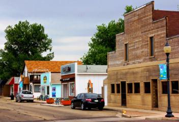
Friendly Hills
Friendly Hills is an established neighborhood in Morrison Colorado. Its boundaries are approximately West Quincy Avenue to its north, South Youngfield/Alkire Street to its east, West Belleview Street its south and C-470 to its west. This neighborhood was established in the 1970's and construction continued in the 1980's and as recently as 2000's. There are variety of styles that were constructed in this neighborhood from 2-story, ranches, and multi-levels. Bear Creek State Park is to its north.
View Community
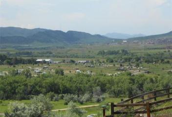
Frisco
The Town of Frisco is located in Summit County. Frisco was founded by Henry Recen and was built because of the mining boom in the area. It was incorporated on December 3, 1880. Frisco is a popular town for skiers from around the world because of its close proximity to four major ski resorts, Copper Mountain, Breckenridge, Keystone, and Arapahoe Basin. Dillon Reservoir is also located on the east side of Frisco along Highway 9. It is utilized for boating and water sports in the summer time.
View Community
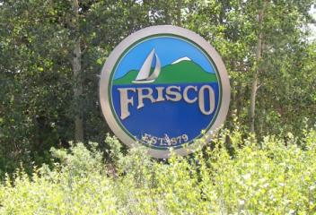
Genesee
Genesee is located in the foothills of Jefferson County along I-70 corridor outside of Golden. This community is scenic with exception view of Golden and the plains to the east and Downtown Denver. Genes Park is in Jefferson County and is the largest park in the Denver Mountain Parks System with a total of 2,413 acres. The land for Genesee Park was initially purchased in 1912 and the park was largely completed by 1926. Exit 254 along I-70 is an scenic overlook in viewing the historic Bison herd.
View Community
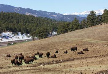
Georgetown
The historic Town of Georgetown is located in Clear Creek County. The town was founded in 1859 during the Pike's Peak Gold Rush by George & David Griffith, two prospectors from Kentucky. "Georgetown" was named in honor of the older of the two brothers. Although it was founded during the gold rush, the discovery of silver on September 14, 1864 that caused the town to grow rapidly. Georgetown was incorporated on January 10, 1868 and its historic courthouse, that still stands, dates from that year
View Community
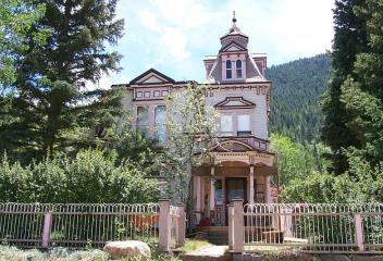
Glenbrook
Glenbrook is a neighborhood located by Southwest Plaza. It is actually located in Denver County and some have Littleton addresses. This area was constructed and developed approximately in the 1980's. This area was known as the "Blue Ghetto" because all the Denver Police Officers moved and lived here when the City and County of Denver required all city employees live within the city and county limits. This neighborhood is by Southwest Plaza, shopping, restaurants, specialty shops very accessible.
View Community
Glenmoor Country Club
Glenmoor Country Club is nestled in the heart Cherry Hills Village Colorado. Glenmoor features a championship 18-hole golf course designed by world famous Pete Dye course. In 2008 Glenmoor completed its interior remodel of the clubhouse for $8M, which included display style kitchen, new locker room facilities, fitness room, massage rooms, children activity room & a spacious banquet level for hosting events. The country club offers three different pools, three outdoor tennis courts, dining & etc.
View Community
Glennon Heights
Glennon Heights is a neighborhood in Lakewood Colorado. Its approximate boundaries are West Alameda north, South Kipling Parkway east, West Mississippi Avenue south and South Union Blvd. west. Glenn Heights is located south of the Denver Federal Center and adjacent to Green Mountain Village. Its location provides easy access to Belmar Shopping Center, Green Mountain Market Square, Union Square Shopping, mountain access & 6th Avenue Freeway. Glennon Heights Park and Pool are in this neighborhood
View Community
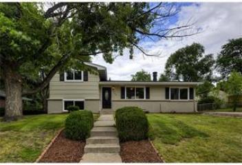
Glenwood Springs
The City of Glenwood Springs is located in Garfield County Colorado. Glenwood Springs was originally known as "Defiance", a name sometimes still used by locals businesses. Defiance was established in 1883, a camp of tents, saloons, and brothels. It was populated with the expected gunslingers, gamblers, and prostitutes. Town Founder, Isaac Cooper persuaded the founders to change the name to Glenwood Springs after his wife beloved hometown Glenwood, Iowa because of her difficulty adjusting.
View Community
Globeville
Globeville Neighborhood was originally settled in the late 1880's around the Globe Smelting and Refining Company. Many of the early workers were Eastern European immigrants. Globeville was originally platted in 1889 and incorporated as a town in 1891. Denver annexed Globeville in 1902. Even its early years, Globeville was isolated from the rest of the city. Railroads and the South Platte River served as barriers. In the mid 20th century, Globeville was further impacted with I-70 was constructed.
View Community
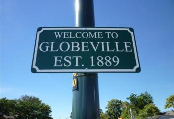
Golden
Golden was founded during the Pike's Peak Gold Rush on June 16, 1859, the mining camp was originally named Golden City in honor of Thomas L. Golden. Golden is home to Colorado School of Mines, National Earthquake Information Center, Coors Brewing Company, National Renewable Energy Laboratory, Spyderco, Colorado Railroad Museum, American Mountaineering Center and was the birth place of the Jolly Rancher, a candy that was bought out by Hershey Foods Corporation. Golden is very rich in history.
View Community
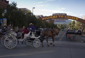
Golden Gate Canyon
Golden Gate Canyon is home to Golden Gate State Park, which is located in Gilpin and Jefferson Counties northwest of Golden Colorado. The 11,998 acre Front Range Park was established in 1960, has 36 miles of hiking trails. Wetland & riparian plant communities are found along Ralston, Nott and Deer Creeks and small ponds within the park. Ponderosa Pine, Rocky Mountain Junipers, Douglas Fir, & Aspen are in the forested areas. There are residential homes and ranches in areas of Golden Gate Canyon.
View Community
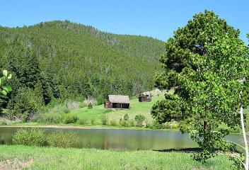
Golden Triangle
Golden Triangle, one of the oldest neighborhoods in Denver, with many single family victorian and bungalow homes built in the late 19th and early 20th centuries. Between 1904 and 1919, Denver Mayor Robert Speers completed his ambitious plan for the Civic Center area, placing a urban canyon around Cherry Creek & creating Speer Blvd. Starting 1990's a new Central Library was constructed and the neighborhood began its transformation into a functional multi-use neighborhood with new condos & lofts.
View Community
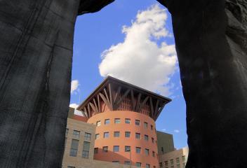
Governor's Ranch
Governor's Ranch is a Neighborhood Community in Littleton. Its boundaries are West Belleview Avenue to the north, Kipling Street to the west, Bowles Avenue to the south and Southwest Plaza to the east. Governor's Ranch is a covenant community, with a clubhouse, pool, tennis, open space for walks and etc. There is a mixture of single family homes and townhomes in this neighborhood. Southwest Plaza is to the east of the community that offers shopping, restaurants, coffee shops, Whole Foods &. etc.
View Community
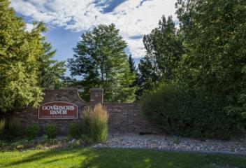
Granby
The Town of Granby is the most populated municipality in Grand County Colorado. The town was founded in 1904 along the route of Denver, Northwestern & Pacific Railway, and was incorporated one year later. It was named after Granby Hillyer, a Denver lawyer who later served as the United States Attorney for the city's district. Granby is situated along US Highway 40 in Middle Parkabout 85 miles west of Denver, southwest of Rocky Mountain National Park. Granby is 7935 Feet above sea level.
View Community
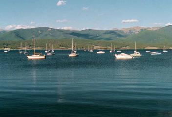
Grand Junction
The City of Grand Junction is located in Mesa County Colorado & incorporated July 22, 1882. It is named for Confluence of Grand River & Gunnison River. A little known aboriginal civilization known as the Fremont first moved into the area about 200 A.D. Living in pit-houses, eating insects, small animals and sparse produce from tiny gardens, the mysterious Fremont left about 1300 A.D. Until 1821, the Grand Valley was part of the Kingdom of Spain. The land remained mostly Ute Territory until 1881.
View Community
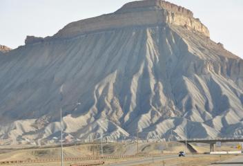
Grant Ranch
Grant Ranch is a community of villages off of West Bowles Avenue in Littleton. This community is adjacent to Bowles Reservoir and Marston Lake. Grant Ranch offers a variety of homes, whether ranch style homes to patio homes (for the busy executives or retirees) to more adult friendly communities. It has a clubhouse pool area for the neighborhood in addition to community parks & trails. It's location makes it convenient to explore, whether Southwest Plaza, restaurants, specialty shops, & lakes.
View Community
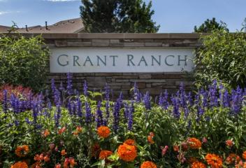
Greeley
Greeley was named after Horace Greeley, editor of the New-York Tribune, who came to Colorado in the 1859 Pike's Peak Gold Rush. It was founded as the Union Colony in 1869, an experimental utopian society, but the name was later changed in honor of Horace Greeley. Governor Benjamin Harrison Eaton declared Greeley an official city in April 6, 1886. Greeley is home University of Northern Colorado. Greeley is still growing & changing today, its population has more than doubled since 1970.
View Community
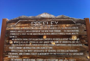
Green Mountain
Green Mountain is a neighborhood in Lakewood. This has been a poplar neighborhood for many whom crave to get away from the higher denser metropolis areas throughout Denver. It has an easy commute into Downtown Denver via I-70 or 6th Ave. Located at the western fringes of the metro area in the foothills, residents love the abundance of open space. William Frederick Hayden Park has more than 2,400 acres of open space on Green Mountain and is the second largest park in Lakewood, with stunning views
View Community
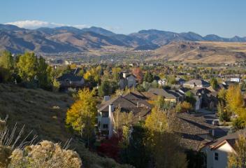
Green Valley Ranch
Green Valley Ranch is a Denver Neighborhood just south of Denver International Airport. It is still a developing and expanding community and still under construction today. As the Denver International Airport Corridor continues to grow and expand, so will Green Valley Ranch. Green Valley Ranch has its own public golf course, recreation center, shopping centers, restaurants, schools, open space to accommodate its neighborhood. Today construction continues in this rapidly developing community.
View Community
Greenfield
Greenfield Neighborhood is located in south Aurora. The boundaries for the Greenfield neighborhood is Smoky Hill Road north, South Liverpool Street south, East Arapahoe Road south and abuts to Piney Creek East west. The Greenfield subdivision was developed and constructed about 1990's and early 2000's. The homes constructed range from 2-story, ranch, multi-level styles. This neighborhood is located close to Saddle Rock Golf Course, Southlands Mall, E-470, DTC, and Buckley Air Force Base.
View Community
Greenwood Village
Greenwood Village is located in the Denver Tech Center area. It meanders in and out of the cities of Englewood and Centennial. Greenwood Village is home to many office buildings, restaurants, hotels, wineries, galleries, shopping, boutiques, coffee shops, pizzerias, health clubs, parks, trails and etc. It is also home to The Landmark Theater, Comedy Works, InVINtions, and etc. It's location is convenient to both Centennial Airport and Denver International Airport with easy access to interstates
View Community
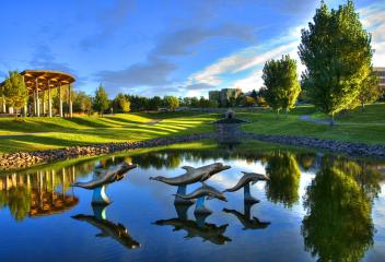
Gypsum
The Town of Gypsum is located in Eagle County. Gypsum was named for nearby gypsum deposits and was incorporated on November 25, 1911. Gypsum is located just 30 minutes from Beaver Creek Ski Resort and 45 minutes from Vail Ski Resort, its proximity is good. Gypsum is the location of the Eagle County Regional Airport, a popular regional airport used in the winter to transport skiers to nearby Vail. Gypsum is home to American Gypsum drywall plant, which, provides a variety of wallboard products.
View Community
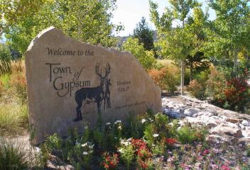
Hale
The Hale Neighborhood is a community, which many consider part of the Mayfair area. Hale Parkway begins at the intersection of Colorado and 12 Avenue and continues through the neighborhood and connects to 8th Avenue. Hale Parkway is a 2 lane street, separated with a center median. This area has a lot of multi-family units along Hale Parkway as well as the single family dwellings. This area was surrounded by hospitals, in which University Hospital relocated to Fitzsimons. Rose Medical remains.
View Community
Hallcrafts Village East
Hallcrafts Village East is a neighborhood in South Aurora, that borders East Mississippi Avenue to the north, South Peoria Street to the west, East Jewell Avenue to the south and South Potomac Street to the east. Hallcrafts Village East is directly east of Village East and at times gets misconstrued as being part of Village East. This neighborhood is in close proximity of the Buckingham Shopping Center and Utah Park is a neighborhood community park located at Jewell Avenue and Peoria Street.
View Community
Hampden South
Hampden South Neighborhood is located in southeast Denver. Much of this area was constructed by Hutchinson homes, single brick ranch style with basements. These homes are still prominent in Hampden South. Hampden South Neighborhood has seen some significant changes in its surroundings, with the renovation and revitalization of Tamarac Square and Tiffany Plaza. Kennedy Golf Course is also located in this neighborhood. Light Rail Transfer Station is located at the intersection or Parker Rd & I-225
View Community
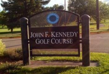
Harriman Park
Harriman Park Neighborhood is located in Jefferson County, south of West Quincy Avenue to its north and South Simms Street to the east, West Belleview Avenue the south & South Youngfield Street to the west. Weaver Hollow Park is located in this community, with a swimming pool, skateboarding, trails and etc. Harriman Lake Park is located to the east across South Simms Street. The homes in this area are mostly single family homes with style from 2 story, trip-levels, 4-level & ranch style homes.
View Community
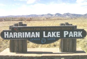
Harvey Park
Harvey Park Neighborhood is one of Denver's best kept secrets in southwest Denver. It is situated south of Evans Ave to the north, Sheridan to the west, Hampden Blvd. to the south to approximately Lowell Blvd. to the east. Most of the homes in the Harvey Park area were constructed in the 1950's, brick ranches with basements. There are others that were constructed on slab, without basements. Harvey Park is a Denver Park and has a community recreation center, trails, ballfields, lakes and etc.
View Community
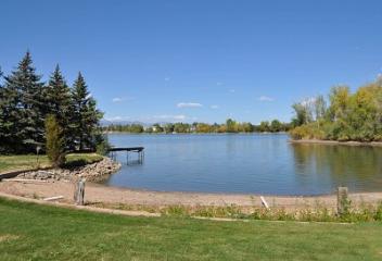
Harvey Park South
Harvey Park South is a neighborhood in southwest Denver from approximately West Yale Avenue to the north, South Lowell Street to the east, Highway 285 to the south and South Sheridan to the west. Harvey Park is a neighborhood park managed by Denver Parks and Recreation. Ward Lake is located in the park as well as the Harvey Park Recreation Center. Harvey Park South is further south than the Harvey Park Neighborhood. Harvey Park South has panoramic mountain view that are quite magnificent.
View Community

Henderson
Henderson, formerly known as Henderson Island, is an unincorporated community in Adams County. Portions of the Henderson area have been annexed by Commerce City, Brighton, and Thornton. In 1859, John D. "Colonel" Henderson built a ranch, trading post, and hotline Henderson Island in the South Platte River. Henderson sold meat and provisions to gold seekers on their way up the South Platte River Trail. Henderson Island today is the home and site of the Adams County Regional Park and Fairgrounds.
View Community
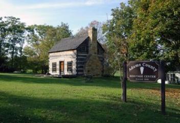
Heritage at Eagle Bend
Heritage at Eagle Bend is located in Aurora, in a gated golf community that is home to Heritage Eagle Bend Golf & Country Club. Heritage Eagle Bend Golf Course was designed by Arthur Hills & its 18 hole championship course makes use of the dramatic elevation changes, native areas, panoramic views and wide, accommodating fairways to appeal to players of all levels & provides tests at every bend. The community is located off South Gartell Road and Eat Heritage Parkway. Close to Southlands Mall.
View Community
Heritage Estates
Heritage Estates is a community located in Lone Tree Colorado. This community is located southwest of the intersection of East Lincoln Avenue and South Yosemite Street/Ridgeway Parkway. This community began development early to mid 1990's and continued development over the next ten years or more. Heritage Estates is located on and is built around the fairways of the Lone Tree Golf Course. Buffs Regional Park is adjacent to Heritage Estates and its close to Park Meadows Mall, I-25, C-470 & E-470.
View Community
Heritage Hills
Heritage Hills community is newer located in Lone Tree Colorado. This community is located north of East Lincoln Avenue off of South Yosemite Street. This community began development about 2000 and continues some development. It is located near the Lone Tree Golf Club and Hotel, Park Meadows Mall, Denver Tech Center, Heritage Hills Park and Medical Facilities on Park Meadows Drive, Sky Ridge Medical Center, Bluffs Regional Park. This community has convenient access to C-470, E-470, I-25 & etc.
View Community
Highlands
Highlands was founded in 1859 when the Highland Town Company formed and planned to connect Auraria and Denver via a bridge across the Platte River. Highlands is west of Downtown Denver and many times is mischaracterized as Highlands in other neighborhoods. LoHi is a newer neighborhood connecting Highlands to Downtown Denver. The intersection of Lowell Blvd. and 32nd Avenue is a poplar meeting place for the neighborhood and visitors alike with many restaurants, coffee shops, bars, boutiques & etc
View Community
Highlands Ranch
Highlands Ranch was founded in 1981 as a 22,000-acre master planned community. Like many parts of the Colorado Front Range, the first residents of Highlands Ranch were Native Americans. In 1978, Highlands Ranch was purchased by The Mission Viejo Company. As the suburbs of Denver expanded, the company desired to build a new planned suburb in northern Douglas County, akin to its first planned development of Mission Viejo, California. New neighborhoods are being developed in Highlands Ranch today.
View Community
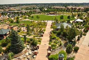
Highlands Ranch Westridge
Highlands Ranch Westridge is an established community in Highlands Ranch. This community is located east of South Santa Fe Drive off of Town Center Drive & Redstone Park. Highlands Ranch Westridge development started about 1990 & continued through the 1990's. Red Stone Park is nearby Highlands Ranch Westridge. Redstone Park offers the following amenities: Creekside Shelter, Fishing Pier, Gazebo and Pumphouse Shelters, Playground, Picnic Tables, Fishing Pond, Skate Park, Dog Park, Tennis Courts.
View Community
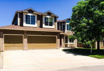
Highpoint
The Highpoint Neighborhood is an established community located in South Aurora. Its boundaries are East Hampden Avenue north, South Tower Road west, East Quincy Avenue south, South Halifax Street east. The neighborhood and homes were developed about 1980's. The home styles range from ranch style, tri-levels, 4-levels, bi-levels, 2-story. This neighborhood is located near the Plains Conservatory Center. It has easy access to E-470, Southlands Mall, Buckley Air Force Base, Quincy Reservoir & etc.
View Community
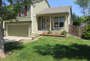
Highwoods
Highwoods is a luxurious established community in Highlands Ranch. This community is located at the northeastern quadrant of the intersection of South Broadway and East Wildcat Reserve Parkway. Highwoods was developed in about 1995 and continued its construction past 2000's. This community has magnificent panoramic views of the Rocky Mountain Range, has an abundance of open space, trails for biking, walking, hiking, convenient access to C-470, DTC, Lucent, golfing, shopping, restaurants, & etc.
View Community

Hillcrest
Hillcrest is an established community in Highlands Ranch. This community is located in southeastern quadrant of the intersection of South University Blvd. and N Highlands Ranch Parkway/South Colorado Blvd. This community was developed in the 1990's. Hillcrest is in the Douglas County School District and Highlands Ranch High School is in close proximity. Falcon Park is a nearby neighborhood park, which offers sports fields, shelter, playground, and picnic tables. Shopping, restaurants are close.
View Community
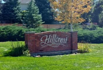
Hilltop
Hilltop Neighborhood gets its name from the fact that it is higher in elevation than its surrounding parts of the city. The neighborhood is bordered by Colorado Blvd to the west, Alameda Ave to the south, Severn Ave to the north and the eastern border is uneven, but includes Monaco Blvd. Hilltop is in close proximity and just east of Cherry Creek and the Cherry Creek Mall. It is also just south of the new development at 8th and Colorado Blvd., a huge new redevelopment of shops, condos and etc.
View Community
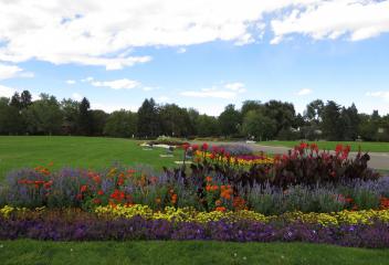
Historic Downtown Littleton
Littleton's history can be traced to the Pikes Peak gold rush of 1859. In 1872, Along with the gold-seekers came merchants and farmers to provide necessities of life. Rough and Ready Flour Mill was built in 1867, providing a solid economic base in the community for years to come. A milestone in Littleton's history occurred when the Old Arapahoe County was divided into six counties in 1902. Littleton was named the temporary county seat by Governor Orman, which brought businesses to the area.
View Community
Hoffman Town
Hoffman Heights is an established neighborhood in northern Aurora. Its location is approximately East 13th Avenue north, Potomac Street east, East 6th Avenue south, and Peoria Street west. This community was developed about 1950's and the majority of these homes were built on slab with no basements, which is typical for this community. This is a community in transition because of its proximity to the Fitzsimon's Medical Campus, which is home to University of Colorado, Children's Hospital and etc
View Community
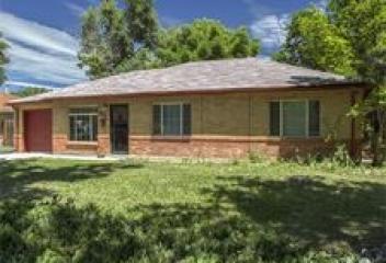
Horse Shoe Ridge
Horseshoe Ridge is a new or newer community in Parker. This community is located north of East Hess Road along N Motsenbocker Road. This community began development about 2008 and development continues today and construction most likely will continue for the next several years. Horseshoe Ridge is located west of Salisbury Equestrian Park and Sports Complex, which is a 160 acre park with 30 acres of undeveloped open space. Salisbury Equestrian Park serves Parker's Equestrian Community with arena.
View Community
Hudson
The Town of Hudson is located in Weld County. It was incorporated on April 2, 1914. The Town of Hudson is located at I-76 and Highway 52, 30 minutes northeast of Denver. On May 24, 1862 the Union Pacific Railroad drove the spike to complete the railroad line stretching from Omaha, Nebraska to Denver. Located along the the way were water stops, and at these locations small towns began to grow. In 1863, they built a section house and depot to add to the water cistern where Hudson stands today.
View Community
Hunters Run
Hunters Run is an established condominium community in Unincorporated Arapahoe County. This community is located between East Harvard Avenue north and East Yale Avenue south along South Syracuse Way east. This complex was developed about mid 1990's. This convenient condominium community offers its residents a community pool, maintains all exterior buildings and roofs, ground maintenance, insurance, water, sewer, trash and snow removal. This community is conveniently located to DTC and Denver.
View Community
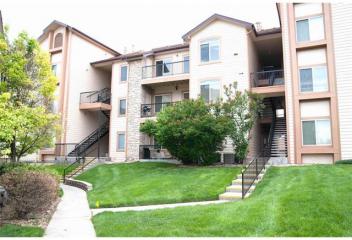
Huntington Acres
Huntington Acres is an established community in Greenwood Village. This community is located south of East Orchard Road between DTC Blvd./South Yosemite Street and South Dayton Street. The development of this community began at about 1981. This community is located in the Cherry Creek School District. Silo Park is home to Huntington Acres, a neighborhood park, which offers a tot-lot playground, demonstration gardens, amphitheater, multi-use playing field, natural area with trail, and shelter.
View Community
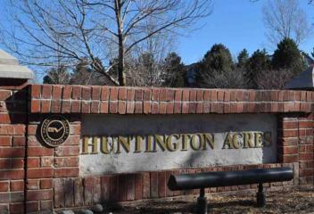
Huntington Estates
Huntington Estates is an established community in unincorporated Arapahoe County. This community is located between East Jewell Circle north, East Iliff Avenue south, South Dayton Street east & South Alton Way west. This community began development about early 1970's & continued into the 1980's. Huntington Estates is conveniently located to Denver Tech Center, Buckley Air Force Base, RTD Light Rail, Highland Trails, I-225, Cherry Creek Country Club & Golf Course, restaurants, shopping & more
View Community
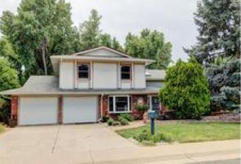
Huntington Pines
Huntington Pines is an established community in Greenwood Village. This community is located along South Dayton Street between East Maplewood Avenue and East Caley Avenue. This community's development began about early 1990's. Huntington Pines is located south of Huntington Acres. In close proximity to this community are neighborhood parks, Silo Park and Tommy Davis Park. Huntington Pines is just east of the Denver Tech Center, and offers close proximity to restaurants, shopping, Lightrail & etc
View Community
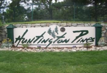
Hutchinson Hills
Ted Hutchinson is the contractor and developer of Hutchinson Hills. As Colorado's population experienced a post-war surge, he quickly recognized the need for affordable housing. In 1949 he launched the ambitious 540-acre development of University Hills. By 1955, having completed some 3,500 homes, with 2,000 more under construction. One of his most significant projects, Hutchinson Hills in Southeast Denver, still bears his name. Hutchinson Hills is still an ideal Denver Neighborhood today.
View Community
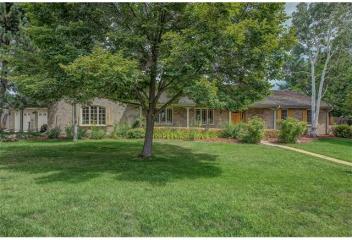
Idaho Springs
On January 5, 1859, during the Colorado Gold Rush, prospector George A. Jackson discovered gold at the present site of Idaho Springs, where Chicago Creek empties into Clear Creek. Idaho Springs was originally known as "Jackson's Diggings". Once the location became a permanent settlement, it was variously called "Sacramento City", "Idahoe", and finally Idaho Springs. In 1969 film Downhill Racer portrayed an alpine ski racer from Idaho Springs, played by Robert Redford, a brief scene filmed here.
View Community
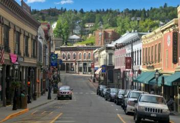
Idyllwilde
Idyllwilde is located in Parker Colorado off of Hess Road. Idyllwilde is located at the southern portion of The Black Bear Golf Course at Canterberry Crossing. This neighborhood is newer construction and is approaching closeout status. The Idyllwilde development began at approximately 2005 and continued through 2015. Idyllwilde has a community recreation center and pool. Its proximity to Mainstreet Parker, restaurants, shops, coffee shops, trails, Black Bear Golf Course, DTC make it appealing.
View Community
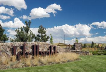
Indian Creek
Indian Creek is an established neighborhood in Denver County. The neighborhood is located in the southeastern portion of Denver County between South Quebec Street and South Parker Road. This community is a collection of single family detached homes, attached townhomes and attached condominiums, variety of selection of dwellings. Its location offers convenient access to the Highline Canal, which offers trails for hiking, walking and biking, Cherry Creek Country Club for the gold enthusiasts.
View Community
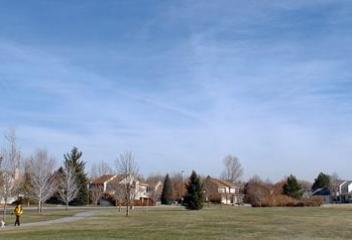
Indian Hills
John D. Parmalee sold his interests in the toll road to Benjamin F. Eden in 1885, who became toll keeper of the road from Morrison to Conifer (earlier known as Morrison to Bradford Junction). In 1885 Eden sold the road to Jefferson County and acquired more than 1,000 acres in the northern end of Parmalee Gulch. George W. Olinger purchased the Eden land in 1921. Olinger planned a development to be called "Indian Hills" and it was recorded in 1923. Denver residents used this area for summer homes
View Community
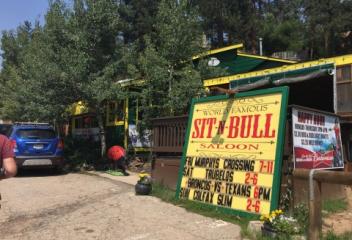
Indigo Hills
Indigo Hills is an established community in Highlands Ranch. This community is located west of South Broadway along West Wildcat Reserve Parkway at Royal Eagle Road and West Wildcat Reserve Parkway intersection. This community was developed late 1990's and continued into the early 2000's. Indigo Hills is located in the Douglas County School District and Saddle Ranch Elementary School is located in Indigo Hills. Indigo Hills is conveniently located near shopping, restaurants, DTC, C-470 and etc.
View Community
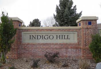
Inspiration Point
Inspiration Point has grandiose views from atop. On the northwest side of the park is a plague describing the first visits to Colorado in the 1800's that led to the Gold Rush of 1848 and the discovery of Pike's Peak in 1849. The 25.5 acre park offers views of the entire front range, views of the mountain peaks, from Pike's Peak to Long's Peak and MT. Evans. The park offers people scenic views and truly inspiring, picnic areas, park benches. There is an enclave of homes around Inspiration Point.
View Community
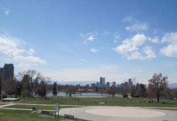
Jefferson
Jefferson is an unincorporated community in Park County Colorado. It is located at the northern end of South Park, along US Highway 285, approximately 15 miles northeast of Fairplay, at the western foot of Kenosha Pass. It lies 6 miles from Como, 23 miles from Bailey, & 37 miles from Breckenridge. The most notable landmarks in town are a historic one-room schoolhouse & the Historic Jefferson Denver, South Park & Pacific Railroad Depot (circa 1880), highly visible in the grasslands of South Park.
View Community
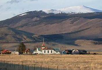
Jefferson Park
Jefferson Park is a neighborhood and public park that overlooks Downtown Denver. Views east of Jefferson Park take in Elitch Gardens Theme Park, Children's Museum, Denver's Downtown Aquarium, Pepsi Center and the REI flagship store and other attractions in Downtown's Central Platte Valley. Downtown and Central Platte Valley are quickly assessed from Jefferson Park, using the 23rd Avenue overpass on I-25 and Water Street. In addition, the Light Rail C-Line is located by Sports Authority Field.
View Community
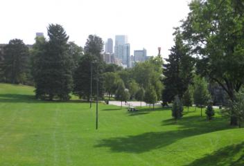
Johnstown
Johnstown is a town in Larimer County & located about 41 miles north of Downtown Denver. The Town of Johnstown began with the vision of Harvey J. Parish before platting in 1902. The town was named for Parish's son & was incorporated in 1907. Johnstown is served by two school districts. The majority of residents fall within the Weld County School District RE-5J, though the north west of the town falls within the Thompson R2-J School District. There has been considerable growth the past few years.
View Community
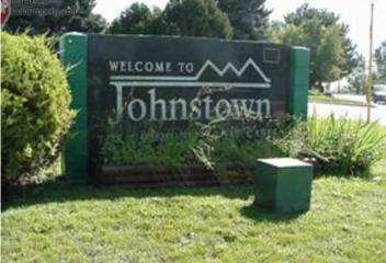
Jordan Crossing
Jordan Crossing is a newer community located in Parker. This community is located on South Jordan Road south of East Mainstreet and south of the Parker Olde Town neighborhood. This community began its development about 2007 and continues construction today. Jordan Crossing is adjacent to a neighborhood to its east with approximately 5 acre lots and is also located near the Salisbury Equestrian Park and Sports Complex. Salisbury Equestrian Park and arena, home to Parker's Equestrian community.
View Community
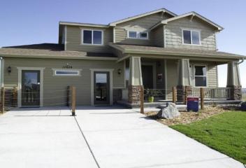
Keenesburg
The Town of Keenesburg is located in Weld County. Keenesburg was named for Les Keene, an early settler, & was incorporated on June 4, 1919. In 1906, the towns people built the railway station that was later demolished in 1963. In 1912, Keenesburg first school opened, which helped cease the mild overflow. In 1919, the bar building downtown was built along with a number of other buildings. In the 1930's &1940's more people moved in and the population continued through the 1950's and early 1960's.
View Community
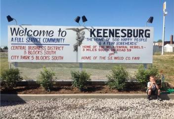
Ken Caryl
Ken Caryl's history begins with Major Robert B. Bradford's purchase of the property in 1859. He soon built the Braford/Perley House as well as toll road. The combination of the Bradford/Perley House Inn and the toll road heading towards the mining camps proved very lucrative. In 1895 Ken Caryl was transformed into a stable working farm. The area remained a farming community until it was sold in 1971 to John-Manville Corporation. It became a corporate campus, the housing community quickly evolved
View Community
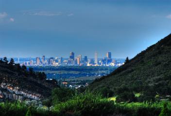
Kentley Hills
Kentley Hills is an established community in Highlands Ranch. This community is located along Fairview Parkway and East Wildcat Reserve Parkway at the intersection of these Parkways. Kentley Hills was developed in the late 1990's and continued past 2000. This community is adjacent to open space with trails for walking, biking and hiking and Dad Clark Park, which offers a community garden, playground, dog park, sports fields, basketball courts, picnic tables, shelter and awesome mountain views.
View Community
Keystone
Keystone, home to Keystone Ski Resort, is located in Summit County Colorado. Keystone was originally constructed by Ralston Purina Company in the 1970's & is now owned by Vail Resorts. The Keystone Ski Resort occupies 3 separate mountains: Dercum Mountain, North Peak, & The Outback. Its recent expansions of terrain & services offers snowcat skiing in Independence Bowl, Bergman Bowl, Erickson Bowl, in addition to the existing North Bowl & South Bowl on Wapiti Peak. Short drive to other resorts.
View Community
Kiowa
Kiowa was named for the Kiowa People and incorporated in 1912. It was settled in 1859 along the banks of Kiowa Creek and was originally nothing more than a stage stop. The original settlement was named "Wending" after Henry Wending, whom ran the stage station and was one of the early settlers. Sometime during the 1860's, the name changed to "Middle Kiowa". One may ask, why "Middle Kiowa"? At one point there were two settlements along Kiowa Creek, one named "High Kiowa" the other "Low Kiowa".
View Community
Kipling Villas
Kipling Villas is an established neighborhood in Littleton Colorado. Its boundaries are West Bowles Avenue north, South Wadsworth Blvd. east, West Coal Mine Avenue south, & South Kipling Street west. The Kipling Villas homes were built in the 1970's. Lilly Gulch Recreation Center, as well as Lilly Gulch Park is in Kipling Villas neighborhood. The proximity to Southwest Plaza, Kipling Place Shopping Center, Clement Park, C-470, US Highway 285, restaurants, shopping, are attractive attributes.
View Community
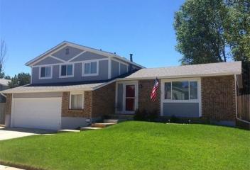
Kittredge
Kittredge is located in Jefferson County along SH 74. This tiny mountain town community is located near the towns of Evergreen & Idledale in Bear Creek Canyon & offers access to several Denver Mountain Parks & Jefferson County Open Space parks for picnics, hiking, mountain biking, snowshoeing & cross-country skiing. This is a small town and the Black Hat Cattle Company Restaurant is located in Kittredge. Kittredge is ideal for residents that are outdoor enthusiasts & enjoy the smaller towns.
View Community
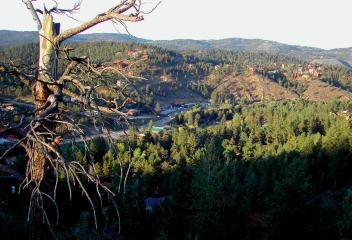
Lafayette
Lafayette was founded in 1888 by Mary Miller. She and her husband, Lafayette Miller, had moved to the area to farm land acquired through the Homestead Act in 1871. Lafayette quickly became a part of the coal-ming boom that all of eastern Boulder and southwestern Weld counties were experiencing. Mary Miller continued to be a leader in the community, especially in January 1900 when the town burned. She founded the Miller Bank in 1892, and it became the Lafayette Bank in 1902, it closed in 1914.
View Community
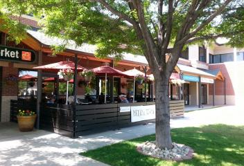
Lake Arbor
Lake Arbor Neighborhood is located in Arvada Colorado. Its location is at Wadsworth Blvd. and Pomona Drive. Lake Arbor Golf Club is within the Lake Arbor neighborhood. Lake Arbor Golf Club in Arvada has become a golfing oasis in the middle of a city setting. The player friendly course measures about 5,900 yards in length. Lake Arbor Park is also within the neighborhood in addition to the golf club, thus there are walking and hiking trails. Lake Arbor is close to the shopping at 80th & Wadsworth.
View Community
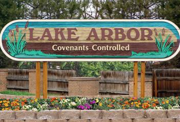
Lakehurst
Lakehurst is a neighborhood in Littleton, CO. Its boundaries West Quincy Avenue to the north, South Kipling Street to the east, West Belleview Avenue to the south and South Simms Street. Harriman Lake and Harriman Lake Park are to the north of this community at the intersection of Kipling Street and Qunicy Avenue. Lakehurst Neighborhood is made up of mostly single family homes and is a well established community. It is in close proximity to a number of shopping strips & malls, restaurants & etc
View Community
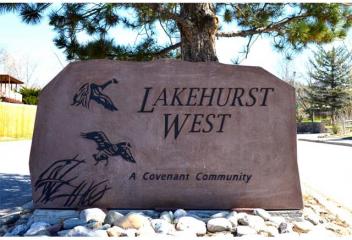
Lakewood
The Lakewood community was begun in 1889 by Charles Welch and W.A.H. Loveland, whom platted a 13 block area along west Colfax Ave west of Denver in Jefferson County. Lakewood continued to operate with no municipal government until 1969, when it was finally incorporated as Jefferson County. Soon after the election the city's name was changed to Lakewood. Lakewood is home to Belmar Shopping Center, Denver Federal Center, Lakewood Country Club, shopping centers and remains a gateway to the Rockies.
View Community
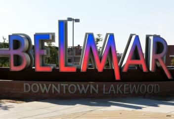
Lakewood Country Club
Lakewood Country Club, founded in 1908 and is Colorado's second oldest country club and one of the state's oldest golf courses. In 1908, the Club hired prolific golf course architect, Tom Bendelow, to design the course. In 1916, the Club brought in world-renowned gold course architect, Donald Ross, to remodel the original design. Lakewood has a strong tradition of being a very social club and offers activities & programs for the entire family. Neighborhoods have been established around the club.
View Community
Lantern Hill
Lantern Hill is an established community in Highlands Ranch. This community is located along East Wildcat Reserve Parkway & Rustic Redwood Way intersection. This community was developed about 2000 and continued for the next several years with magnificent mountain views. Lantern Hill is a smaller community within Highlands Ranch & is adjacent to open space and trails. Lantern Hill is in the Douglas County School District and Mountain Vista High School and Mountain Ridge Middle School are nearby.
View Community
Larkspur
Larkspur is a small town located south of Castle Rock & north of Colorado Springs. It has seen significant growth in the past few years due to location & residents seeking acreage & a smaller town atmosphere. Larkspur has numerous attractions for Colorado residents & travelers in the area. It is home to the annual Renaissance Festival, which attracts large crowds over the weekend. Larkspur has very scenic views, with red sandstone formations in its area, nearby golf courses, restaurants and etc.
View Community
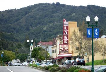
Leadville
Leadville is located in Lake County Colorado. Leadville was founded in 1877 & incorporated February 18, 1878. The Leadville area was first settled in 1859 when placer gold was discovered in California Gulch during the Pikes Peak Gold Rush. By 1860, a town, Oro City (oro is the Spanish word for gold) had sprung up, but Oro City never became a major settlement. Horace Tabor, who became known as the "Leadville Silver King" and his wife Augusta were among the first prospectors arriving in Oro City.
View Community
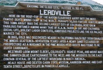
Leawood
The Leawood Neighborhood is located in Littleton Colorado. Its boundaries are West Bowles Avenue to the north, South Pierce Street to the west, West Coal Mine Avenue to the south and approximately South Sheridan Way to the east. This is an established neighborhood that was built in the 1960's and 1970's. The home styles range from 2-story, ranches, and bi-levels. This neighborhood is south of the Grant Ranch Neighborhood. West of this neighborhood is Clement Park and Southwest Plaza Mall.
View Community
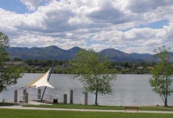
Leyden Rock
Leyden Rock is a new development in western Arvada. Its approximate location is Highway 72 north, Indiana Street east, West 82nd Avenue south, and Highway 93 to the west. This is a community that honors the natural landscaping is being built to reflect its natural beauty of the land. This community is filled with open space, trails, and wildlife and the community is surrounded by majestic mesas and sweeping views. This is an area where one can hike, bike, walk, and ride horses for miles.
View Community
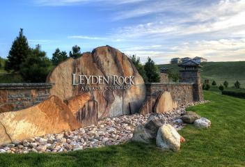
Limon
The Town of Limon is located in Lincoln County along Interstate 70 east of Denver and located immediately east of Elbert County. The town was named for John Limon, meaning lemon in Spanish, a railroad construction supervisor. Limon was incorporated on November 18, 1909. Limon has been called the "Hub City" of Eastern Colorado because of Interstate I-70, US Highways 24, 40, and 287 and State Highways 71 and 86 all pass through the town. Most of the properties in the Limon area are ranches.
View Community
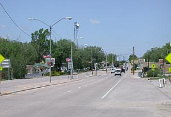
Lincoln Park
Lincoln Park is close to Downtown Denver and Metropolitan State University of Denver. Lincoln Park Neighborhood is also home of the Santa Fe Arts District. Santa Fe Arts District has more than 40 galleries and the "First Friday Art Walk" and the "Collectors' Night" are monthly events in the district. Lincoln Park is a Denver City Neighborhood Park, home to LaAlma Rec Center, with a public swimming pool, ballfields and etc. Buckhorn Restaurant is a 105 year old Lincoln Park Neighborhood landmark.
View Community
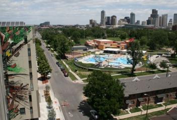
Littleton
The City of Littleton's history dates back to the 1859 Pike's Peak Gold Rush, which brought not only gold seekers, but merchants and farmers to the community, lies on the S Platte River. Downtown Historic Littleton and charming Main Street are lined with the turn-of-the-century buildings that house some of the metro area's most unique, independently owned businesses. It features art galleries, antique shops, specialty shops, clothing boutiques and both trendy and quaint restaurants and bars.
View Community
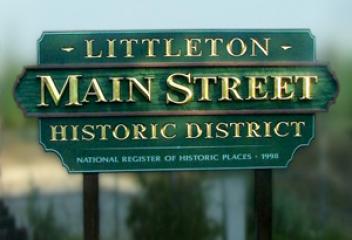
Lochbuie
The Town of Lochbuie is a Statutory Town located in Weld and Adams County. Originally Lochbuie was developed in the 1960's as the Spacious Living Mobile Home Park, and known as Space City until it was incorporated in 1974. The town was named after Lochbuie, Mull in Scotland. Lochbuie is just north of Brighton off of I-76. As Brighton and Lochbuie continue to expand and grow, it is difficult to determine which town you are in as they blend together. Lochbuie only has a few convenience stores.
View Community
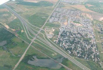
Lochwood
Lochwood and Lochwood Hills are neighborhoods in Lakewood. Its approximate boundaries are West Mississippi Avenue north, South Garrison Street east, West Jewell Street south and South Union Blvd. west, abuts to Green Mountain Village. This is an established neighborhood and most of the construction was completed from the late 1960's to mid 1980's. This neighborhood is home to Kendrick Reservoir and Kendrick Lake Park, smith, Main and East Reservoirs, and Kendrick Lakes Elementary School.
View Community
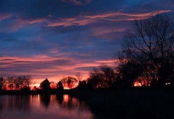
LoHi
LoHi is short for Lower Highlands. There is no other Denver Neighborhood that has experienced more growth in the past several years as LoHi, which is located northwest of Downtown Denver. You can walk from Downtown Denver to LoHi by strolling over a series of three pedestrian bridges or bike on the Cherry Creek Bike Trail. LoHi is one of Denver's trendiest neighborhoods and has well known Little Man Ice Cream parlor, coffee shops, restaurants, bars, nightlife, trendy shops and boutiques & etc.
View Community
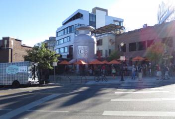
Lone Tree
Lone Tree was incorporated in 1996. It is in what is called the "south metro" area of Denver, and is a suburb of Denver. It is bordered by Park Meadows Drive and Green Acres Green on the northwest corner of the city, lies a body of water that is known to locals as Lake Lone Tree. Water fowl and citizens alike utilize its waters for recreation. The city is proud host of to popular special events, arts, culture and recreation activities in the area. Nestled on 38 acres is Historic Schweiger Ranch.
View Community
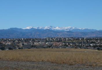
Longmont
The word "Longmont" comes from Longs Peak, a prominent mountain for explorer Stephen H. Long that is clearly visible from Longmont, and "mont", from the French word "montagne" for mountain. Longmont was founded in 1871 by a group of people from Chicago, Illinois, originally called Chicago-Colorado Colony. Memberships were sold in the town, which the proceeds purchased land for the town hall. As the first planned community in Boulder County, streets were laid out in a grid plan in a square mile.
View Community
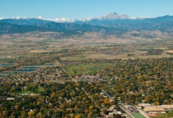
Lookout Mountain
Lookout Mountain is a foothill on the eastern flank of the Front Range of the Rocky Mountains. The 7,377 foot peak is located in Lookout Mountain Park, is located 1.7 miles west-southwest of downtown Golden & 12 miles to the east is Denver, which can be seen clearly from the mountain. The summit is famous for the gravesite of William Fredrick "Buffalo Bill" Cody & has several sites listed on the National Register of Historic Places. The Ute Tribe and American Indians used it as a lookout point.
View Community
Louisville
Louisville dates back to the start of the Welch Mine in 1877, the first coal mine in an area of Boulder and Weld Counties known as the Northern Coalfield. The town was named for Louis Nawatny, a local landowner who platted his land and named it for himself. Louisville was incorporated several years later in 1882. Louisville began its history as a rough mining community in 1877, suffered through period of labor violence in the early 20th century, mines closed in 1950, to residential community.
View Community
Loveland
Loveland was founded in 1877 along the newly constructed line of the Colorado Central Railroad, near its crossing of the Big Thompson River. Loveland was named after William A.H. Loveland, the president of the Colorado Central Railroad. Loveland is south of Ft. Collins, its larger neighbor, and both cities have expanded steadily toward each other the last several decades. The establishment of county-owned open space in the 1990's was intended to create a permanent buffer between the two cities.
View Community
Lowry
The Lowry Neighborhood is located at the site of the former Lowry Air Force Base. The Lowry Air Force Base closed in 1994. The cities of Denver & Aurora lost 7,000 jobs and $295 million in annual spending. Therefore, the Lowry Redevelopment Authority was created by the cities of Denver & Aurora to redevelop the base. Today Lowry is one of Denver's premier neighborhoods and a national model of sustainable development. The parcel known as Boulevard One will be the key focus for the next few years.
View Community
Lyons
The Town of Lyons is located in Boulder County Colorado. The Town of Lyons was founded in 1880 by Edward S. Lyon & incorporated on April 10, 1891. He purchased 160 acres, noticing potential to quarry out red sandstone outcroppings which offered easy quarrying access in the region. Lyon platted the town in 1881. The first main building to be built was the red sandstone schoolhouse in 1881. In 1894 the Old Stone Church was built. It was saved from demolition in 1979, now the town's history museum.
View Community
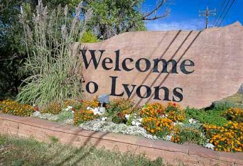
Mace
Mace is an established neighborhood in Arvada. Its location is approximately West 87th Avenue north, Alkire Street west, West 86th Parkway south, Ward Road east. Mace's development started at about mid 1970's. This community is zoned A-2, zoned for horse property, and 1 acre of land. Mace is located very close to Standley Lake and Standley Lake Regional Park, providing great access to trails (for hiking, biking, walking), boating, wildlife observations & convenience to Historic Olde Town Arvada.
View Community
Manitou Springs
Manitou Springs was founded for its scenic setting and natural mineral springs. General William Jackson Palmer & Dr. William Abraham Bell founded Manitou Springs in 1872, intending the town to be a "scenic health resort". Manitou Springs has been a quintessential tourist town since the 1870's, when visitors discovered the healing waters the Ute Indians had been drinking for years. Many of the towns mineral springs still function today & the water is free. It is one of Oldest Historic Districts.
View Community
Mansion Hills
Mansion Hills is an established community in Highlands Ranch. This community is located east of South Broadway & East Gateway Drive. Mansion Hills began its development about 1995 & continued for the next several years. Kistler Park is a neighborhood park, which offers soccer field, shelter, playground, picnic areas, trails for walking, biking and hiking. This community is in the Douglas County School District and Bear Canyon Elementary School is nearby. Mansion Hills has great mountain views.
View Community
Mansion Pointe
Mansion Pointe is an established community in Highlands Ranch. This community is located along South Broadway & South Sylvester Road. This community began its development at about 1994 and continued through early 2000's and offers great mountain views. Kilter Park is a nearby neighborhood park, which offers soccer fields, shelter, playground, trails for biking, walking & hiking, & picnic tables. Mansion Pointe is in the Douglas County School District & Bear Canyon Elementary School is nearby.
View Community
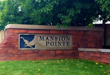
Mar Lee
Mar Lee Neighborhood is located in Southwest Denver. It's boundary is Mississippi Avenue to the north, Sheridan Blvd. to the west, Jewell Avenue to the south and Federal Blvd. to the east. Garfield Lake Park is a park within the Mar Lee Neighborhood, which is used heavily by the locals. It has ballfields, basketball and tennis courts, trails and Garfield Lake. This neighborhood has been experiencing growth & renovations of existing homes. Mar Lee is north of the Harvey Park Neighborhood.
View Community
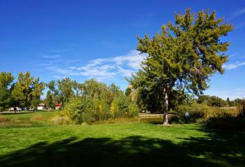
Mayfair
The Mayfair neighborhood is experiencing a transition. Long home to University of Colorado Hospital, since relocated to Fitzsimons, Mayfair is undergoing revitalization. There will be retail shops, residential housing, restaurants planned for the area at 8th Ave and Colorado Blvd. Trader Joe's opened up its first Denver store at this location. Mayfair was always known for its bungalows, today the trend is changing, newer larger homes are built and mixed in with the older neighborhood bungalows.
View Community
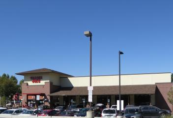
Meadow Hills
Meadow Hills Neighborhood is located in South Aurora. Its Boundaries are East Hampden Avenue to the north, South Chambers Rd. to the east, East Quincy Avenue to the south and South Parker Rd. to the west. Meadow Hills is home to the Meadow Hills Golf Course, which is located at East Hampden Avenue and Dawson Street. It has the feel of an old style country club. It has signature tree-lined fairways, large lakes, small greens, and lush grounds. Cherry Creek State Park and Reservoir are adjacent.
View Community
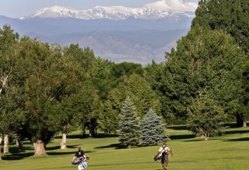
Meadow Lake Estates
Meadow Lake Estates is an established neighborhood in Arvada. This neighborhood was originally developed about 1960's and has had some construction in later years. The boundaries of this neighborhood are approximately West 64th Avenue north, Ward Road east, West 58th Avenue south, and Alkire Court or the eastern edge of Wyndham Park. This neighborhood is home to Meadows Lake, a community neighborhood park and lake with fantastic mountain views. This community is close to shopping at Ward & 64th.
View Community
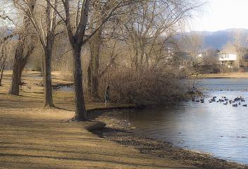
Meadowbrook Heights
Meadowbrook Heights is an established neighborhood in South Littleton Colorado. Its boundaries are West Chatfield Avenue north, South Platte Canyon Rd. east, C-470 South and South Kipling Parkway west. Most of Meadowbrook Heights was developed, except for one vacant parcel of land at approximately West Hatfield Avenue and South Dudley. Richmond completed that phase of their development at about 2013. Meadowbrook Heights is just north-northwest of the Chatfield Reservoir and State Park.
View Community
Meadowood
Meadowood is a subdivision of Aurora Colorado. It is bordered by South Buckley Road to the east, East Yale Avenue to the north, South Chambers Road to the west, East Hampden Avenue to the south. Meadowood was developed in the 1970's. Meadowood Park, maintained by City of Aurora, bisects the subdivision into the east & west halves. The subdivision is not currently covenant controlled, membership is voluntary. Olympic Athletic Park is located at the intersection of Yale Avenue and Chambers Road.
View Community
Meadows at Castlewood
Meadows at Castlewood is an established community in Franktown. This community is located south of Highway 83 along N Russellville Road. Meadows at Castlewood is has estates with ranch land of approximately 35 acres or more, zoned A1 allowing for private well and livestock. This community is located nearby to Castlewood Canyon State Park, which retains a unique part of Colorado's history, the remains of Castlewood Canyon Dam, bursting in 1933, and also contains the historic Cherry Creek Bridge
View Community
Meridian
Meridian is a new and newer community located in Parker. This community is located south of East Lincoln Avenue on South Oswego Street. Meridian first began construction about early 2000 and continues in 2015 and probably beyond. Meridian is located close to the Wildlife Museum located along East Lincoln Avenue. This community has convenient access to Downtown Parker via Ridgegate Parkway/East Mainstreet or East Lincoln Avenue. Its proximity to DTC, Castle Rock, I-25, E-470, C-470 is convenience
View Community
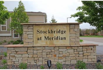
Meridian Village
Meridian Village is a new and newer community located in Parker. This community is located south of East Lincoln Avenue on Meridian Village Parkway. Meridian Village began construction about 2010 and construction continues well into 2015 and beyond with several builders. This community is conveniently located with easy access to the Denver Tech Center, Downtown Parker via Ridgegate Parkway/East Mainstreet or East Lincoln Avenue, has easy access to E-470 & C-470, I-25, Castle Rock or Castle Pines
View Community
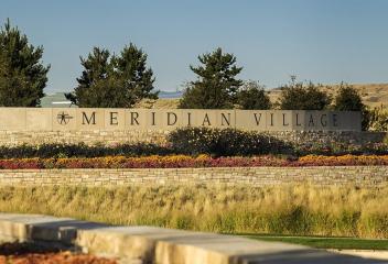
Milliken
The Town of Milliken is located in Weld County Colorado. The town was named for John D. Milliken, a railroad official. The first community located near the Milliken townsite was initially Hillsboro. By 1908 the town of Milliken had grown up nearby Hillsboro and in 1910 Hillsboro was annexed by Milliken. The fires of 1910 destroyed much of Milliken, and in 1917 the Denver, Laramie, and Northwestern Railroad was abandoned. Milliken continued primarily as a farming community through the years.
View Community
Mission Viejo
Mission Viejo is a subdivision in Aurora. It is bordered by Buckley Road (east), Hampden Avenue (north), Chambers Road (west), and Quaincy Avenue (south). The 640 acre plot was purchased around 1972 by Mission Viejo Company of California with the purpose of creating a planned development in the style of Mission Viejo, California with "Barcelona" entrance walls and "Mission Bell" street lights. Two Parkways (Alicia and Marguerite) are named in honor of Rancho Mission Viejo's matriarchs.
View Community
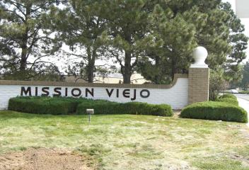
Montbello
Montebello began as a suburban-style development, the first annexation of privately owned land to the far northeast area of Denver, in September 1965. The annexation included almost 3,000 acres of land. Plans called for development of mixed use community. Developers built a large variety of homes ranging from smaller ranches to multi-level family homes. The neighborhood lies north of I-70 and was isolated from Denver by the Stapleton International Airport. Today its along the DIA Corridor.
View Community
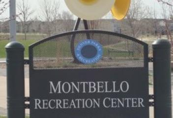
Montclair
Montclair was originally developed as a small suburban community east of Denver. The land was purchased and developed by the Montclair Town and Improvement Company in 1885. The community was named after one of its founders, Matthias P. Cochrane. The community was originally designed to attract wealthier residents who were turned off by Denver's "400 saloons and forty Market Street bordellos". To this end, homeowners were required to purchase and build on lots that were twice the Denver size.
View Community
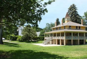
Monument
The first homesteaders arrived in Monument in 1865 to mark out the town's preliminary shape. The area was incorporated as a town called Henry's Station, after prominent settler Henry Limbach on June 2, 1879. Three years later the town was renamed to Monument after Monument Creek and Monument Rock in the west. Monument is bordered by Pike National Forest on the west, Colorado Springs & the United States Air Force Academy to the south, foothills & outcroppings to the north and rolling plains east
View Community
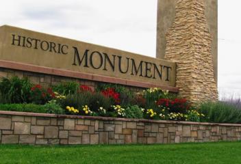
Morrison
Morrison is named after George Morrison, a builder and businessman who left a mark not only on the town that now bears his name, but on the history of the entire area. George Morrison moved to to Bear Creek where he founded the Morrison Stone, Lime and Town Co., and in 1874 platted the town that became known as Morrison, or briefly as Mt. Morrison. In 1877, the holotypic remains of the dinosaurs were discovered near Morrison by Arthur Lakes. Morrison remains unincorporated in Jefferson County.
View Community
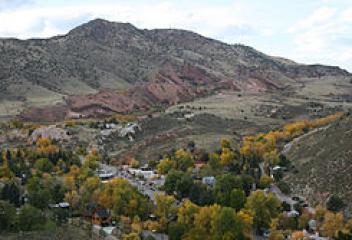
Mount Vernon Country Club
Mount Vernon Country Club is nestled in the foothills of Golden Colorado. It overlooks the city lights of Denver and the surrounding foothills vistas. The neighborhood is perched atop of Lookout Mountain 20 minutes from Denver. The community began in the early 1920's with small summer cabins and cottages. The neighborhood lives peacefully among elk, mule deer, bobcat, fox, coyotes, wild turkeys, golden and bald eagles, and hawks. Members pay a one-time membership fee when buying their property.
View Community
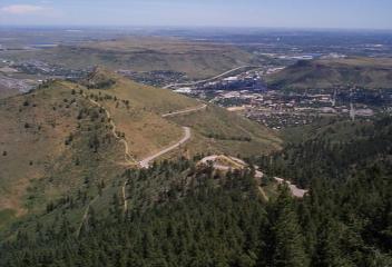
Murphy Creek
Murphy Creek is a newer development in South Aurora. It is located east of Gun Club Road and west of South Harvest Road, E. Jewell Avenue to the south. Murphy Creek Golf Course has a unique design scheme that takes golfers back in time. The 1920's farmhouse theme and a wonderful and different layout make it a destination course. With over 80 bunkers, stunning water features and wide, rolling fairways, Murphy Creek is truly an golfing experience. Cherry Creek School District neighborhood.
View Community
Nederland
Nederland is located in southwest Boulder County near Barker Meadow Reservoir. The town was named called "Dayton", then "Browns Crossing", then changed to "Middle Boulder" after the creek that flows through the center of town. In 1873 the Caribou Mine, at an elevation of roughly 10,000 feet, sold to the Mining Company Nederland from the Netherlands. In the Dutch Language, Nederland ("Netherlands" in English) means low land & the town came to be known as Nederland, adopted & incorporated in 1874
View Community
Newlin Meadows
Newlin Meadows is a newer community located in Parker. This community is located at N Newlin Gulch Blvd. & East Hess Road. This community first began development at about 2005 and continues into 2015 with new construction. This community is located near Double Angel Ball Park and the development of Douglas County School District of a football stadium at the intersection of South Chambers Road and N Newlin Gulch Road. This community has close proximity to Downtown Parker, DTC, I-25, E-470 & etc.
View Community
Niwot
Niwot is located in Boulder County along State Highway 119, halfway between Boulder and Longmont. It is named for Arapahoe Chief Niwot, a tribal leader in the Boulder area during the nineteenth century. The name means "left-handed". Nowise remains a small town its location in the Rocky Mountain foothills community, makes it an ideal location for residents that want to live in the mountains, yet be close proximity to metropolitan cities. Niwot is the headquarters for footwear, Crocs, Inc.
View Community
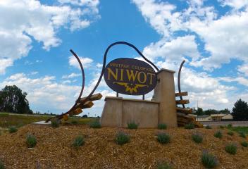
Nob Hill
Nob Hill is a neighborhood located in Centennial Colorado. Its location is East Arapahoe Road to its north, South Colorado Blvd. to its west, approximately South Dexter Street to its east and East Easter Avenue to its south. Nob Hill is an established neighborhood and most of its homes were brick ranch style homes built in the 1960's. Nob Hill is adjacent to the Liberty Hill and Rideview Hills Neighborhoods. Nob Hill is less than a mile from the newly renovated and refurbished Southglenn Mall.
View Community
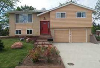
Normandy Estates
Normandy Estates is a Neighborhood community in Littleton, CO. Normandy Estates Pool and Tennis Club was established in 1959 and offers swimming, tennis, and picnic families to its residents. Normandy Estates Farm and Stables is located in this neighborhood, horse stables & barn where people can board horses. Southwest Plaza is within close proximity. Columbine Valley (Columbine Country Club) along Bowles Avenue is located across the South Platte Canyon Drive as well as Historic Old Littleton.
View Community
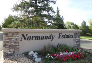
North Park Hill
North Park Hill Neighborhood is part of the Park Hill Neighborhood. The boundaries of North Park Hill are 23rd Avenue to the North, Quebec Street to the east, Martin Luther King Blvd. to the north and Colorado Blvd. the west. In 1887, Baron Aloisvon Winkler platted the original Park Hill development on 32 acres. The first homes in Park Hill were offered for sale in 1900. As the neighborhood grew, settlers from many nations moved in, residential increased in the northern part of the neighborhood.
View Community
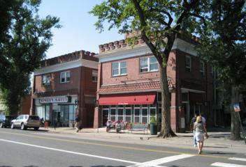
Northeast Park Hill
Northeast Park Hill is the northern most quadrant of Park Hill. Its boundaries are from Martin Luther King Blvd. to the south, Colorado Blvd. to the West, City and County of Denver city limits to the north and Quebec Street to the east. Dahlia Square Shopping Center, which was originally built on a landfill, has been revitalized and redeveloped. This neighborhood is also home to the Park Hill Golf Course, an 18 hole public course and there is more development north of the Park Hill Golf Course.
View Community
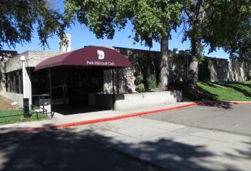
Northglenn
Northglenn is located in Adams County and was incorporated in 1969. It is bordered by Thornton to the east and Westminster to the west. Northglenn is located 15 minutes north of Downtown Denver and 25 minutes away from Denver International Airport. Northglenn is connected with 28 miles of off street walking & biking paths connecting with the larger trail systems that lead throughout the Denver Metro Area. Northglenn residents enjoy restaurants, shopping, parks, lakes, open space & rec facilities
View Community
Observatory Park
Observatory Park Neighborhood is located east of Denver University, also known as University park Neighborhood. The neighborhood boundaries are from Yale Ave. (south), Colorado Blvd. (east), I-25 (north) and University Blvd. (west). Observatory Park is a neighborhood park for the community and has The University of Denver's historic Chamberlin Observatory located in the park. This is a convenient location for proximity restaurants, Wellshire Golf Course, hospitals, schools, trails and etc.
View Community
Old Colorado City
Old Colorado City, formally Colorado City, is in a national historic district in the city of Colorado Springs. Its approximate boundaries re US Highway 24 south, 32nd Street west, 13th Street east, and Uintah Street north, with the town square restructured as Bancroft Park. Old Colorado City was founded on May 22, 1859, when the Colorado Town Company, a group mainly from Denver and Auraria, laid claim to two square miles. Old Colorado City was incorporated into Colorado Springs in 1917.
View Community
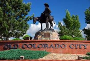
Old Town Arvada
The first documented discovery of gold in the Rocky Mountain region occurred on June 22, 1850, when Lewis Ralston, a Georgia prospector headed for the California Gold Mines, dipped his sluice pan into a small stream near its mouth at Clear Creek, discovered 1/4 ounce of gold, but continued to California. In 1858, Ralston returned back to the site of his first discovery. The Town of Arvada was formally incorporated on August 14, 1904. Today Old Town Arvada's history is being preserved.
View Community
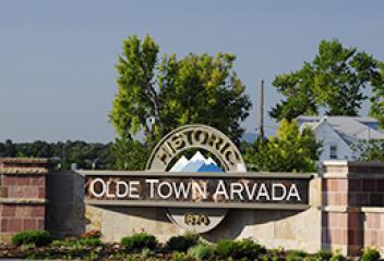
Orchard Gate
Orchard Gate is an established community in Englewood. This community is located south of East Orchard Road between South Dayton Street and South Havana Street. This community began development about 1978 and continued into the 1980's and into the 1990's. This community is located in the Cherry Creek School District and High Plains Elementary School is located in the Orchard Gate community. Orchard Gate is in close proximity to the Denver Tech Center, convenient access to interstates and etc.
View Community
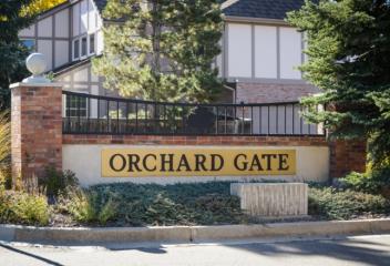
Overland
Overland Neighborhood is in Denver located in central/southwest Denver, Its borders are Mississippi Avenue to the north, South Broadway to the east, Hampden Ave. to the south and South Platte Drive to the west. Overland Municipal Golf Course, a Denver Parks and Recreation Golf Course, is located at Jewell Avenue and South Santa Fe Drive. There is revitalization between Santa Fe Dr. and South Broadway. The Gates Rubber Company location at Mississippi/Broadway has a number of construction projects
View Community
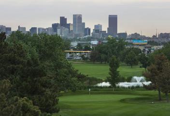
Pa-1011
Pa-1011 is an newer established neighborhood in Arvada Colorado. This community is located at approximately West 86th Avenue and Ward Road south. This community is located near Standley Lake and Stanley Lake Regional Park and Village of Five Points. Standley Lake is open to the public except for two restricted areas. One is the lake's northwest due to the presence there of nesting bald eagles. The second is the spillway and mile-long dam wall that stretches along the lakes northwest shore.
View Community
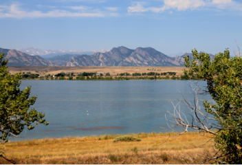
Palomino Park
Palomino Park is a gated resort community in Highlands Ranch. It was designed with the free-spitted, who seek a lifestyle of choice. Palomino Park offers a collection of townhomes & condominiums for those that want a maintenance free lifestyle. The amenities this resort offers are jogging trails, tennis courts, putting greens, soccer/football fields, baseball/softball fields, pond/gazebo/picnic, sand volleyball, frisbee, swimming pool, health club, water features, & large grilling/eating areas.
View Community
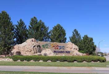
Park Hill
Park Hill was platted in 1887 by Baron Alois Von Winckler who owned the land just east of City Park. Housed within the Park Hill historic community is Johnson & Wales University on 26 acre tree-filled campus. Park Hill is also home of historic 17th Avenue Parkway, one of several tree lined parkways with wide center medians throughout Denver. Its close proximity to City Park, Denver Museum, Denver Zoo, Downtown Denver and local restaurants makes it a very attractive neighborhood in East Denver.
View Community
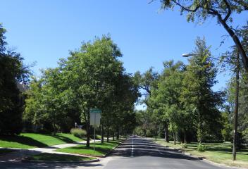
Parker
Parker was incorporated in 1981 and is the second most populous town in Douglas County. Parker continues to expand with many new communities still in the development and construction phases. Many ranchers from both Douglas and Elbert County come to Parker for food and ranch supplies. Throughputs expansion, Parker has maintained its small town atmosphere. Parker is part of Douglas County Schools, has retail shops & boutiques, restaurants, coffee shops, open space, trail system, open spaces & etc.
View Community
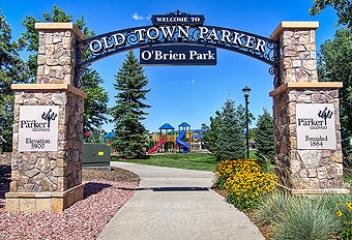
Parker Olde Town
Parker Olde Town or Olde Town at Parker is a newer community located in Parker. This community is located south of East Mainstreet along between South Jordan Road west & N Motsenbocker Road east, south of the Clarke Farms neighborhood. This community first began development about 2006 and continues development today. There will probably be additional developments within this community in the next several years. Parker Olde Town is close to Downtown Parker, shopping, restaurants, trails, & parks.
View Community
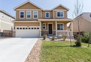
Parkfield
Parkfield is a newer planned unit development between Montebello and Green Valley Ranch. It is a collection of single family homes, condos, townhomes and apartment complexes. Parkfield is also home to Parkfield Lake Park. The park development preserves and enhances the best of the precious natural areas including the lake, the shore-line and walking trails, while also showcasing exciting new features for structured sports, casual use, and uniquely, making the park a sure destination for many.
View Community
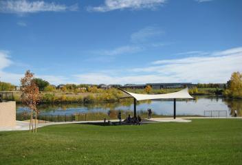
Perry Park
Perry Park is located in Douglas County. The Perry Park area was originally inhibited by the Ute, Kiowa, Arapahoe, & Cheyenne Native American tribes. It was not settled by American immigrants until 1858 Pike's Peak Gold Rush near present day Colorado Springs. In 1870 John D. Perry visited Colorado and purchased the 4,000 acres "Pheasant Park" that would eventually be named Perry Park. Charles Roberts, one of the investors, built one of the only homes on Lake Wauconda, which is now the Clubhouse.
View Community
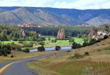
Pheasant Run
Pheasant Run is an older established neighborhood in south Aurora. This neighborhood's development began about early 1970's. The style of homes vary in this neighborhood, which take on the 1970's styles that range from 2-story, bi-level, multi-level & ranch. This neighborhood is located at East Quincy Avenue north, Chambers Road east, East Smoky Road south. Pheasant Run Park is a community park that offers clubhouse, swimming pool, tennis courts, open space, picnic areas, available to residents.
View Community
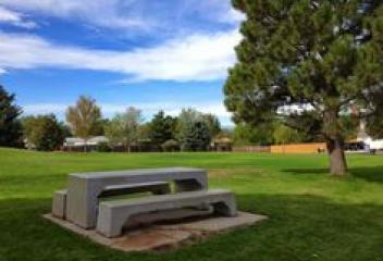
Pine
Nestled in the foothills southwest of Denver, Pine, a picturesque mountain community offering lots to outdoor enthusiasts and history buffs. Nearby Communities are Conifer, Bailey & Evergreen. Pine's rustic downtown hails from another era, & those interested in history will enjoy a leisurely stroll through the mix of historic structures still clinging to life in this quiet pocket of Colorado. Pine's most famous dining & drinking establishment is The Bucksnort Saloon, its history written on walls
View Community
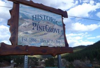
Pine Junction
Pine Junction is a small unincorporated community in central Colorado. Pine Junction is situated in the foothills along US Highway 285, approximately 25 miles southwest of Denver and south of Mount Evans. Pine Junction is the first intersection with a traffic light on US Highway 285. At this traffic, you can turn left on Colorado Rd. 126 to go the historic Town of Pine Grove and continue to State Highway 67 to Deckers and Woodland Park. This community sits astride the Park-Jefferson County line.
View Community
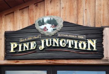
Pinehurst Country Club
Pinehurst Country Club is a beautiful secret located in Southwest Denver's rolling green hills, several mirrored lakes and ponds, 100 year old trees & unparalleled views of the great Rocky Mountains & the City of Denver. It opened its doors in 1958. Pinehurst Country Club is located west of South Sheridan Blvd. off of Quincy Avenue. Its amenities include an elegant clubhouse, tennis, swimming, banquets, & dining. Pinehurst Country Club is an 18 hole golf course was designed by Press Maxwell.
View Community
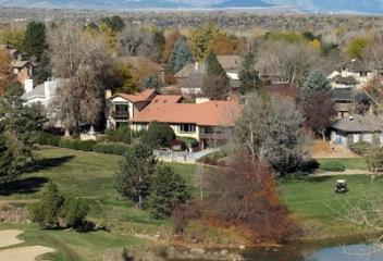
Piney Creek
Piney Creek is located in the city of Centennial. The boundaries of Piney Creek are the City of Aurora line just north of The Hilltop on the north, E. Orchard Rd. on the south, Buckley Rd. on the east and includes the Glen subdivision on the west. Piney Creek offers expansive views of the Front Range. It is located in the Cherry Creek School District, and adjacent to the Cherry Creek Reservoir, a Colorado State Park and one of Colorado's finest water-oriented recreational areas.
View Community
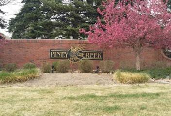
Platt Park
Platt Park was incorporated in 1886 as the Town of South Denver. The first and only mayor of Town of South Denver was James Fleming, an oil man from Pennsylvania who came to Colorado to try his luck in mining and real estate. His estate was built at South Grant Street and Florida Avenue, is a designated Denver Landmark today. Old South Pearl is the trendy and poplar shopping in Platt Park, with restaurants, breweries, coffee shops, Farmer's Markets. Platt Park is a neighborhood park on Logan.
View Community
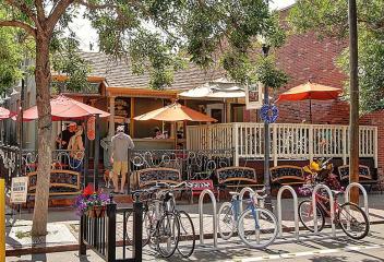
Platteville
Platteville is located in Weld County. It was founded on May 27, 1871, & was incorporated on January 1, 1887. The town is situated along the east bank of the South Platte River at the intersection of US Highway 85 and State Highway 66. The town was named for its location on the Platte River. Platteville has a public library, United States Post Office, four parks, an elementary school & a middle school. Platteville is also home to Fort Vasquez, an 1830's fur trading post, and the Pioneer Museum.
View Community
Players Club Estates
Players Club Estates is located in Castle Rock at the Plum Creek Golf and Country Club, which is located at South Plum Creek Blvd. and Players Club Drive. The Plum Creek Golf Course was designed by legendary architect Pete Dye and opened in 1984. Its a 7,107 yard, par 72 course that sprawls over hilly terrain and provides spectacular views of the mountain range. Whether being an avid golfer or enjoying the ambiance of its surroundings, this area provides both. Close to Downtown Castle Rock.
View Community
Plum Creek
The Plum Creek Community is located in Castle Rock Colorado. It is east of I-25 at the Crystal Valley Parkway exit & a left onto South Plum Creek Blvd. This community began development about 2000 & continues construction today. The community has a combination of detached single family homes, attached townhomes & condominiums. Plum Creek Golf Course is in this community. Plum Creek Golf Course was designed by legendary architect Pete Dye and opened in 1984. This community has spectacular views!
View Community
Polo Club
Polo Club is a luxurious and prestigious location in Cherry Creek. Its boundaries are Cherry Creek Drive South north, Colorado Blvd. east, East Exposition Avenue south and South University Blvd. west. In 1909 the Denver Country Club formed at polo team called the "Freebooters" and began playing on the Denver Country Club grounds. The most colorful piece of the Polo Clubs history came in the mid 1950's and the late 1960's when Calvery Temple planned a huge expansion, which was rejected.
View Community
Polo Reserve
Polo Reserve is located in Littleton Colorado. Its location is south of Columbine Valley and north of West Mineral Avenue along South Platte Canyon Road. This neighborhood has custom built homes, built about mid 1990's and a some after 2000. The lot size of these homes vary, with some over 2 acres and others less. This community os located in a gated, secluded area, Cooley Lake and Columbine Polo Club. This is a great neighborhood for residents into equestrian riding, being around horses & polo.
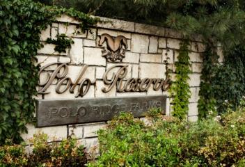
Pradera
Pradera is a luxury home community located in Parker Colorado. Paradera is nestled between Parker and Castle Rock and offers wide open vistas that may be unmatched. With the hundreds of acres of beautiful Colorado Open Space, it may be one Denver's area's most sought after new luxury homes in Parker. This community is home to The Club at Pradera. The Club at Pradera celebrated its grand opening in June 2005. It was voted best Golf Course in Colorado in 2013 and continues to win recognition.
View Community
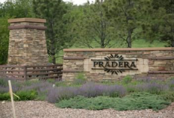
Prides Crossing
Prides Crossing is an established neighborhood in south Aurora. Its location is about southeast of Quincy Reservoir. This neighborhood was first established in the 1980's and continued development in the 1990's and early 2000's. This community is close to Quincy Reservoir for the communities enjoyment. Quincy Reservoir offers trails for walking, biking and hiking, fishing, and marvelous views. This community has convenient access to Buckley Air Force Base, DTC, E-470, Southlands Mall and etc.
View Community
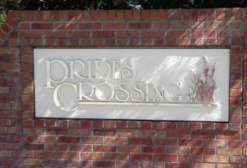
Province Center
Province Center is an established community in Highlands Ranch. This community is located south of C-470 along South Colorado Blvd. and Siskin Avenue. Province Center was developed about 1994 to 2000. Province Center is home to Kline Homestead Park and Province Park. Cougar Run Park, Falcon Park and David Lorenz Regional Park are nearby as well as The Links at Highlands Ranch an 18 hole golf course and its facilities can be utilized for anniversary celebrations & neighborhood social gatherings.
View Community

Ptarmigan Park
Ptarmigan Park is an established community in south Aurora. This community is located at the northeast corner of the intersection of South Peoria Street and East Yale Avenue, with entrances at Peoria and East Harvard Drive and Yale and South Racine Street. Ptarmigan Park was developed at about 1979 and continued into the early 1980's. This community is conveniently located to RTD Light Rail Station at Parker Road and I-225, Heather Ridge Golf Course, Denver Tech Center, shopping, & restaurants.
View Community
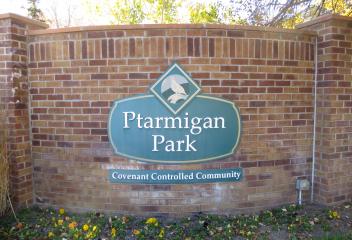
Pueblo
Pueblo is situated at the confluence of the Arkansas River & Fountain Creek, 112 miles south of Denver. James Beckwourth, George Simpson & other trappers such as Mathew Kinead, claimed to have helped construct the plaza that became known as El Pueblo or Fort Pueblo around 1842. The adobe structures were built with the intension of settlement & trade next to the Arkansas River. Todays Pueblo is the consolidation of four towns, Pueblo 1870, South Pueblo 1873, Central Pueblo 1882 and Bessemer 1886.
View Community
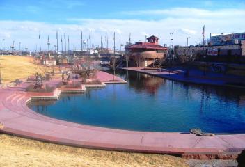
Rainbow Ridge
Rainbow Ridge is an established neighborhood in Arvada. Its location is approximately West 56th Avenue north, Ward Road west, West 52nd Avenue south and Simms Street east. This development began construction about early 1980's and has had some new developments later. This community is located near Wheat Ridge, I-70, shopping, restaurants, open space and lakes. It offers easy access to Historic Olde Town Arvada, access to the mountains and foothills, Standley Lake and Standley Lake Regional Park.
View Community
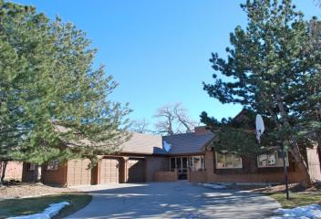
Ralston Acres
Ralston Acres is a subdivision in western portion of Arvada. Ralston Acres is located west of Quaker Street, and north of West 72nd Avenue. These properties offer an acre or more of land for homeowners interested in having horses or being away from the city life. This community is close proximity to Tucker Lake and offers magnificent views of the Rocky Mountain Range in the background. This community offers homeowners the beauty of living in the country, yet being very close to everything.
View Community
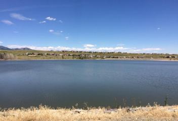
Ralston Estates
Ralston Estates is an established neighborhood in Western Arvada. Its approximate boundaries are West 72nd Avenue north, Ward Road east, West 64th Avenue south and Indiana Street west. This community began development about 1970's and there was some newer construction about mid 1990's. This community has Ralston Valley Park, a neighborhood park, with Ralston Creek flowing through the park. West Wood Golf Course to its west off of Quaker Road. There is also convenient shopping at Ward & 64th Ave.
View Community
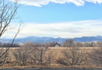
Red Hawk
The Red Hawk Community is located in Castle Rock Colorado. This community is located west of I-25 on the East Wolfensberger Road exit and to Red Hawk Drive. This community began its development at about 2000 and has continued through the years. This community is located by the beautiful Red Hawk Ridge Golf Course that opened in 1999. Its course was designed by golf course architect Jim Engh, receives rave reviews from local and visiting golfers alike. It has rolling hills and dramatic views!
View Community
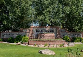
Regis
Regis Neighborhood is a neighborhood in Northwest Denver. It is located north of the Berkeley Neighborhood. Regis University, located in the heart of Regis Neighborhood, was established by a group of exiled Italian Jesuits in 1877. The institution was named Las vegas College. In 1884, the Bishop of Denver invited the Jesuits to create a college at Morrison where Sacred Heart College was opened. In 1887, the two colleges merged and moved once again to the present location of Regis University.
View Community
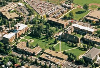
Reunion
Reunion is located in Commerce City north of the Denver International Airport. Reunion is totally redefining great living in the northeast metro Denver area. It offers a 21,000 SF state of the art recreation center and a 52 acre neighborhood park. The out door pool has interactive water features. There are 10 miles of trails, 8 acres of lakes, shopping center nearby for shopping, coffee shops, and etc. Reunion can be accessed from a number of different directions whether E-470 off of 104th Ave.
View Community
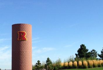
Ridge View
Ridge View is a neighborhood in Littleton Colorado. It is a neighborhood that is south-southeast of Historic Downtown Littleton. Its boundaries are approximately West Caley Avenue north, South Broadway east, approximately West Ridge Road south, South Santa Fe west. The majority of these homes were built post 1950's & were the standard solid brick ranch construction. The past few years with land around Downtown Littleton becoming a premium, the landscape has been changing around this neighborhood
View Community
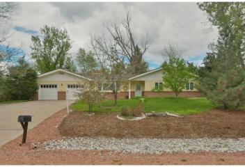
RiNo
RiNo is located just north of Downtown Denver, which includes a remarkable concentration of creative businesses, wineries, small batch breweries, distilleries, art galleries, architects, designers, ceramicists, furniture makers, illustrators, authors, painters, media artists, sculptors, photographers, performance artists and has an array of studio spaces. You will find visitors to RiNo taking pictures of the many artists paintings on buildings, others visiting the wineries, breweries & eateries.
View Community
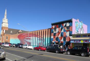
Riverfront
Riverfront, or Little Raven, is another one of Denver's hidden neighborhood gems. It is located just east of LoHi, west of Downtown Denver. Tucked between the Millennium Bridge that terminates the 16th Street Mall in LoDo and the expansive Commons Park, Riverfront host a handful of cheery locally-owned businesses. Riverfront Park is adjacent to Little Raven, a public park adjacent to the Platte River. Riverfront is also one of those special places to get to on foot or by bike, verses a car.
View Community
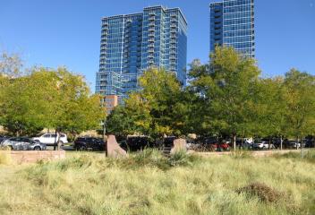
Riverwalk
Riverwalk is a unique community in Littleton & is located near Santa Fe Drive & South Prince Street. This is a community with approximately 552 homes of distinct & coordinating styles surrounded by trees, greens, ponds of the Littleton Golf & Tennis Club. The community is divided into 9 separate properties. Downtown Littleton, RTD Light Station, Platte Valley Greenway path & Aspen Grove Shopping Center compliment this golf course community & make Riverwalk a prime location in Arapahoe County.
View Community
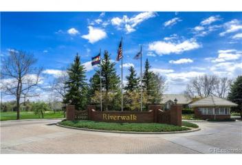
Rosedale
Rosedale Neighborhood is south of Evans Avenue on its north, Downing to the east, Broadway to the west and Yale to the south. It is south of the Platt Park Neighborhood. Rosedale surrounds Harvard Gulch Park, a 57 acre park, with its Recreation Center, outdoor pool, playgrounds, baseball fields, 3 par nine hole golf course, community gardens, trails. This neighborhood is comprised of mostly single family homes. It is close to Old Pearl Street, Denver University and Porter Adventist Hospital.
View Community
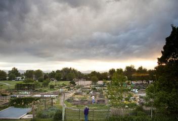
Rowley Downs
Rowley Downs is an established community in Parker. This community is located south of East Mainstreet on Stonehenge Way, which is west of Canterberry Crossing. This community first began construction at about early 1970's and continued into the 1990's. Rowley Downs is located near Downtown Parker, Black Bear Golf Club and Course, open space, trails for walking and biking, restaurants, shopping, Parker Road, East Lincoln Avenue, E-470, Denver Tech Center, & close to locations with horse property
View Community
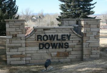
Roxborough
Roxborough State Park, is a state park of Colorado, outside the Roxborough residential developments. Roxborough is known for its dramatic red sandstone formations. Roxborough State Park is located in Douglas County 20 miles south of Denver, it is a 3,339 acre park that was established in 1975. In 1980 it was recognized as a National Natural Landmark. Arrowhead Golf Course is also located in Roxborough. The red sandstone formations make this area a natural wander, great place to enjoy wildlife.
View Community
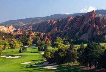
Ruby Hill
Ruby Hill Park is a ski and snowboard terrain park located in Denver at the intersection of Platte River Drive and Jewell Avenue near Downtown Denver. Ruby Hill Rail Yard opened in January 2007 and was the USA's first free terrain park located in Ruby Hill Park, which is made possible by Winter Park Resort, Denver Parks and Recreation, Christy Sports, Johnson Controls, Denver Water, Choose Outdoors, The North Face, Wahoo's Fish Tacos, snowboard Outreach Society with over 30 volunteers.
View Community
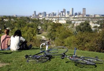
Saddle Brook
Saddle Brook is a newer community in Arvada. This community is located at approximately McIntyre Street and West 74th Avenue. This community was began development after 2000. Saddle Brook offers its residents approximately 1 acre lots and is adjacent and backs to open space, trails, lakes and etc. Saddle Brook has magnificent unobstructed mountain views, adjacent to Saddle Brook's Open Space and Moon Gulch Trail. Saddle Brook Neighborhood is zoned for and allows homeowners to have horses.
View Community
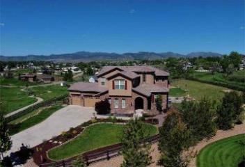
Saddle Rock
Saddle Rock Golf Course is the former home of the Colorado Open, numerous statewide amateur and professional events. It was ranked as one of the America's Top 10 Best New Courses by Golf Digest in 1998. Its magnificent panoramic views, the compelling course layout & the first-rate service. Saddle Rock has a number of different home communities in the Saddle Rock area. Saddle Rock is situated close to Aurora Reservoir & Southlands Mall. The community continues to expand with new home construction
View Community
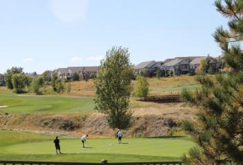
Salida
The City of Salida is located in Chaffee County Colorado. Salina was founded in 1880 and incorporated March 23, 1891. Salina was originally a railroad town and was significant link in the Denver and Rio Grande Western Railroad. After World War II the railroad began pulling back its operations in Salida. After World War II many of its residents worked either in local ranching operations. Today, the most prominent business is tourism consisting of skiing at Monarch, whitewater rafting, & kayaking.
View Community
Saxony
Saxony is an established patio home community in Englewood. This community is located at the northwest intersection of South Dayton Street and East Caley Avenue. This community was developed about mid 1990's and is a smaller clustered community of detached patio homes. This is an ideal community for any homeowner seeking a detached home will the HOA will maintain the grounds, snow removal and etc. Saxony is located just east of the Denver Tech Center, and close to the Arapahoe Light Rail Station
View Community
Sedalia
Sedalia is a tiny north of Castle Rock on US 85 or those looking for adventures in the Pike National Forest will have to pass through Sedalia to get there. While new communities are being developed on either side of Sedalia, this tiny quaint town has managed to keep many of its quaint qualities. Several older buildings and homes remain in the area and a few craft shops and restaurants. The Scottish-style castle, Cherokee Ranch, with 15th & 16th century European paintings is one not to miss.
View Community
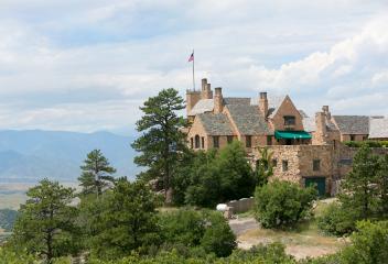
Serenity Ridge
Serenity Ridge is a community in south Aurora. Serenity Ridge is located east of Southlands Mall on East Smoky Hill and South Oak Hill Way. This community's development began about 2005. New communities are currently being developed within Serenity Ridge. This community has neighborhood parks, trails, picnic areas, park benches throughout. The proximity to Aurora Reservoir, Blackstone Country Club and Golf Course, Saddle Rock Golf Course, Southlands Mall, E-470, make this community ideal.
View Community
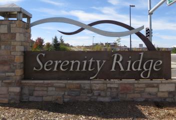
Seven Hills
Seven Hills is a neighborhood in South Aurora & is located between East Villanova Place to the north & East Hampden Avenue to the south, Tower Road to the west & South Halifax Street to the east, which abuts to the Plains Conservation Open Space. Seven Hills is near the shopping center at East Hampden Avenue & South Tower Road. Some of its residents within Seven Hills, go to Cherry Creek School District, others go to the Aurora School District. Flanders Park is located in this neighborhood.
View Community
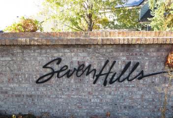
Sheridan
Sheridan was originally part of the Indian Territory and has always been a small community. The first white settler was John McBroom in 1859. The town was initially named Petersburg. Another prominent figure in Sheridan's early history was Peter Magnes, a Swedish immigrant. In 1865 Magnes laid out the town of Petersburg and encouraged Swedish families to immigrate to his town. In April 14, 1890, the Town of Sheridan was incorporated. Its name comes from US Army General Philip H. Sheridan.
View Community
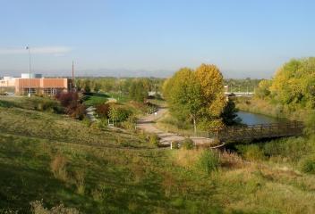
Silverthorne
The Town of Silverthorne is located in Summit County. It's the county's 2nd most populous town. Silverthorne served as a makeshift camp for workers during the construction of the Dillon Reservoir from 1961-1963, & later as a stop along Interstate 70. It was eventually incorporated on April 5, 1967. Surrounding the valley are Ptarmigan, Tenderfoot & Ten Mile Peak. Today Silverthorne continues its mountainous growth & is home to the Silverthorne Outlet Stores, restaurants, hotels, shopping & etc.
View Community
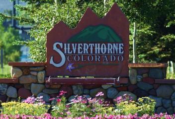
Sky Rim
Sky Rim is a community located in Douglas County. This is a community is located in Parker off East County Line Road and N Delbert Road or (County Road 1). This community development began about 2000 and construction continued several years afterwards. These homes are on 5 acre lots, thus for any homeowner looking for larger lots or horse property this community may be an ideal solution. Sky Rim is close proximity to Blackstone Country Club and Golf Course, Aurora Reservoir and Southlands Mall.
View Community
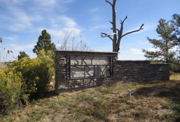
Skyland
Skyland is a Denver Neighborhood in east Denver. It's boundaries are from York Street to the west, Martin Luther King Blvd. to the north, Colorado Blvd. to the east and East 23rd Avenue as its southern border. The Skyland Neighborhood is located north of City Park, which includes the City Park Golf Course, which is often confused with City Park North. Skyland is a smaller neighborhood with most homes are mostly residential ranch style bungalows, duplexes and with some 2 story homes.
View Community
Sloans Lake
Sloan Lake, also known as Sloan's Lake & Sloans Lake is a body of water, park and neighborhood northwest of Denver. The true history of the creation of Sloan Lake may never be officially known. During the settlement of the Denver area, in mid to late 19th century, the lake didn't exist. Thomas F. Sloan received a patent for the land from President Andrew Johnson in December 1866, which was used for agricultural purposes. It is believed when digging for a well an aquifer may have flooded the land
View Community
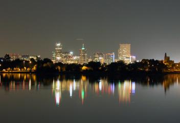
Snowmass
The Town of Snowmass Village is located in Pitkin County, Colorado. A popular winter resort location for skiing and snowboarding, the town is known as the location of the Snowmass Ski Area, the largest of the four nearby ski areas operated collectively as Aspen/Snowmass. The Town of Snowmass Village was incorporated in 1977. Snowman Village is to the north and at the base of the Snowmass Sir Area. It is located on Brush Creek, not Snowmass Creek. Brush Creek was settled circa 1910 by ranchers.
View Community
Solterra
Solterra is a newer home community in Lakewood Colorado. It is located west of Bear Creek Blvd. on West Alameda Parkway. This a community that began development at about 2008 and new construction continues in this community. Solterra is conveniently located to many prime scenic sites, such as: Red Rocks Park and Amphitheater, South Dinosaur Open Space Park, Red Rocks Golf Course, Bear Creek Golf Club, Bear Creek Lake and Bear Creek Lake. This community has convenient access to C-470 & Highway 6.
View Community
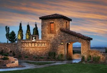
Sorrel Ranch
Sorrel Ranch is a new community in south Aurora. This community is located at South Aurora Parkway and East Alexander Drive. Sorrel Ranch began its development at about 2005 and has continued throughout the years. This is a covenant controlled community and offers its residents a community center and community pool. Appaloosa Park is a neighborhood park, which offers offers shelters and playground. Sorrel Ranch is nearby Southlands Mall, which offers boutiques, shopping, restaurants and trail.
View Community
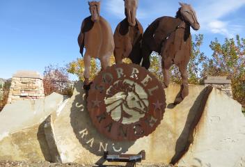
South Broadway Heights
South Broadway Heights is an established neighborhood in Englewood Colorado. Its boundaries are East Hampden Avenue to the north, South Clarkson Street (borders Cherry Hills Village) to the east, East belle view Avenue to the south and South Broadway to the west. South Broadway Heights was mostly built pre-1960's and the majority of the homes are ranch style and many with no basements. The construction was both brick and frame. This neighborhood is close to the Columbia Swedish Medical Center.
View Community
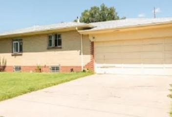
South Park Hill
South Park Hill is the southern most portion of the Park Hill Neighborhood. Its boundaries are 23rd Avenue to the north, Colorado Blvd. to the west, Colfax Avenue to the south and Quebec Street to the south. South Park Hill is enjoying the renovations and revitalization along Colfax Avenue. South Park Hill is home to the Historic 17th Avenue Parkway, one of the few Avenue Parkways designed with a wide median in the middle or 17th Avenue Parkway. Specialty & coffee shops have recently opened.
View Community
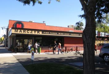
South Turkey Creek
South Turkey Creek is located in the Rocky Mountain Foothills towards Conifer. It follows Turkey Creek and scenic. The winding roads through South Turkey Creek are scenic and definitely not for the fast lane drivers. Homes along Turkey Creek can be built in hills or higher to take advantage of the tree top views. The homes can be of frame construction or log home. Some of the homes are not that spacious, which truly were built as get away cabins or residents preferring mountain living.
View Community
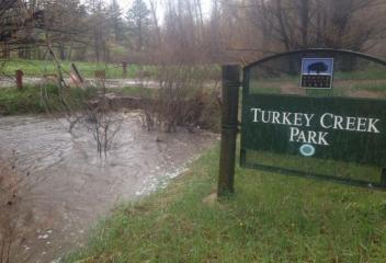
Southbridge
The Southbridge Community is an established neighborhood in Littleton Colorado. Its approximate boundaries are South Broadway east,West Mineral Avenue south, South Prince Street west and West Geddes Avenue north. South bridge neighborhood is a collection of single family subdivisions, & attached townhouse subdivisions. The neighborhood first started being developed at about 1980's & has continued into the 1990's. RTD Mineral/Santa Fe Lightrail Station, & shopping at Mineral/Broadway nearby.
View Community
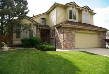
Southglenn
Southglenn is an established neighborhood in Centennial Colorado. Its boundaries are approximately East Arapahoe Rd. north, South University Blvd. east, East Dry Creek Rd. south & South Clarkson Street west. This neighborhood was developed about 1960's & there are many ranch style brick homes in this areas well as trip-levels, bi-levels & etc. The major focal point of this community is the renovated & revitalized Southglenn Mall, with new shops & housing that has invigorated this community.
View Community
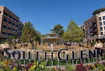
Southmoor Park
Southmoor Park is a Denver Neighborhood in Southeast Denver. Its boundaries are from Hampden to the north, Belleview to the south, Happy Canyon and Dahlia to the west and Tamarac to the east. It is located in the revitalization and redevelopment of Tamarac Square Shopping Center. It has become a very active & poplar shopping center with Whole Foods, Target, office buildings, hotels, restaurants, theaters, & etc. Southmoor Park is located north of the Denver Tech Center, convenience for locals.
View Community
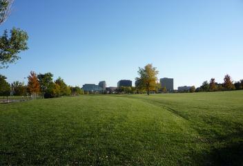
Southpark
Southpark is an established neighborhood in Littleton Colorado. Its boundaries are West Mineral Avenue north, South Broadway south, West County Line Road south & South Santa Fe Drive west. There are detached single-family homes, attached townhomes & condominiums in this community. The neighborhood development began about 1980's. McLellan Reservoir & Writer's Park Vista, neighborhood park, are in this community. RTD Mineral/Santa Fe Lightrail Station & shopping at Mineral/Broadway are nearby.
View Community
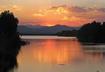
Southshore
Southshore Neighborhood is home of the Aurora Reservoir. It is a newer community & continues to expand with new home communities from builders. There is an elegant community center & clubhouse for local residents with a swimming pool, use for parties & banquets. There are numerous green spaces and open spaces with water features throughout the community. It is in close proximity to the Blackstone Country Club. As the community continues to expand, more filings are available for development.
View Community
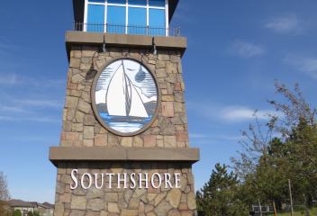
Speer
Speer is the official name for the neighborhood bounded by 7th Ave. north, Broadway west, Alameda Ave. south & Downing Street east. The northeast portion of Speer Blvd. is generally referred to as Alamo Placita due to the local park and the historic district. The neighborhood character is defined by Capitol Hill, Washington Park and Baker Neighborhoods. The Speer Neighborhood itself contains both multi & single-family residences. Most commercial buildings are along thoroughfares & Speer Blvd.
View Community
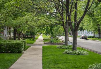
Standley Lake
Stanley Lake neighborhood is located in Arvada. Its name is derived for its proximity to Stanley Lake. Its approximate location is about at the intersection of West 86th Parkway and Simms Street. The neighborhood began construction at about mid 1970's and continues today in some areas. Stanley Lake is a 1,200-acre reservoir located in Westminster Colorado, Arvada town limits border the southern portion. Stanley Lake Regional Park is a 2,321 acre park located in unincorporated Jefferson County.
View Community
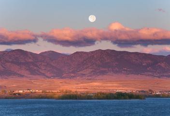
Stapleton
Stapleton, used to be Stapleton International Airport. When Denver International Airport opened, Stapleton became a 4,700 ac redevelopment. The community is expected to reach 30,000 residents, 12,000 homes, 10-plus schools and an 80 acres Central Park, a commuter-rail train station, 10,000,000 SF planned office space, 1,500,000 SF retail space and 1,100 ac of parks and open space. It borders the restored Sand Creek Greenway & Buff Lake Nature Center, one of the largest urban wildlife refuges.
View Community
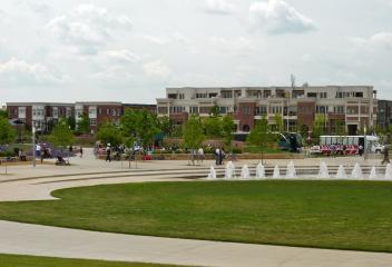
Steamboat Springs
The city of Steamboat Springs is located in Routt County, Colorado. Steamboat Springs was incorporated on July 19, 1900. It is located in the upper valley of the Yampa River, along US Highway 40 just west of the Continental Divide & Rabbit Ears Pass. The city is an internationally known winter ski resort destination. Steamboat is home to natural hot springs that are located throughout the area. Upon first hearing a chugging sound, early trappers believed that steamboat was coming down the river.
View Community
Sterling
Sterling Colorado is located in Logan County, 128 miles northeast of Denver on I-76 in the northeastern plains of Colorado. Sterling was incorporated December 3, 1884. The current site where Sterling stands was owned by John E. Boyd. In 1881, news arrived that the Union Pacific Railroad was going to extend its line from Galesburg Colorado to La Salle Colorado . Citizens of "old Sterling" knew if a railroad came through this territory a town would be established somewhere near its settlement.
View Community
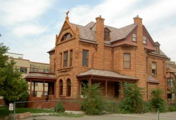
Sterling Hills
Sterling Hills is an established subdivision in South Aurora. Its boundaries are East Jewell Avenue north, South Tower Road west, East Villanova Place/Seven Hills Neighborhood south and Plains Conservation Center boundary east. Sterling Hills is connected off of Hampden Avenue by Conservatory Parkway. This neighborhood is conveniently located for Buckley Air Force Base, E-470, I-70, DTC, shopping at Hampden/Tower or Southlands Mall. This subdivision is in the Aurora School District.
View Community
Stonebury
Stonebury is a newer established community in Highlands Ranch. This community is located on East Wildcat Reserve Parkway at Ridgemont Circle. Stonebury began its development at about 2001. Stonebury community is surrounded open space with trails for biking, walking and hiking. Kilter Park is a nearby park with soccer fields, playground, shelter, picnic tables and etc. Stonebury is conveniently located to DTC, Lucent, Highlands Ranch Parkway, South Broadway, C-470, shopping, restaurants and etc.
View Community
Stonegate
Stonegate is an unincorporated community in Douglas County. Approximate boundaries for this community are E-470 north, Jordan Road to the east, East Mainstream to the south and Chambers Road to the west. Stonegate a combination of detached single family dwellings, townhomes and condominiums. The community began construction about 1990's, south of Lincoln Avenue and continued construction north of Lincoln Ave. later. These different communities within Stonegate have Community Centers and pools.
View Community
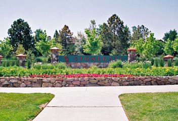
Stony Creek
Stony Creek Neighborhood is located in Littleton, CO. Its boundaries are West Coal Mine Avenue to the north, Wadsworth Blvd. to the east, West Ken Caryl Avenue to the south, and South Kipling Street to the west. Stony Creek has two schools, Stony Creek Elementary School and Deer Creek Middle School within its neighborhood. It has two neighborhood parks, Christensen Meadows Park and Valley View Park. The Meadows Golf Course is across, west of Kipling Street, from Stony Creek. Close to shopping.
View Community
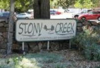
Strasburg
Strasburg was the location of the "joining of the rails", the actual last link in the coast to coast railroad networking the United States, completed in August 1870 with the completion at Strasburg of the Denver extension of the Kansas Pacific Railway. Strasburg was previously known as Comanche Crossing and was renamed the following year in honor of an official of the Kansas Pacific Railroad. Strasburg is experiencing some growth and there is new construction and new communities being built.
View Community
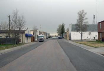
Stratton Ridge
Stratton Ridge is an established community in Highlands Ranch. This community is located south of C-470 along South University Blvd and East Dad Clark Drive. Stratton Ridge was developed about mid 1980's and continued construction into the 1990's. Sand Creek Park is a neighborhood park adjacent to Stratton Ridge to the south. It has picnic areas, ballfields, sitting benches, trails for walking, biking and hiking. Stratton Ridge is conveniently located to C-470, DTC, shopping, restaurants and etc
View Community
Stroh Ranch
Stroh Ranch is a neighborhood in Parker Colorado. Stroh Ranch is located about 2 miles south of Mainstream Parker on Parker Road. Stroh Ranch is a m mixture of single family homes and condominiums. The development was started approximately mid 1990's and construction continued after 2000. There are number of home styles in Stroh Ranch, from 2-story, ranch, multi-level and condominiums. Stroh Ranch Soccer Fields are in the neighborhood is 16.5 acres and has two regulation size soccer fields.
View Community
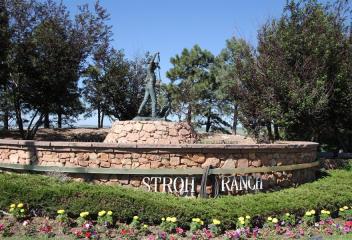
Summer Valley
Summer Valley is an established neighborhood in Aurora Colorado. Its boundaries are East Hampden Avenue north, South Tower Road east, East Quincy Avenue south & South Buckley Road west. Summer Valley was developed and most of the construction occurred about 1980's. The homes in this area are diverse, ranging from ranch style, 2-story, multi-levels, bi levels & etc. Summer Valley Neighborhood is located north of the Quincy Reservoir, close to Hampden/Tower Shopping Area, & Buckley Air Force Base.
View Community
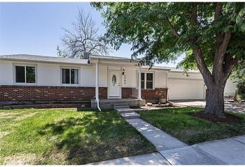
Sun Valley
Sun Valley is a central Denver Neighborhood, bordered by I-25 on the east, Federal Blvd. to the west, 6th Avenue on the south and 20th Avenue to the north. Lakewood Gulch traverses through the neighborhood, ending at the South Platte River just south of Colfax Avenue. The neighborhood is home to Rude Park along the west side of the neighborhood. The park contains a recreation center, baseball field and bike paths. RTD Light Rail will have a single stop through the neighborhood at Decatur Street.
View Community
.jpg)
Sun Valley Estates
Sun Valley Estate Neighborhood is located in Lakewood. Its approximate boundaries are East Alameda Avenue north, South Garrison Street east, West Mississippi Avenue south, South Kipling Parkway west. Addenbrooke Park, which has a lake, picnic shelters, trails and etc. is located in Sun Valley Estates in the neighborhood. Sun Valley Estate is located southeast of the Denver Federal Center, offers easy access to the 6th Avenue Freeway, Alameda Avenue and is blocks away from Belmar Shopping Center.
View Community
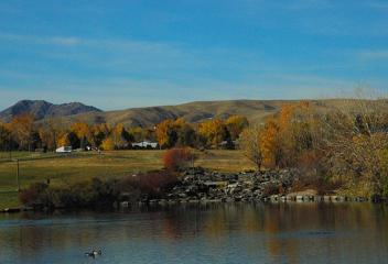
Sunnyside
Sunnyside is a city-center neighborhood located in northwest part of Downtown Denver. It is west of I-25, Union Pacific Railroad lines on the east, I-70 to the north, Federal Boulevard to the west and 38th Avenue to the south. It is bordered by the Highland Neighborhood or LoHi to the south. It is a neighborhood experiencing revitalization and redevelopment from expanding borders of LoHi. It has a collection of architecture with Victorians and bungalows. Chaffee Park is east of Sunnyside.
View Community
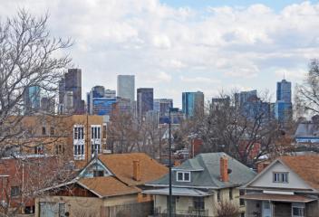
Sunrise Creek
Sunrise Creek neighborhood is located in Littleton Colorado. Its approximate boundaries are West Belleville Avenue north, South Simms Street west, West Berry Avenue south & South Oak Street east. The development of this community began at about 2000 and some construction has occurred much more recently. This community doesn't offer clubhouse & pool amenities for its residents, however has lower HOA fees. This community is located near the shopping center at Kipling & Belleview & Southwest Plaza.
View Community
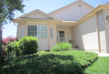
Sunset Ridge
Sunset Ridge is an established community in Highlands Ranch. This community is located on South Venneford Ranch Road and East Thistle Ridge Road. This community was developed in the early 1990's. Sunset Ridge is adjacent and surrounded by open space that offers trails for walking, biking and hiking. Sand Creek Park and Toepfer Park are neighborhood parks within this community.nSunset Ridge is conveniently located to South University Blvd. and C-470, DTC, shopping, restaurants, coffee shops & etc
View Community
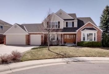
Superior
Superior is a Town in Boulder County. Its history is one of coal mining & its first mines were developed in the late 19th century. Coal was discovered on the Hake family farming 1894, and its recollections of member of pioneers families in Superior. The town itself was founded in 1896, incorporated in 1904. The town was reportedly named for the "superior quality" of coal found in the area. Mining continued to be the major force in Superior's history until 1945 with the Industrial Mine closure.
View Community
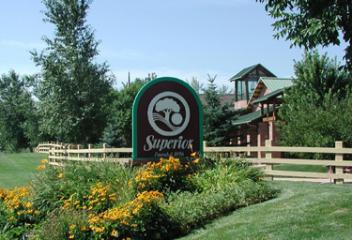
Supreme Estates
Supreme Estates is an established neighborhood in Arvada. This community is located at West 72nd Avenue and McIntyre Street. This community's development began about 1980's and continued into the 1990's. These homes do have larger lot sizes, over a quarter of acre. Supreme Estates has a community center and swimming pool. West Woods Golf Course which is nearby. This golf course was designed by one of Colorado's best known golf architects, Richard M. Phelps, which opened about 1994
View Community
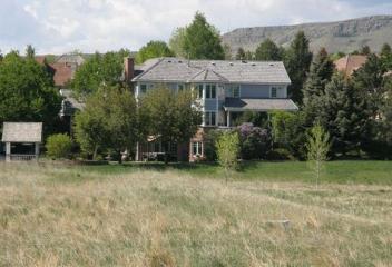
Tallyn's Reach
Tallyn's Reach is a neighborhood community in Southeastern Aurora at Smoky Hill Road and Tallyn's Reach Parkway. Tallyn's Reach is nestled into a natural setting among 200 year old ponderosa pines. Homestead Park is a 10 acre residential park featuring, a six-lane swimming pool, trails leading to Samuel's Point, a picnic plaza with a barbecue where you cab sit back and enjoy great views of the Front Range. There are over 200 acres of planned open space. Its proximity is close to Southlands Mall.
View Community
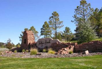
The Club at Rolling Hills
Rolling Hills Country Club was incorporated in Colorado on November 18, 1955. The idea for a Country Club was born in April of 1955 by ten future board members. Searching for the perfect golf course spot, they eventually settled on a piece of property owned by Tedd Knowles. The original Rolling Hills Country Club was built (which today is known as Applewood Golf Course). Coors Brewery did a land swap in the mid 1960's, which led to the Country Club being in its present location opening in 1968.
View Community
The Conservatory
The Conservatory is located in southeastern Aurora, nestled in the rolling hills, with mountain views, three community parks, playgrounds, community clubhouse with a seasonal pool & an extensive trail system for biking and hiking. The Conservatory is located west of E-470 on East Hampden Avenue. There are plenty of amenities nearby to enjoy, whether it is the shopping center at the intersection of Hampden Avenue and Tower Rd and Southlands Shopping Mall. The Plains Conservation Center is nearby.
View Community
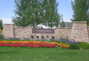
The Fairways at Buffalo Run
The Fairways at Buffalo Run is a new single family community development at Buffalo Run Golf Course in Commerce City. The homes are being developed around the fairways of the golf course. The Buffalo Run Golf Course is an 18-hole championship course which was designed by renowned golf course architect Keith R. Foster. It is recognized both locally and nationally as one of the region's premier golf facilities. Since 1996 Buffalo Run has offered its visitors a total challenging golfing experience.
View Community
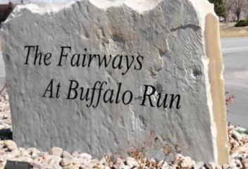
The Fairways of South Suburban
The Fairways at South Suburban is an established neighborhood in Arapahoe County located at East County Line Road and South Colorado Blvd. This community was developed about mid 1990's and is located at the South Suburban Golf Course. The South Suburban Golf Course is a regional golf course in this area that offers an 18-hole regulation par 72 course with rolling fairways and large undulating greens which challenges players of all skill levels. It also offers a pro shop and dining pleasure.
View Community
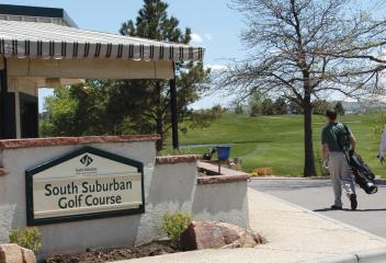
The Hamlet at Columbine
The Hamlet & The Hamlet at Columbine is a small enclave of single family homes off of West Bowles Avenue. The community is located south of Bow Mar. The construction of the homes in The Hamlet is a single family oriented community. The homes are mostly ranch style or 2-story homes. Hamlet Park is a neighborhood community park in the center of the enclave of homes. The Hamlet is conveniently located to Historic Downtown Littleton, Southwest Plaza Mall, Marston Lake, restaurants, & specialty shops
View Community
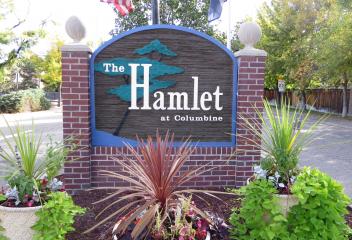
The Highlands at Parker
The Highlands at Parker is a new community in Parker in the Canterbury Crossing Community. This community is located south of East Mainstreet on Canterberry Parkway. This community is building larger more upscale homes around Canterberry Crossing. The Highlands at Parker is located east of Downtown Parker and is close to the Black Bear Golf Club. Golf membership at the Black Bear Golf Club also provides access to the Blackstone Country Club and Golf Course located near the Aurora Reservoir.
View Community
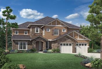
The Landing
The Landing is a community located in Arvada. This community is located near Standley Lake at West 86th Parkway & Ward Road, east of the Villages of Five Parks. This community began development at about 1990. The Landing's close proximity to Standley Lake & Standley Lake Regional Park (which offers trails through its preserves & wildlife watching), Hills of Standley Lake Park, Pioneer Park, Michael Northey Park, Village of Five Parks (which has summer performances) make its location attractive.
View Community
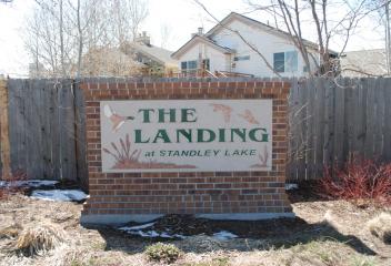
The Meadows
In the late 1970's Medema Homes started the subdivision with the model homes that were in the cul-de-sac off of South Lee Way. In the early 1980's Medema Homes went out of business & the growth of the community stopped. The following years some of some lots were sold to smaller builders. In 1990's Richmond Homes came in and built 15 models, Premier West built the last homes in the neighborhood. There continues to be one lot in the neighborhood that remains empty because of an underground springs
View Community
The Meadows at Castle Rock
The Meadows is located in Castle Rock in Douglas County. The Meadows is a master planned neighborhood community located 30 minutes from both Denver and Colorado Springs. Its convenient location is situated between both metropolitan areas, yet it offers a small town living atmosphere. The Meadows offers picturesque views from its landscape surroundings including different views of the "The Rock" in Castle Rock. The Meadows offers a community center and pool, trails for biking and walking and more
View Community
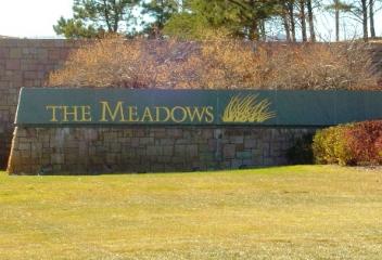
The Pinery
The Pinery is located in Douglas County. The Pinery is a golf course community and is home to The Pinery Country Club. The Pinery Country Club features 27 holes of scenic, challenging golf. The Country Club offers outdoor and indoor swimming, tennis courts, dining and etc. There have been renovations done to the club recently. The Pinery is located south of Parker on Parker Rd (Highway 83). The Pinery residents scenic views from Pike's Peak to Long's Peak. Newer subdivisions within have emerged.
View Community
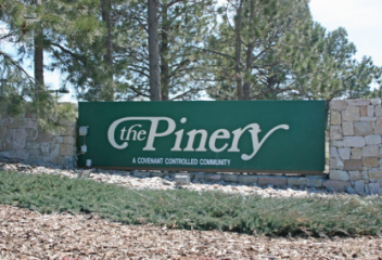
The Preserve
The Preserve is located in Greenwood Village, Colorado, 15 minutes from Denver. It is defined by open space, parks and greenbelts. Greenwood Village still holds on to its spirit of its rural history. Green wood Village used to be home to orchards and dairy cows. The original barn built by Marjorie Perry, its first land owner, is still visible next to one of the many ponds within the preserve. The area has 55-acres of estuaries, ponds and trails, cottonwood trees, wildlife (fox, geese and eagles)
View Community
The Villages at Buffalo Run
The Villages at Buffalo Run are a new & newer development in Commerce City. This community is located along Chambers Road & The Greens at Buffalo Run. This community began development at about 2004 & new construction is ongoing in 2015 with new builders. The Villages at Buffalo Run community is adjacent to the Buffalo Run Golf Course with its Clubhouse located east of Chambers Road on East 112th Avenue. This development offers a variety of model homes for buyers looking for new home construction
View Community
Thornton
Thornton was named in honor of Former Colorado Governor Daniel I.J. Thornton. Thornton consisted solely of farmland until 1953 when Sam Hoffman purchased a lot off of Washington Street about seven miles north of Denver. The town he laid out was the first fully planned community in Adams County, and the first to offer full municipal services from a single tax levy, including recreational services and free trash pickup. Today Thornton continues its growth and expansion of new neighborhoods.
View Community
Todd Creek
Todd Creek is neighborhood located in unincorporated Adams County. Todd Creek Gold Club is located in the Todd Creek subdivision. The course was designed by Arthur Hills and is a hidden gem, located just north of Denver. The golf course opened in 2007, is a full-service facility, offers premium casual ding, banquets and other events for up to 250 people. The golf course has a rolling terrain with a variety of elevation changes, emphasizes the surrounding landscape, native grasses, wetlands & etc
View Community
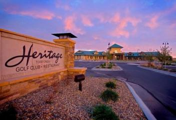
Tollgate Crossing
Tollgate Crossing is a neighborhood in South Aurora and its boundaries are East Quincy to the north, Gun Club Road and S. DeGaulle Street (from Belleview) to the west, East Belleview Avenue and East Berry Place (from DeGaulle) to the south and South Harvest Road to the east. This community does have a community center and pool. There are still new communities being developed in Tollgate Crossing. Its location and proximity to Southlands Mall and E-470, make this a desirable location for many.
View Community
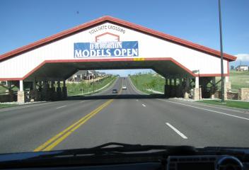
Township at Dakota
Township at Dakota is a gated community in Littleton Colorado. Its location is on West Belleview Avenue between Kipling Street and Simms Street. Township at Dakota is a collection maintenance free single family detached ranch style nation homes and a collection of townhomes, either 2-story or ranch style. This is a desirable area for many because of its maintenance free exterior environment and comfortable living with everything on one level. There is a community pool and it is a gated community
View Community
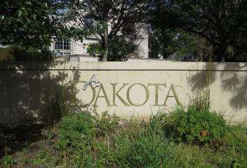
Trailmark at Chatfield
Trailmark at Chatfield is a newer community in Littleton Colorado. It is located at south of C-470 & South Wadsworth Blvd. Trailmark development began at about 2000. Trailmark at Chatfield is a combination of detached single family homes, and patio homes and attached condominiums at Star Canyon at Trailmark. The Star Canyon patio homes numbers 68 homes. It is a mix of retired professionals, single people and families with children, which has a Beaver Pond to its north that attracts wildlife.
View Community
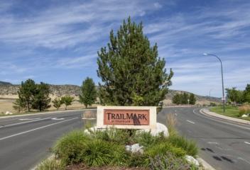
Tresana
Tresana is a newer community in Highlands Ranch. This community is located at northwestern quadrant of South University Blvd. and N Highlands Ranch Parkway. This community began its development about 2009 and continued for the next several years. Tresana is a covenant controlled condominium and townhouse community with a Community Clubhouse and Community Pool, Fitness Center, which also maintains the grounds and exterior building maintenance. Tresana has convenient access to C-470, DTC, and etc.
View Community
Trinidad
Trinidad is located in Las Animas County Colorado. It was incorporated on December 30, 1879. Trinidad is located 21 miles north of Raton, New Mexico and 195 miles south of Denver. Trinidad was first explored by Spanish and Mexican traders, who like the Santa Fe Trail. It was founded after coal was discovered in the region, in 1862. An important milestone for the town occurred in 1878, when Atchison, Topeka and Santa Fe Railway reached Trinidad. It has been home to a number of well-known people.
View Community
Tuscany
Tuscany is an established community in South Aurora, with its replica of Tuscany Italy. Its location is East Smoky Hill Road north, South Tower Road, East Orchard Road south & east. Tuscany's development started at about 1990 and continued after year 2000. This community does have a community pool and tennis court. Tuscany is in the Cherry Creek School District & Falcon Creek Middle School is located in the neighborhood. This community is conveniently to Southlands Mall, Cherry Creek Reservoir.
View Community
University Hills
University Hills is located at the northeast corner of the intersection of Hampden Avenue and Colorado Blvd. It was a neighborhood long known for its smaller bungalow ranch style homes. University Hills has undergone significant changes as newer construction homes are replacing the smaller ranch style homes. University Hills Shopping Center has undergone similar renewal and redevelopment efforts. Wellshire Golf Course is located to west and Mamie Dowd Eisenhower Park is the neighborhood park.
View Community
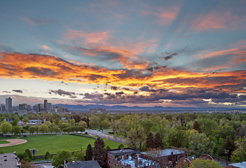
Uptown
Uptown is city center neighborhood north of Capitol Hill and east of Downtown Denver. Uptown is undergoing significant renovations and redevelopment as growth continues from Lower Downtown, Five Points, Capitol Hill & et. Uptown is a very diverse neighborhood and is close proximity to Denver Nightlife, restaurants, coffee shops, specialty markets, wineries, specialty grocery stores and walking distance to LoDo. There is a mixture of condos, townhomes, and apartment building in the neighborhood.
View Community

Vail
The Town of Vail is located in Eagle County. The town was established and built as the base village of Vail Ski Resort. Vail Ski Resort's first season was December 1962, it is the third largest ski mountain in North America. Vail was incorporated in 1966, four years after opening Vail Ski Resort. By 1969 Vail was the most poplar ski resort in the state. Vail opened China Bowl, making Vail the largest ski area in North America. Many Vail owners use their properties as rentals or second homes.
View Community
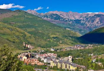
Valverde
Valverde is one of Denver's oldest neighborhoods. The neighborhood is bordered by Federal on the west side. 6th Avenue on the north side, Alameda on the south side and South Platte River on the east side. With I-25 running along the South Platte River, technically the eastern border is the Baker Neighborhood. It also borders Barnum and Westwood Neighborhoods. Valverde consist of mostly single family homes, many built in the 1930's to 1940's. Most are bungalow style or low profile 2-story homes.
View Community
Van Bibber Valley Estates
Van Bibber Estates is a newer established neighborhood in Arvada. Its location is at approximately West 58th Avenue and North Yank Street. Van Bibber Park is located in this neighborhood. It offers hiking, cycling, horse back riding and picnicking. The park is 133 acres, 3.8 miles of trails and offers its visitors a get-away from neighborhoods and home. The Van Bibber Creek wetlands ha habitat for water fowl, amphibians and insect that can be viewed from the observation deck. Enjoy nature here.
View Community
Victor
Victor was founded in 1891, shortly after Winfield Scott Stratton discovered gold nearby. The town was named after the Victor Mine, which may have been named for an early settler, Victor Adams. The town boomed as the surrounding Cripple Creek mining district quickly became the most productive gold mining district in Colorado. The mining district, which hit its peak in 1900, became the 2nd largest gold district in the country's history. Victor Downtown Historical District is a historic district.
View Community
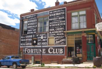
Villa Park
In 1871, developers bought more than 1,000 acres of land that includes Villa Park and the Barnum neighborhoods. The original plan was to build a subdivision with artificial lakes, ravines and beautiful landscape design by Frederick Law Olmsted, the man who designed Central Park. The plan never came to fruition & the land was sold. Because of its unfavorable landscape, Villa Park was slow to develop. Single family dwellings were constructed in the 1950's, when most of the area was fully developed
View Community
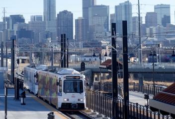
Village East
Village East is an established neighborhood in Aurora. It's Boundaries are approximately Florida Avenue (north), Havana Street (west), Jewell Avenue (south) and Peoria Street (east). Buckingham Square Shopping Mall is within a mile to the neighborhood, which has restaurants, coffee shops, Sprouts Farmers Market, Target and etc. Utah Park is located at the intersection of Peoria Street and Jewell Avenue, which is a neighborhood community park. Village East is in the Cherry Creek School District.
View Community
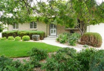
Village of Five Parks
Village of Five Parks, which is an award winning, wired and green community located in Arvada between Alkire and Indiana, north and south West 86th Parkway, west Arvada. This community began construction 2002, the developer Village Homes, promised to to build a community of 625 homes, retail shops and office center, recreation facilities and parks, all within walking distance. The homes qualify for five-star energy efficiency rating. The community is located 15 minutes to I-70 & 7 to Highway 93.
View Community
Villages at Raccoon Creek
The Villages at Raccoon Creek are located in Littleton & built on historic Grant Family Ranch. Its location is off of West Bowles Avenue. Development of this community began the later part of 1990's & still some development today. Raccoon Creek Golf Course is located in this community, complete with bar & dining. The Barn at Raccoon Creek, Denver's only historic barn venue opened in 2015, can accommodate 200 guests, is a new special events facility perfect for weddings & other special events.
View Community
Villages of Parker
Villages of Parker is an established community located in Parker. This community is located east of Downtown Parker south of East Mainstreet and Riva Ridge Street. Villages of Parker is west of Canterberry Crossing and is part of the Canterberry Crossing HOA. This community began development about mid 1990's and continued after 2000. Villages of Parker has a lot of open space and trails around its development as well as access to the Black Bear Golf Club and Course. Close to Downtown Parker.
View Community
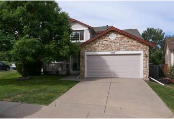
Vintage Reserve
Vintage Reserve is a newer neighborhood development in Littleton Colorado. Its location is at West Coal Mine Road and depew Street. Vintage Reserve's development began at approximately 2005 and continued for the next several years. Vintage Reserve is nestled in a very private location in Littleton in a relaxed country setting that exudes character. The community features trend-setting homes that exudes the vintage lifestyle. Olde Littleton, Southwest Plaza, Raccoon Golf Course, are nearby.
View Community
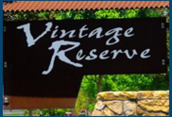
Virginia Vale
Virginia Vale Neighborhood is located in southeastern Denver, south of Hilltop. The neighborhood boundaries are Alameda Avenue to the north, Quebec Street to the east, South Cherry Creek Drive to the south and its western borders merge into the City of Glendale. In the heart of Virginia Vale sits the Four Mile Historic Park & the Four Mile House, a Denver Landmark that "served as a stage stop, wayside inn and tavern to travelers on the Cherokee Trail." Cherry Creek runs through the neighborhood.
View Community
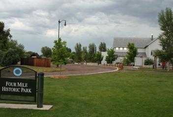
Virginia Village
Virginia Village is a neighborhood in Southeastern Denver. The neighborhood bounds the intersection of I-25 and Colorado Boulevard one of the busiest thoroughfares. It is served by the Colorado Station on the RTD light rail. Virginia Village is bounded by Colorado Blvd., Mississippi, Evans and South Cherry Creek Drive. Virginia Village offers its residences convenience & accessibility to retail shopping, local restaurants, neighborhood parks, biking and hiking trails, and RTD light rail service.
View Community
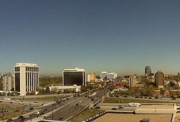
Vista Ridge
Vista Ridge is a community developed in Erie Colorado. It is located 2 miles west of I-25 on Highway 7. Vista Ridge offers its residents all the amenities as a five star resort. Vista Ridge is a gold community and ideal for people that want to live near Denver, Boulder and Longmont or in the northwest corridor. There are custom single family homes, condominiums, low-maintenance home within the community. There is open space, splendid views of the Rocky Mountain Range, including Longs Peak & more
View Community
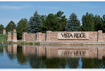
Walnut Hills
Walnut Hills Neighborhood is located in Centennial Colorado. It is located off of Arapahoe Road to the north, South Quebec Street to the west, approximately Dry Creek to the south and South Yosemite to the east. Walnut Hills is an established neighborhood with the homes constructed in the 1960's and 1970's. Walnut Hills Park, a community park, is located in the neighborhood. This community is in the Cherry Creek School District and the Arapahoe Marketplace is just north of Arapahoe Road.
View Community
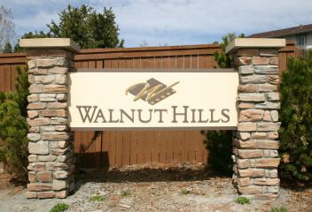
Washington Park
Washington Park, also known as "Wash Park" was initially designed by the German landscape architect Reinhard Schuetze between 1899 and 1908. The design remains fairly intact today and included Smith and Grasmere Lakes and the Lily Pond all fed with a city ditch that Shuetze. Saco Rienk DeBoer and Frederick Law Olmsted Jr. added the elegant Boat House. Today Wash Park has become a very poplar centrally located urban park in Central Denver and is also home of the Old South Gaylord Street.
View Community
Washington Park West
West Washington Park Neighborhood is west of Washington Park. Its boundaries are from Alameda to the north, South Lincoln Street to the west, Mississippi Avenue and I-25 to the south and South Downing Street to the east. The Washington Park West Neighborhood is mostly residential, with Whole Foods and a few other office buildings within its boundaries. Old Pearl Street, Old South Gaylord Street, and Washington Park are main features within the neighborhood. Easy access to all city locations.
View Community
Water Tower Village
Water Tower Village is located adjacent to Old Town Arvada. This was part of the urban renewal of 26 acre parcel, which contained apartment buildings. AURA purchased 50 parcels of land and built the Water Town Village. The construction of these townhomes and condos was approximately 2005-2007. Water Town Village is located close to RTD light rail, adjacent to Old Town Arvada and shopping center to its south. This area offers restaurants, shopping, specialty shopping, coffee shops, pizza parlors
View Community
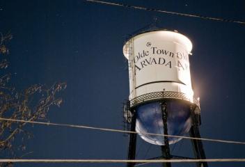
Watkins
Watkins is a smaller town east of Denver along I-70 and E-470. Considered a rural town with the relocation of Denver International Airport and construction of E-470, Watkins is in the corridor that will see growth and expansion. Watkins (also once known as Box Elder) is in Adams and Arapahow Counties and adjacent to the City of Aurora. Watkins was an unincorporated community until June 15, 2004. However, on November 7, 2006, the town overwhelmingly voted to revert back to being unincorporated.
View Community
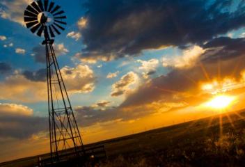
Waverly Knolls
Waverly Knolls is an established neighborhood in Arvada. This community is located at approximately West 72nd north, Ward Road west, & Simms Street bordering the eastern. Waverly Knolls was first developed in at about early 1970's. This is an older neighborhood in Arvada with many of the homes being the 1970's ranch style, tri-levels and multi-levels. Davis Lane Park and Truman Park are near this community. Waverly Knolls has convenient access to Historic Olde Town Arvada and Standley Reservoir.
View Community
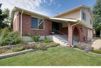
Weatherstone
Weatherstone is an established community in Highlands Ranch. This community is located off of West Wildcat Reserve Parkway and South Stone Mountain Drive, which is located between N Highlands Ranch Parkway and South Broadway. The Weatherstone community began its development about 2000. This community is located in the Douglas County School District. Stone Mountain Elementary is located in the Weatherstone community. Spring Gulch Park is a neighborhood park, which offers many outdoor amenities.
View Community
Wellshire
Wellshire Neighborhood is in southeast Denver and is home to the Wellshire Golf Course. University Hills borders east and Observatory Park/University Park north. Wellshire Golf Center is located at the intersection of Hampden Ave. and Colorado Blvd. It has an events center, 18 hole golf course, with a pro shop, driving range, golfer's pub. It was voted a sone of the best facilities in the nation and it strives to maintain that reputation. Holes 12 through 14 are referred to as "Amen's Corner" .
View Community
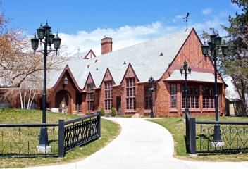
West Colfax
West Colfax is a neighborhood west of Denver. The neighborhood is bordered by Sheridan Blvd. on the west, which is also the border of Lakewood, 17th and 19th Avenues to the north, Federal Blvd. on the east and Lakewood Gulch on the south. West Colfax is named for US Vice President Schyler Colfax and was incorporated in 1891. In the erly 1900's the area that is now known as West Colfax was sparsely populated with several mansions and scattered squatters shacks. "No Man's Land" as known in 1900's.
View Community
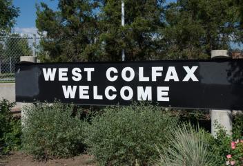
West Woods
West Woods is an established neighborhood in Arvada. Its boundaries are at about West 72nd Avenue north, McIntyre Street east, West 64th Avenue south, Vigil Way west. This neighborhood is built around the West Woods Golf Course. West Woods Golf Club features three unique golf courses: The Sleeping Indian, The Cottonwood, & The Silo. Colorado's best-known golf architects, Richard M. Phelps designed two of courses, The Sleeping Indian and The Cottonwood, the City of Arvada built the first 2 nines.
View Community
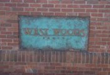
Westgold Meadows
Westgold Meadows is an established neighborhood in Littleton Colorado. Its boundaries are approximately West Belleview Avenue north, South Simms Street east, West Cross Avenue south & South Alkire Street west. This community started construction about 1990's. It is conveniently located to shopping, restaurants, C-470, US Highway 285, mountains, skiing, Red Rocks, Southwest Plaza, golfing at The Meadows Golfing Course or Red Rocks Country Club. Access to everything around the city is convenience.
View Community
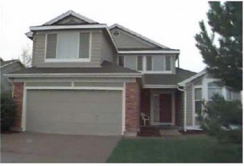
Westminster
Gold discovered in the South Platte River Valley in 1858 brought national attention to the area that would become known as Westminster Colorado. In 1870, Pleasant DeSpain built his home at West 76th Avenue and Lowell Street, which became known as DeSpain Junction. In 1891, the construction of Westminster Castle began at West 83rd Avenue and Federal Blvd. and the castle was incorporated into the town in 1911. The town was renamed one final time to Westminster, in honor of the Westminster Castle.
View Community
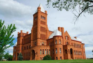
Westridge
Westridge is an established community in Highlands Ranch. This community is located east of South Santa Fe Drive on N Highlands Ranch Parkway. Westridge began its development about early 1990's & continued after 2000. This community is in the Douglas County School District. Coyote Creek Elementary School, Trailblazer Elementary School, Ranch View Middle School & Thunder Ridge High School & Wildcat Shopping Center, Highlands Ranch Golf Course are all close proximity to the Westridge community.
View Community
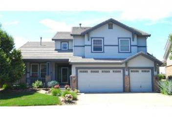
Westridge Village
Westridge Village is an established community in Highlands Ranch. This community is located off of West Wildcat Reserve Parkway & West Hyacinth Road. This community began its development at about mid 1990's. Westridge Village is in the Douglas County School District. Ranch View Middle School and Thunder Ridge High School are nearby to Westridge Village. Spring Gulch Park is a neighborhood park, with amenities: shelter, playground, picnic tables, basketball courts, BBQ Grills & drinking fountain.
View Community
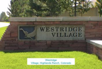
Westwood
Westwood Neighborhood is located in Southwest Denver. Its boundaries are Alameda to the north, Sheridan Boulevard to the west, Mississippi Avenue to the south and Federal Boulevard to the east. It borders Mar Lee Neighborhood to the south and Athmar Park to the east. Westwood is a neighborhood in transition and there have been some newer urban renewal projects within the community. The Westwood Neighborhood has easy access to both Denver and Lakewood. Westwood Park is a neighborhood park.
View Community
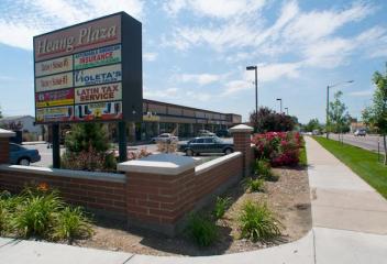
Wheat Ridge
Wheat Ridge incorporated in 1969 due increasing annexation pressures from nearby municipalities. Wheat Ridge grew from a poplar rest stop for travelers during the Gold Rush of the late 1850's to an agricultural & suburban community known as the "Carnation City" in the mid 1900's. As residential areas of unincorporated Jefferson County grew to provide housing to the Denver workforce the 1950's, major transportation corridors were extended to accommodate the commuters & new urban services provided
View Community
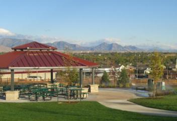
Wheatlands
The Wheatlands Neighborhood is located in southeast Aurora near the Southlands Mall. It is a newer development within the Aurora Reservoir/Southlands area. The Aurora Reservoir area has a number of new developments since it hosted the Parade of Homes a number of years ago. Wheatlands is located just east of Southlands Mall. Its location is an ideal location for shopping, water oriented sports, trails, playgrounds, restaurants, easy access to DTC, Downtown Denver, DIA, & Cherry Creek State Park.
View Community
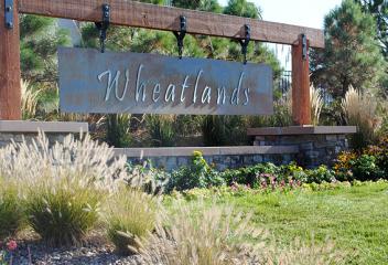
Whisper Creek
Whisper Creek is a community in Arvada. Its location is situated in Arvada, close to both Denver & Boulder. A full 37% of this community's acreage is dedicated to open space which encompasses trails for biking & walking. This community has many of its planned communities developed, including the community clubhouse & community pool. Future amenities include botanic gardens with a pond & dock, tennis courts & ballfields along with parks. Near Standley Lake & its open space wildflower preserves.
View Community
Whittier
Whittier is a Denver neighborhood northeast of Downtown Denver. The neighborhood is named for a school formerly located at 24th Avenue and Downing Street which was named after John Greenleaf Whittier. Given the philosophy of Whittier, the neighborhood was ethnically integrated from its inception. Its boundaries are 23rd Avenue to the south, Martin Luther King Blvd. to the north, Downing Street to the west and York Street to the east. The neighborhood is mostly residential and older 1890's homes.
View Community
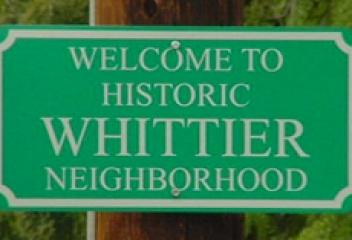
Wiggins
Wiggins is a town located in Morgan County Colorado. The community was established in 1882 as the Burlington railroad depot of Corona. Wiggins was incorporated on October 11, 1974. Around 1900, Corona was renamed in honor of Oliver P. Wiggins, who served as a guide and scout for Captain John C. Fremont, on some of his explorations through northern Colorado in the 1840's. He also accompanied Kit Carson for 12 years on his expeditions. A portion of the town remains Corona, north side of the tracks
View Community
Wild Flower Ponds
Wild Flower Ponds is a community located in Arvada Colorado. This community is located at West 64th Avenue and West 63rd Place. The development of this community began construction about mid 1990's. Wild Flower Ponds has its own neighborhood pond, Wild Flower Ponds, named after the community. Hyatt Lake is a body of water directly south and adjacent to this community surrounded by open space. The open space is ideal for potential wildlife viewing, walking, hiking for this community's residents.
View Community
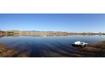
Williamsburg
Williamsburg an established community, is located in Littleton Colorado. Its approximate boundaries are West Roxbury Avenue north, South Kipling Street east, West Ken Caryl Avenue south and adjacent to Woodbourne and Canterbury Neighborhoods to the west and northwest. Eagles Meadow Park is a neighborhood park in this community equipped with courts. The Meadows Golf Course is to the north of this community as well as shopping at Kipling Street and Bowles Avenue. Shopping at Kipling and Bowles.
View Community
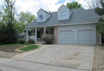
Willow Creek
Willow Creek is a neighborhood located in Centennial Colorado. Its boundaries are East Dry Creek Rd to the north, South Yosemite Street to the east, County Line Road to the south and South Quebec Street to the west. Willow Creek is a covenant community. There are both single-family homes and attached single family homes within this community. Willow Creek Park is a neighborhood community park. There are 2 clubhouses, 26 acres of greenbelts, 2 swimming pools, 6 tennis courts,2 playgrounds & etc.
View Community
Willow Springs
Willow Springs is a neighborhood located in Morrison Colorado. It is a neighborhood in the Rocky Mountain Range Foothills, with Red Sandstone Outcroppings & magnificent views! Willow Springs is home to the Red Rocks Country Club, once known as Willow Springs, which is a private golf community. Red Rocks Country Club sits on what was once known as the Harwood Ranch and offers mountain-style golf. The course was designed by Phelps-Atkinson. It is located 2 miles west of C-470 on Belleview Avenue.
View Community
Windsor
The Town of Windsor is located in Larimer County Colorado, Northern Colorado, was incorporated on April 2, 1890. Windsor, named after Rev. Samuel Asa Windsor, is situated 59 miles north of Denver. Windsor being a rich wheat farming district, it drew its first permanent residents in early 1870's. Two factors played critical roles in stimulating Windsor's early development, irrigation and the railroad. Irrigation increased crop variety and production & the railroad shipped its bounty to market.
View Community
Windsor Gardens
Windsor Gardens is an all adult community in Denver with the minimum age of 55. It is located in southeast Denver off of East Alameda Avenue & South Clinton Street. This is a maintenance free condominium community with many senior activities. This community has a community center (for daily events), community pool, fitness center, restaurant for dining, walking & biking trails, golf course for the avid golfers, sitting benches, RTD bus service, and etc. The buildings are equipped with elevators.
View Community
Windstream
Windstream is an established community in unincorporated Arapahoe County. Even though it is located in Arapahoe County, it does have a Denver address. This community was developed in the 1980's and it is a combination of attached townhomes & condominiums. Its conveniently located in southeastern Denver at East Iliff Avenue & Dayton Street. Its proximity to Parker Road, Highline Canal, Cherry Creek Country Club, Downtown Denver, DTC, restaurants, shopping, I-25, I-225 it offers convenience.
View Community
Winter Park
Winter Park is located in Grand County and is located at the southern end of the Fraser Valley. It is home to Winter Park Si Resort, a well known ski resort which is owned by the City and County of Denver. The town and resort was served by the Ski Train of the Denver and Rio Grande Western Railroad. Winter Park began as two small settlements, Old Town and Hideway Park. On August 1, 1978 the town of was founded and became Winter Park. In the summerit is known for mountain biking, hiking, fishing.
View Community

Woodbourne
Woodbourne is an established community in southwestern Littleton Colorado. Woodbourne is located at South Simms Street and West Ken Caryl Avenue, north of Ken Caryl and abuts to the The Meadows and Canterbury neighborhoods to the east. Woodbourne community was developed about mid 1980's and continued into the 1990's. This community is nearby the The Meadows Golf Course to the north, which is an 18 hole "country club" course for its players and offers dining. It is close to C-470 and shopping.
View Community
Woodland Park
The City of Woodland Park is located in Teller County, which surrounded by the one-million acre Pike National Forest. It was incorporated June 6, 1891. Woodland Park is approximately 17 miles from Colorado Springs. Called "The City Above the Clouds," Woodland Park is 8,465 Feet above sea level. The city has pursued a policy of careful growth and enjoys dramatic views of Pikes Peak. Due to its location, there is a natural limitation to growth. There is easy access to hiking, climbing and fishing.
View Community
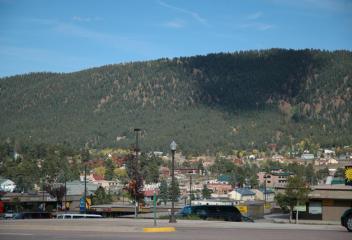
Woodland Valley
Woodland Valley is an established neighborhood in Arvada. Its location is approximately West 72nd Avenue north, Simms Street east, West 64th Avenue south and Ward Road west. This community began its development about late 1960's and early 1970's. Truman Park is a neighborhood park in this community. Woodland Valley is located close to Historic Olde Town Arvada, Standley Lake and Standley Lake Regional Park, Ralston Recreation Park, Arvada West High School, offers many choices for this community.
View Community
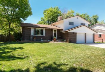
Woodmar
Woodmar is an established neighborhood in Littleton Colorado. Its boundaries are West Bowles Avenue north, South Pierce Street south, West Coal Mine Avenue south and South Kipling Avenue west. The homes in the Woodman neighborhood were developed and constructed about 1970's. Clement Park & Woodman Square Park are located in this neighborhood. Johnson Lake is a 60 acre lake located in Clement Park, which also offers sport courts, games, picnic areas, & playgrounds. Southwest Plaza is nearby.
View Community
Woodrim
Woodrim is an established community in south Aurora. This community is located East Illiff Avenue northSouth Blackhawk Street west, East Yale Avenue south, and approximately South Fairplay east. Woodrim was developed in the latter 1970's and continued into the 1980's. Tierra Park is a 14.3 acre neighborhood park within Woodrim and offers tennis courts, playground, trails for walking and biking, open space for dogs. This community is conveniently located to I-225 and Buckley Air Force Base.
View Community
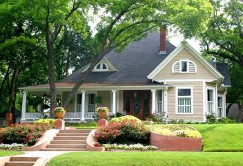
Yorkshire Estates
Yorkshire Estates is a small enclave of homes located in Unincorporated Arapahoe County. This community is located off of South Parker Road on East Colorado Circle. Yorkshire Estates was developed about early 1980's & its community was developed around a circular drive. Yorkshire Estates is in the Cherry Creek School District and offers its residents close proximity to Denver Tech Center, RTD Light Rail, Highland Trail for biking, walking, and hiking, I-225, shopping, restaurants, golfing & etc.
View Community